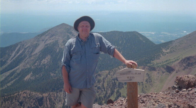
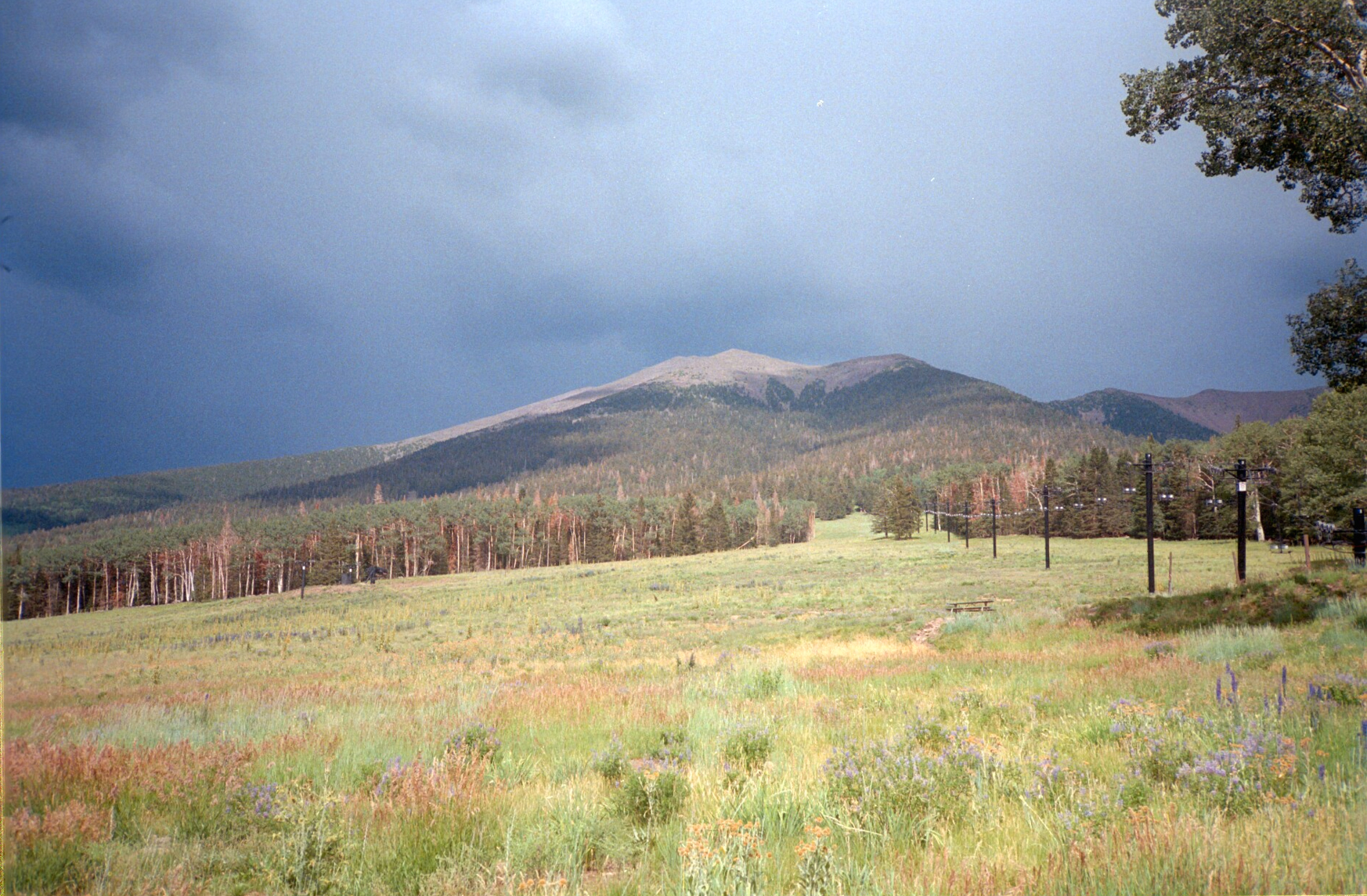
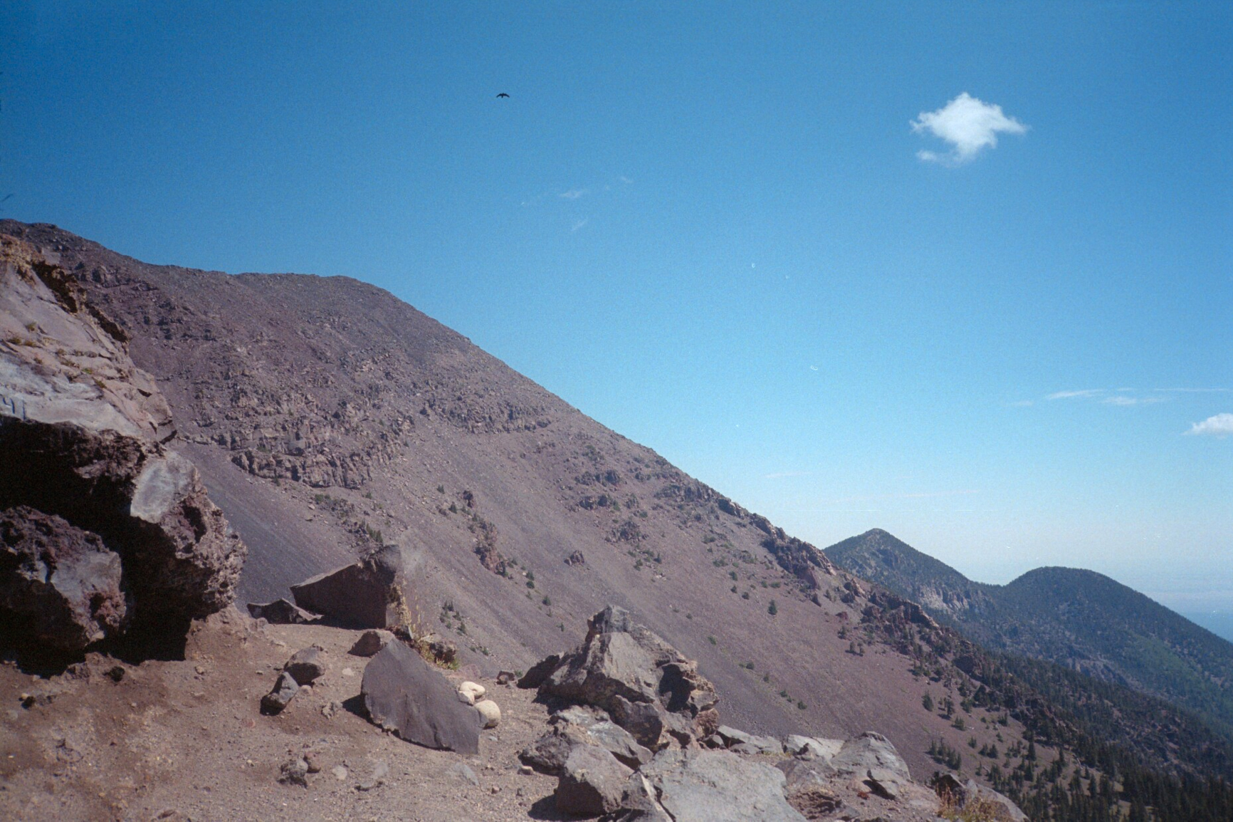
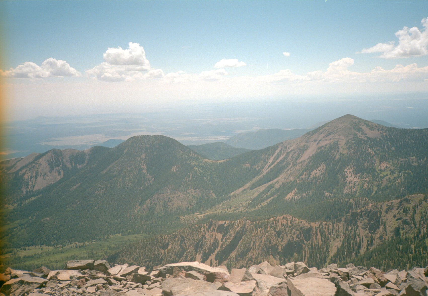
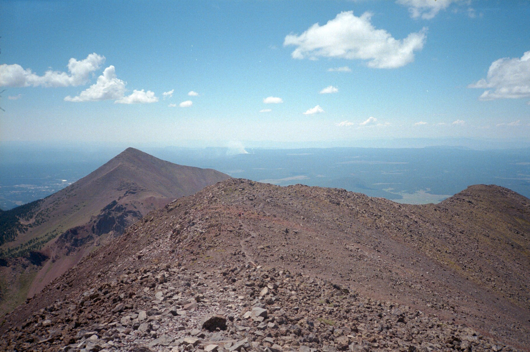
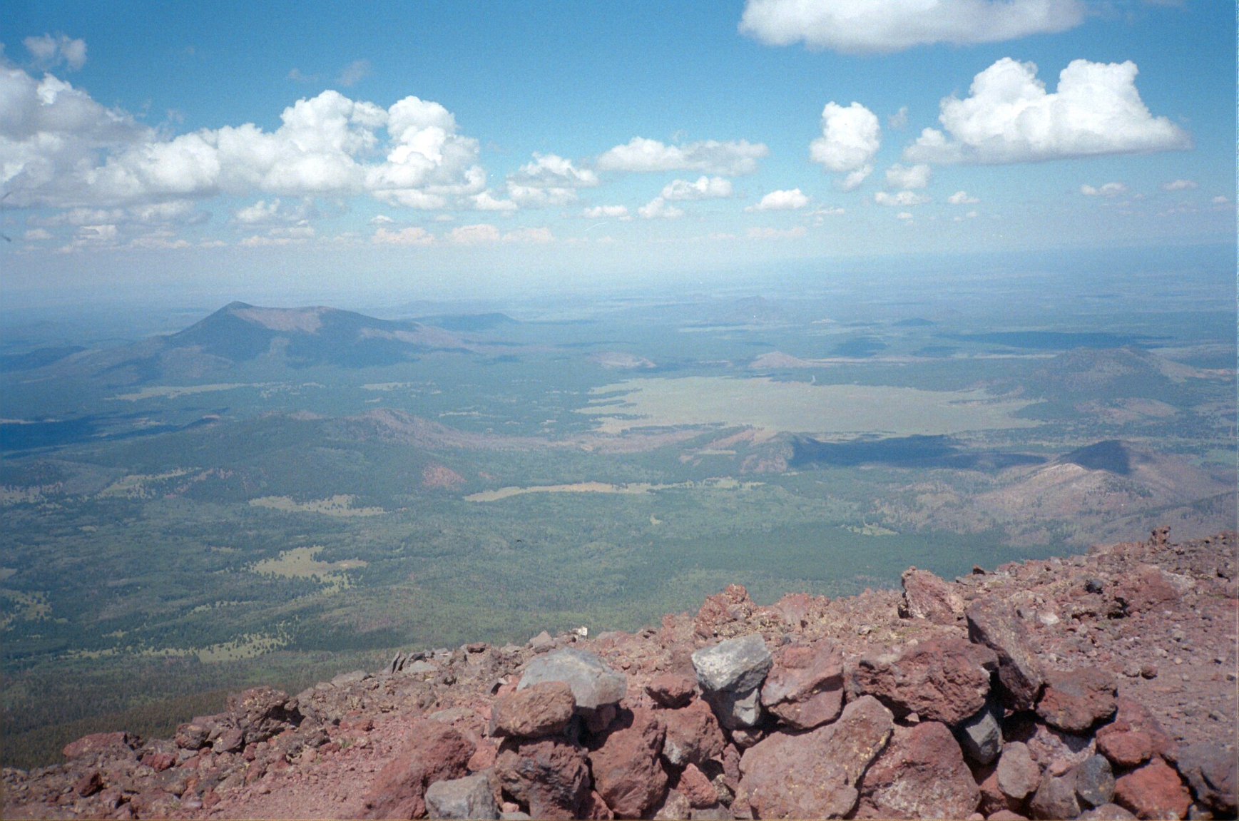
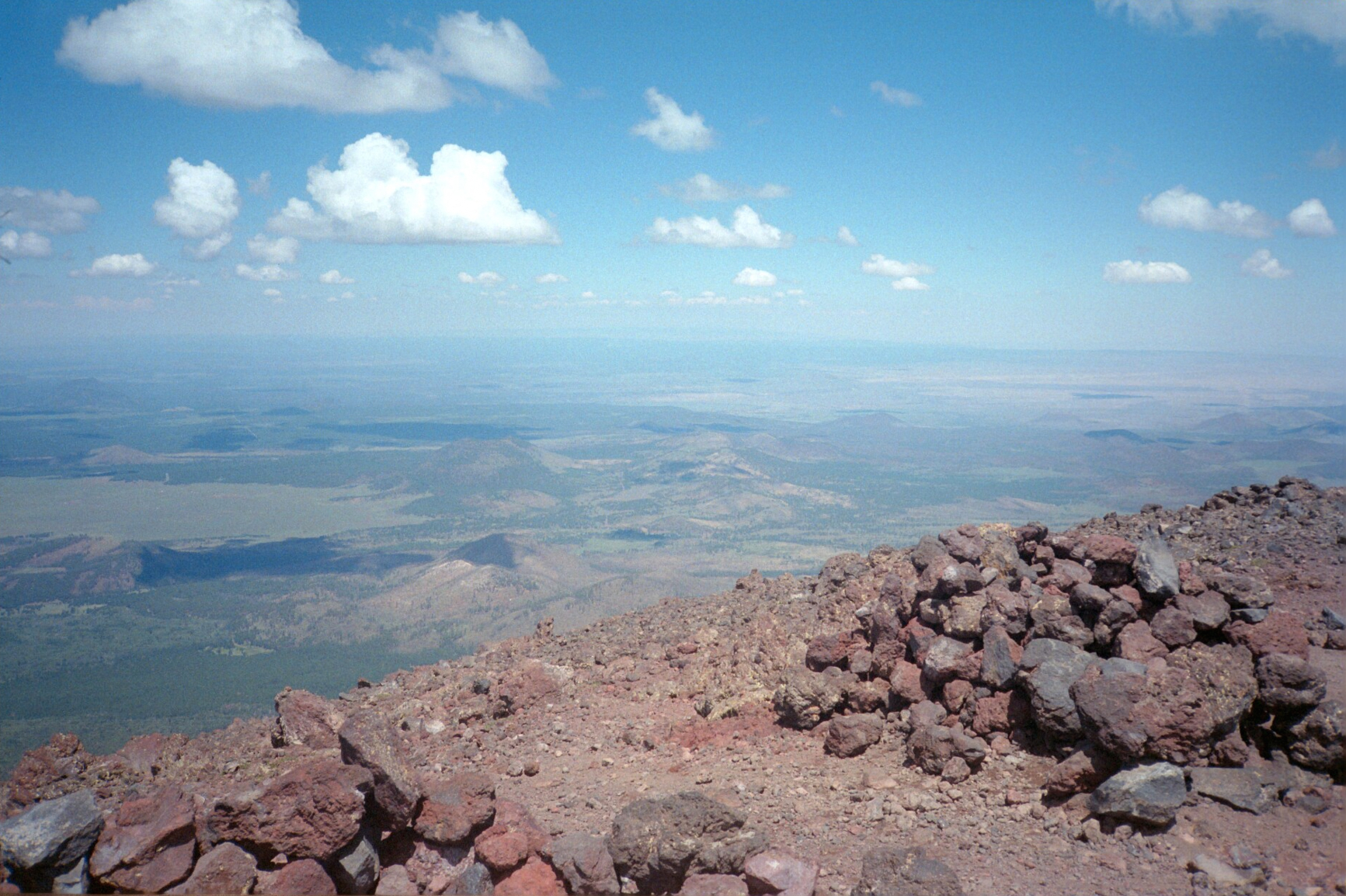
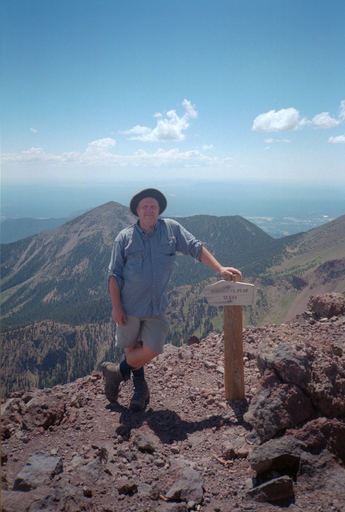
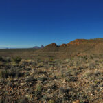
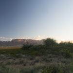
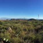
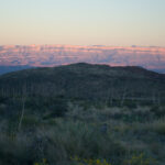
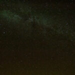
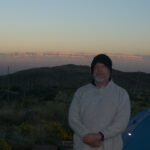
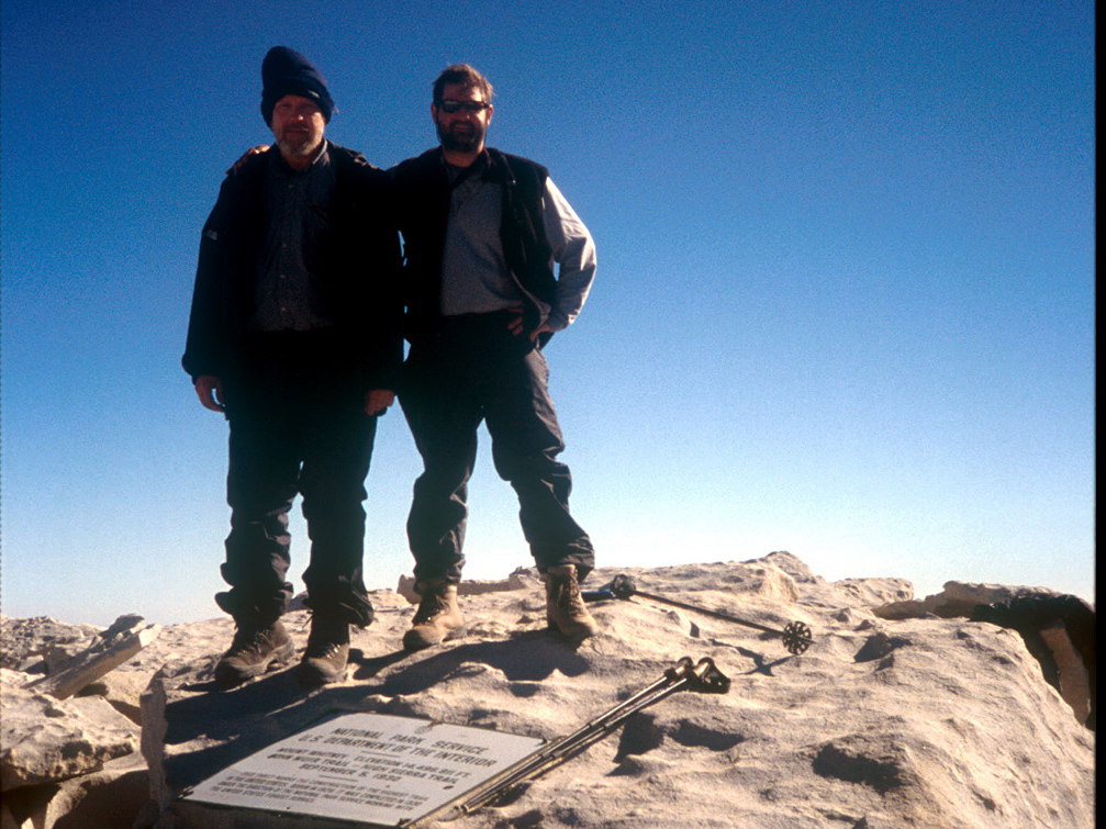
In August 2003, on the way to California to my brother’s wedding, I camped near Flagstaff, Arizona and climbed Humphreys Peak, the high point of the state.
The hike starts off in the “Snow Bowl”, a ski area, then winds its way up through the forest until it gets to timberline. Then it hits a saddle; go left to get to the summit of Humphreys.
Humphrey’s Peak hike AZ HighpointHumphrey’s Peak hike AZ HighpointHumphrey’s Peak hike AZ HighpointHumphrey’s Peak hike AZ HighpointHumphrey’s Peak hike AZ HighpointHumphrey’s Peak hike AZ HighpointHumphrey’s Peak hike AZ Highpoint
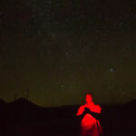
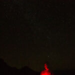
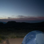
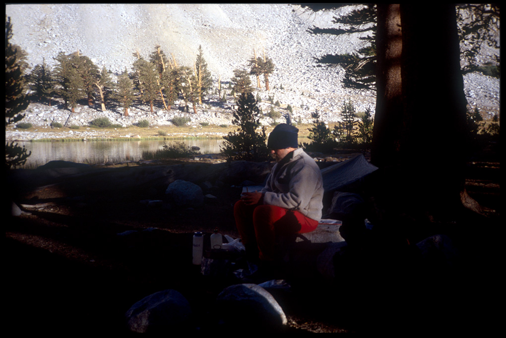
Tarp in use at camp in Escalante National Monument, Utah
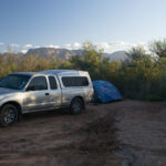
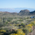
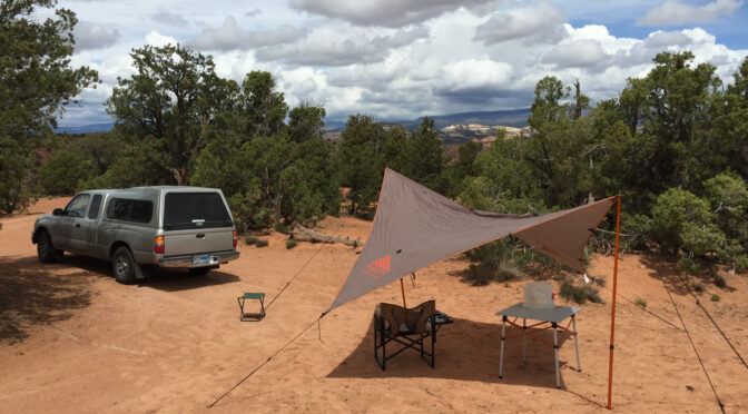
It’s taken me a few years to figure this out. I’ve had a cheap old tarp in the past which I’ve almost never used; then, before my John Muir Trail hike I picked up a ultra-light Sil-Tarp (below) which was marginally effective but I still never really got the hang of pinning it down in the wind.
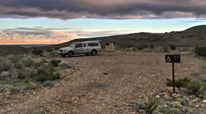
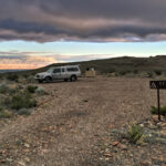
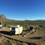
Campsite at Cuchara CampgroundCamp at Escalante National Monument, May 2013. A rainy few days, and a cheap plastic tarp purchased at Hanksville when I realized I hadn’t brought one.
And then here, below, is the cheap one I got in Hanksville, because it rained almost every day in the Escalante National Monument. But these cheap tarps are also unwieldy in the wind and tend to collect rather than shield rain.
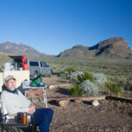
I purchased a Kelty tarp a couple of years ago; have had difficulty in anchoring it for a couple of years, but this last time in Utah I finally got it staked down well (the pic at the top of this post). In a big wind, I still had to anchor one peg with a stool and a large water bag on top of it to make sure it didn’t pull out.
Tarps can be crucial for enjoying your car camping experience; less so for backpacking I think, because when you’re backpacking, you’re going to be on the move the next day anyway. But car camping, you’re probably going to stay put for a few days; the tarp can keep you protected from intermittent showers with little discomfort; you can cook underneath them, hang out, snooze, whatever. Beats the heck out of spending sixteen hours in a tent because of rain.
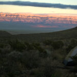
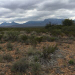
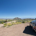
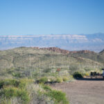
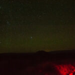
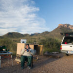
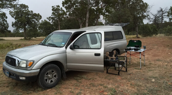
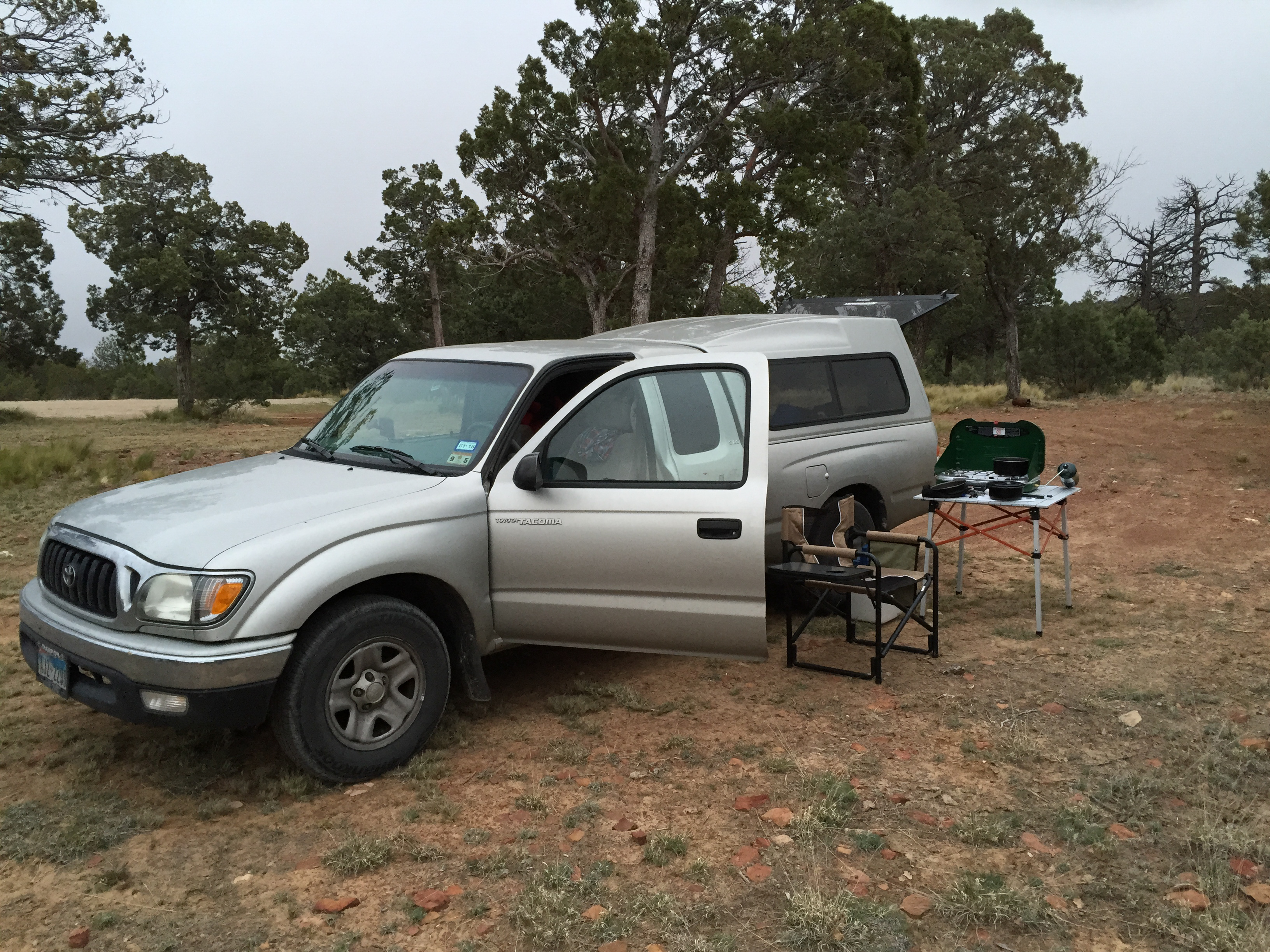
Car camping first night in Lincoln National Forest.
I had planned on camping in Dog Canyon, Guadalupe Mountains National Park, as usual; however the campground and entrance had been closed for months. I needed the altitude for my half-marathon prep so I decided to go almost to Dog Canyon and camp in the Lincoln National Forest, just north of GUMO.
I was up early; and except for the water bottle in my bag still had to deal with some freezing. And since I had pretty much used up all the food, breakfast was a bit skimpy. But I anticipated the pizza slices at the store at Whitney Portal later that day. I found it a bit hard to believe that I could even consider returning to civilization that very day, with hot and cold water on demand, sit down toilets, all the food I could want, and hot, running showers.
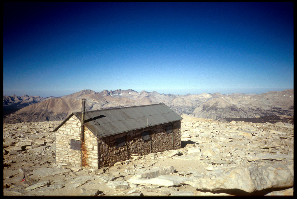
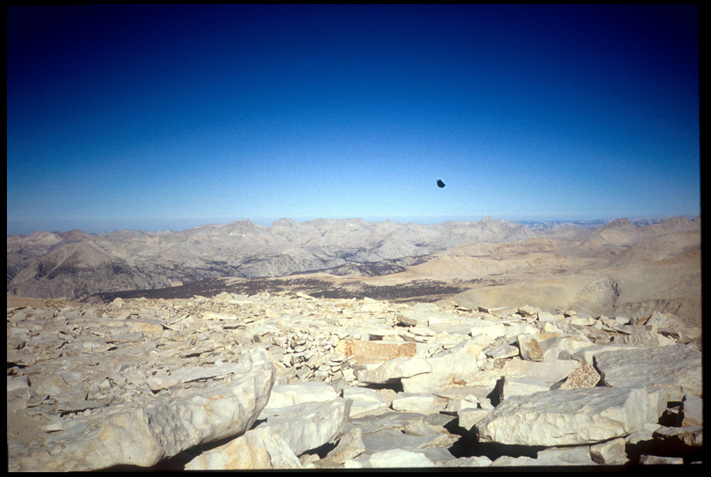
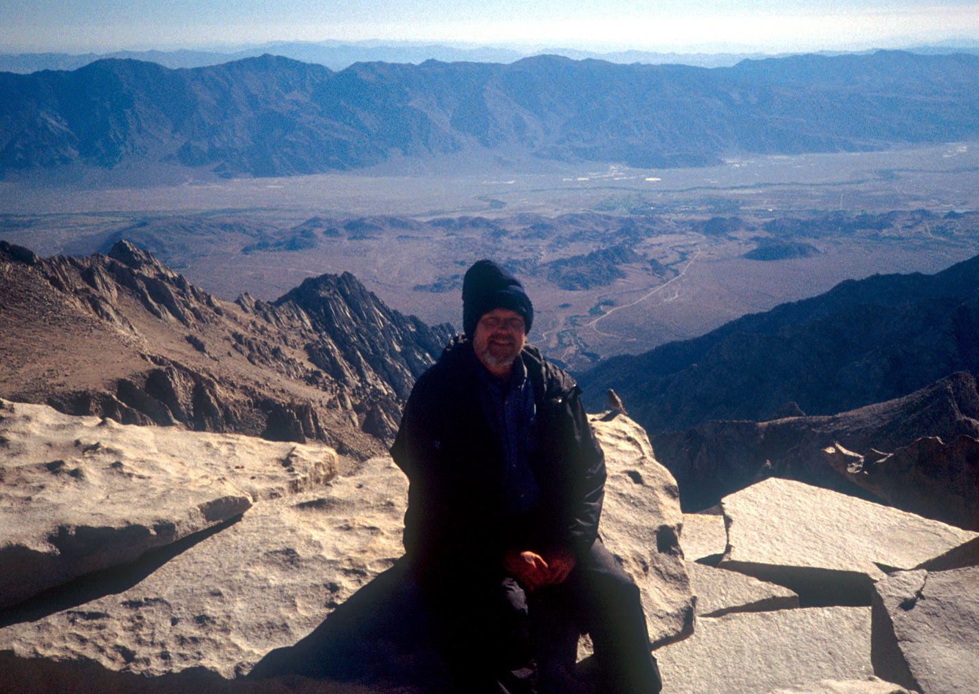
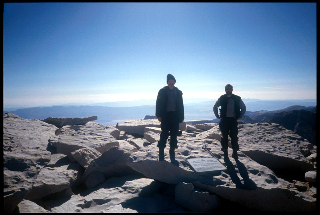
We bugged out at around 7:45 or 8:00. We had originally thought we’d pack up and take our gear on up to the summit in order to keep the allegedly ferocious marmots out of our stuff, but we decided to take nothing up on the summit run. I drank as much water (at least thawed water I could find) as I could to prehydrate, because I wasn’t going to carry a bottle. We secured our gear, then proceded up the trail. The final approach to Mt. Whitney’s summit is a trail hewn right out of the side of the sharp knife-edge one sees from the road miles below. Sometimes you’re so close to the ridge you can see highway 395 through gaps in the boulders to your right. You pass Mt. Muir (14,105′), Keeler Needle, and then the trail begins to wind around what looks like a long, flattened hill. Until you reach the end of the trail, and see the famous stone hut: you’re at the summit, (here. here, and here). (Me on the summit. And a bird) We were the first ones up that day. We looked at the “official” trailhead marker; this was, after all, the end (or beginning) of the John Muir Trail. Also was the offical USGS benchmarks for the summit of Mt. Whitney. Actually, it seemed there were a dozen or more of them. They must put a new one up every year. After a few minutes a couple of other folks arrived. One was a young man from Brazil who had slept in his car and started up the trail at 2:30 a.m. He took a couple of pictures of us on the summit. I took a couple of him. After not too much more tiem on the summit, we headed back down. For me at least, the summit was somewhat anticlimactic. It marked the end, of course, and it was a beautiful summit, but this hike hadn’t been about peak bagging.
We got back to Camp 20 at about 10:30, loaded up, and headed down the steep trail, infamous for its 119 switchbacks (the number varies according to whom you read). Todd hurries ahead; I would meet him later at Trail Camp. While trekking down the steep descent, I pass dozens of aspiring Whitney summiteers heading up. Some in remarkably good shape, some I fear won’t make it anywhere near the summit. Somewhere along this stretch, my bootheel slides on a slippery steep downhill section of trail and I fall. I bang a knee. I recover ok, but I am a little pissed and a little amused: I fell on the trail on the second day, and here I am three weeks later and I fall again. Oh well.
I meet up with Todd at Trail Camp, where we briefly discuss the increasing number of hikers and campers and the rather sloppy tendencies of the campers at Trail Camp. The descent along the trail down to Whitney Portal seems to go on forever. You’d think one would have learned patience after 220 miles, but the 6,000′ foot descent proves to be a test. I remark to Todd that you can tell we’re getting close to civilization by the number of families we’re running into. At one point, a young chap with a British accent asks me “how far is it to the lake?” Which one? I ask. “The one this trail goes to.” Well, I was going to explain to him how I’d just walked 220 miles, and passed about five hundred lakes on this trail, but just then his folks came up and I think I said something like, “Oh, about two miles.”
Down, down, down we went, through ever thickening forest, and ever warming temperatures. At one point I heard a car horn honk. And then at a spot on the trail overlooking the Whitney Portal area, I could see the parking lot and my truck. Finally, the last switchbacks passed and we walked out of the backcountry into a trailhead (“roadhead,” as Colin Fletcher more accurately calls them) at about 4:00. We go to my truck, and I see that it’s not been abused by bears. We strip off pack and boots, and replace with lighter gear.
We head back up to the store and I go to the cafe. I’m a bit troubled to not see “pizza” on the displayed menu, but I don’t worry because I’ve seen with my own eyes people eating pizza there. The proprietor asks my pleasure, and I mention I’m looking for pizza on the menu. “Oh,” he says, ” we don’t have pizza. I mean, we do sometimes, but that’s usually for employees. We don’t sell it by the slice.” Uh-oh. Three weeks of anticipation wiped out in a sentence. He senses my disappointment. “Well, uh, how many slices do you think you’d want?” I tell him I’d eat two, and Todd, obviously overhearing, allows that he’d also eat two. “Well, sure, O.K., I’ll put in a pizza. It’ll be a good twenty minutes or so.” We don’t care.
I’m telling you, that pepperoni pizza was the greatest pizza in the history of the world. While we’re eating our pizza outside, we see who else but Fisherson and Fisherdad, reunited. Turns out Fisherdad had had to spend an uncomfortable night without his gear, but obviously all ended well. We chatted a while, and it seems they were wondering how easy it was to hitch from the Portal there into Lone Pine. I told them if they hadn’t had a ride by the time we left, I’d give them a lift, but I figured the hitching potential is pretty good along that stretch.
One thing I still kick myself for is the fact that I took no pictures at the end. No snaps at the cafe, with pizza slices, or showing off my new, trim waistline. Oh well. The store proprietor was extremely nice and helpful. We chatted a bit and he told me about his previous place on old Route 66; I asked him for suggestions for cheap motels for the night, and he said you won’t find them in Lone Pine. He suggested driving a bit farther, and staying in a place like Ridgecrest. This turned out to be an excellent suggestion. Motels in Lone Pine and Bishop and similar “resort” areas tended to be of the $60-80 variety; Ridgecrest, possibly because it was a heavily military area, was a more reasonable $30-40 type place.
We got a couple of rooms, then went to the grocery store to load up on junk food. I favored Pringles and Onion Dip, with some chocolate milk and Diet 7-Up and cheap canadian whiskey. (Not all at once, mind you.) Next, I took a shower. A long shower. Possibly the longest shower I’d taken in ten years. After recovering from the ecstacy of a new bar of soap and a fresh washcloth, I realized that my calves were caked with a semi-permanent potion of glacial Sierra dust, which seemed to not come off. After much scrubbing, I finally got the cement-like concoction off of my legs. I spent the next two hours watching ESPN. I was stunned (and pleased) to see that the new Houston Texans had beaten Dallas. I noted that OU had beaten Alabama. I watched some Dodger baseball.
I was up early; and except for the water bottle in my bag still had to deal with some freezing. And since I had pretty much used up all the food, breakfast was a bit skimpy. But I anticipated the pizza slices at the store at Whitney Portal later that day. I found it a bit hard to believe that I could even consider returning to civilization that very day, with hot and cold water on demand, sit down toilets, all the food I could want, and hot, running showers.
We bugged out at around 7:45 or 8:00. We had originally thought we’d pack up and take our gear on up to the summit in order to keep the allegedly ferocious marmots out of our stuff, but we decided to take nothing up on the summit run. I drank as much water (at least thawed water I could find) as I could to prehydrate, because I wasn’t going to carry a bottle. We secured our gear, then proceded up the trail. The final approach to Mt. Whitney’s summit is a trail hewn right out of the side of the sharp knife-edge one sees from the road miles below. Sometimes you’re so close to the ridge you can see highway 395 through gaps in the boulders to your right. You pass Mt. Muir (14,105′), Keeler Needle, and then the trail begins to wind around what looks like a long, flattened hill. Until you reach the end of the trail, and see the famous stone hut: you’re at the summit, (here. here, and here). (Me on the summit. And a bird) We were the first ones up that day. We looked at the “official” trailhead marker; this was, after all, the end (or beginning) of the John Muir Trail. Also was the offical USGS benchmarks for the summit of Mt. Whitney. Actually, it seemed there were a dozen or more of them. They must put a new one up every year. After a few minutes a couple of other folks arrived. One was a young man from Brazil who had slept in his car and started up the trail at 2:30 a.m. He took a couple of pictures of us on the summit. I took a couple of him. After not too much more tiem on the summit, we headed back down. For me at least, the summit was somewhat anticlimactic. It marked the end, of course, and it was a beautiful summit, but this hike hadn’t been about peak bagging.
We got back to Camp 20 at about 10:30, loaded up, and headed down the steep trail, infamous for its 119 switchbacks (the number varies according to whom you read). Todd hurries ahead; I would meet him later at Trail Camp. While trekking down the steep descent, I pass dozens of aspiring Whitney summiteers heading up. Some in remarkably good shape, some I fear won’t make it anywhere near the summit. Somewhere along this stretch, my bootheel slides on a slippery steep downhill section of trail and I fall. I bang a knee. I recover ok, but I am a little pissed and a little amused: I fell on the trail on the second day, and here I am three weeks later and I fall again. Oh well.
I meet up with Todd at Trail Camp, where we briefly discuss the increasing number of hikers and campers and the rather sloppy tendencies of the campers at Trail Camp. The descent along the trail down to Whitney Portal seems to go on forever. You’d think one would have learned patience after 220 miles, but the 6,000′ foot descent proves to be a test. I remark to Todd that you can tell we’re getting close to civilization by the number of families we’re running into. At one point, a young chap with a British accent asks me “how far is it to the lake?” Which one? I ask. “The one this trail goes to.” Well, I was going to explain to him how I’d just walked 220 miles, and passed about five hundred lakes on this trail, but just then his folks came up and I think I said something like, “Oh, about two miles.”
Down, down, down we went, through ever thickening forest, and ever warming temperatures. At one point I heard a car horn honk. And then at a spot on the trail overlooking the Whitney Portal area, I could see the parking lot and my truck. Finally, the last switchbacks passed and we walked out of the backcountry into a trailhead (“roadhead,” as Colin Fletcher more accurately calls them) at about 4:00. We go to my truck, and I see that it’s not been abused by bears. We strip off pack and boots, and replace with lighter gear.
We head back up to the store and I go to the cafe. I’m a bit troubled to not see “pizza” on the displayed menu, but I don’t worry because I’ve seen with my own eyes people eating pizza there. The proprietor asks my pleasure, and I mention I’m looking for pizza on the menu. “Oh,” he says, ” we don’t have pizza. I mean, we do sometimes, but that’s usually for employees. We don’t sell it by the slice.” Uh-oh. Three weeks of anticipation wiped out in a sentence. He senses my disappointment. “Well, uh, how many slices do you think you’d want?” I tell him I’d eat two, and Todd, obviously overhearing, allows that he’d also eat two. “Well, sure, O.K., I’ll put in a pizza. It’ll be a good twenty minutes or so.” We don’t care.
I’m telling you, that pepperoni pizza was the greatest pizza in the history of the world. While we’re eating our pizza outside, we see who else but Fisherson and Fisherdad, reunited. Turns out Fisherdad had had to spend an uncomfortable night without his gear, but obviously all ended well. We chatted a while, and it seems they were wondering how easy it was to hitch from the Portal there into Lone Pine. I told them if they hadn’t had a ride by the time we left, I’d give them a lift, but I figured the hitching potential is pretty good along that stretch.
One thing I still kick myself for is the fact that I took no pictures at the end. No snaps at the cafe, with pizza slices, or showing off my new, trim waistline. Oh well. The store proprietor was extremely nice and helpful. We chatted a bit and he told me about his previous place on old Route 66; I asked him for suggestions for cheap motels for the night, and he said you won’t find them in Lone Pine. He suggested driving a bit farther, and staying in a place like Ridgecrest. This turned out to be an excellent suggestion. Motels in Lone Pine and Bishop and similar “resort” areas tended to be of the $60-80 variety; Ridgecrest, possibly because it was a heavily military area, was a more reasonable $30-40 type place.
We got a couple of rooms, then went to the grocery store to load up on junk food. I favored Pringles and Onion Dip, with some chocolate milk and Diet 7-Up and cheap canadian whiskey. (Not all at once, mind you.) Next, I took a shower. A long shower. Possibly the longest shower I’d taken in ten years. After recovering from the ecstacy of a new bar of soap and a fresh washcloth, I realized that my calves were caked with a semi-permanent potion of glacial Sierra dust, which seemed to not come off. After much scrubbing, I finally got the cement-like concoction off of my legs. I spent the next two hours watching ESPN. I was stunned (and pleased) to see that the new Houston Texans had beaten Dallas. I noted that OU had beaten Alabama. I watched some Dodger baseball.
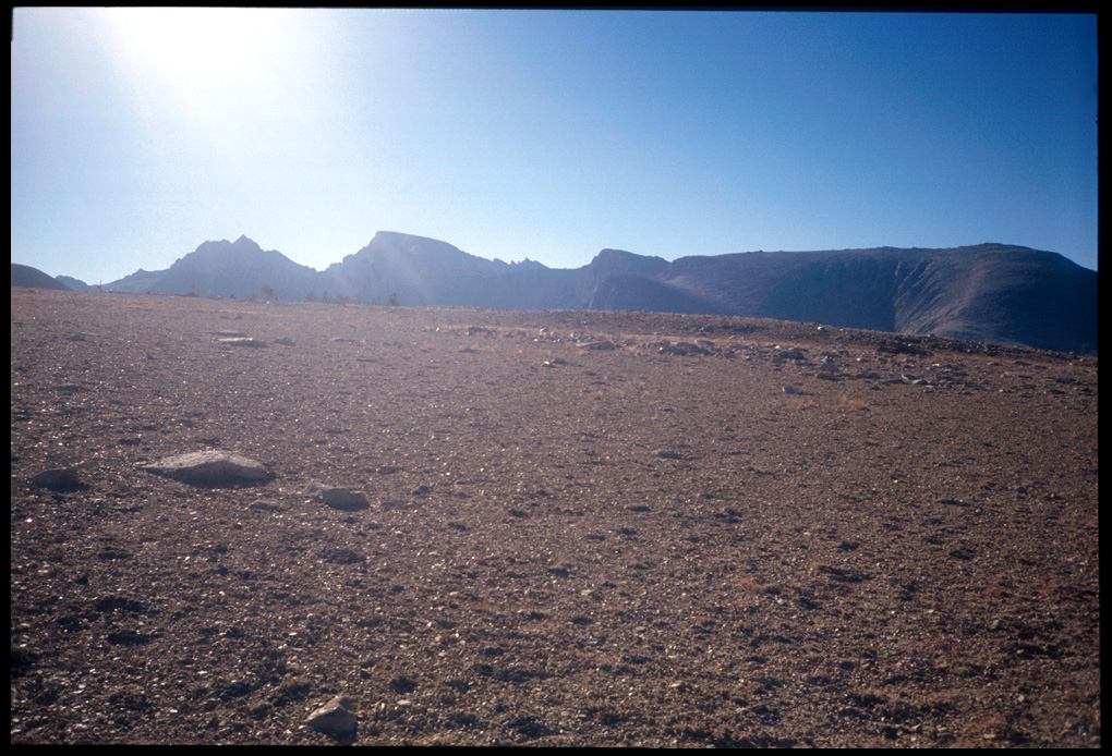
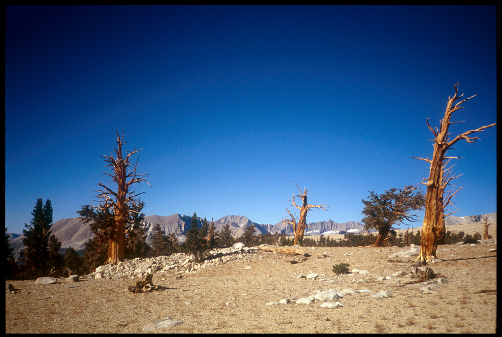
A cold morning greeted us. The only time on the trip, in fact, that my feet were cold. So cold that it took about twenty minutes of hiking to thaw them out. It didn’t take much motivation to get us going, since we knew we would soon be on the shoulders of Whitney. Soon we ascended a little and marched across the Bighorn Plateau, some fairly barren hills, and looking southeast I wondered if I was seeing the first glimpses of Mt. Whitney. A bit farther, looking to the west, I saw some rather intriguing looking twisted trees. I went off-trail to spend some time photographing them. They looked particularly stark with the morning sun on them. Stupid me, it wasn’t until later I realized they may have been Bristlecone Pines, some of the oldest living things on earth.
Bighorn Plateau; first view of WhitneyBighorn Plateau looking West
We hiked on and got to the vicinity of the Crabtree Ranger Station. While breaking/resting/lunching there, (it was about 2:00) I did some cipherin’ and cogitatin’ with the map, and was intrigued with the idea of continuing on that day all the way to the ridge just below the summit of Whitney. It would mean a dry camp, i.e., we’d have to pack our water all the way up, but I felt we were strong enough at that time to make it. After all, we could always change our mind at one of the upper lakes, which we had planned on stopping at anyway. Todd thought about it, and agreed. It would make a world of difference on the last day; spending most of the time descending from Whitney, as opposed to spending half a day climbing, and the rest of the day descending.
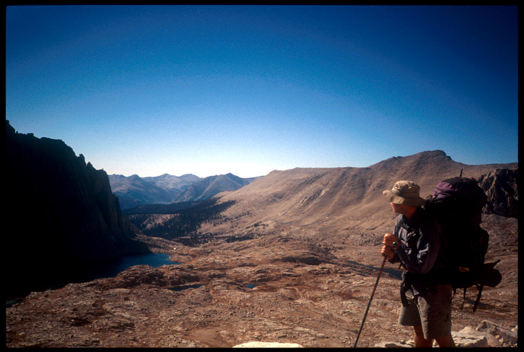
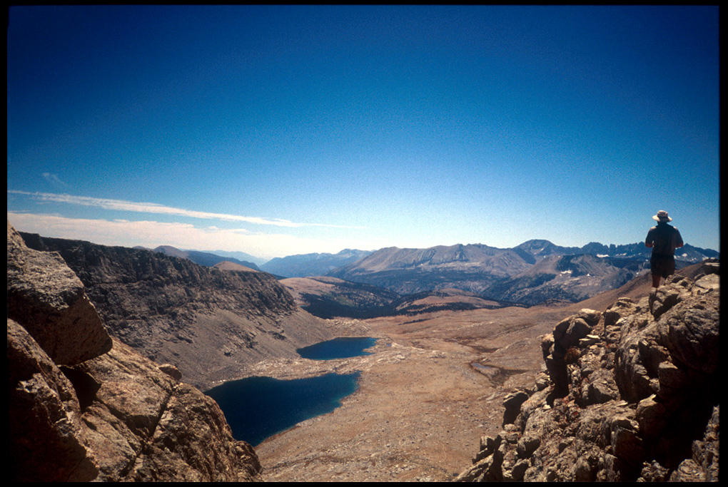
So that’s what we did. We began the ascent from Crabtree at 2:40. We passed a large group (possibly military?) re-watering at Timberline Lake, then another group at Guitar Lake, where we pumped water and made the decision to continue on. The ascent up the backside of Trail Crest was long, but a steady grade and good trail made it fairly straightforward. (Photo nearing Trail Crest, looking back on Hitchcock Lakes, Guitar Lake, and Crabtree Meadow farther down.) At 5:00 we got to Trail Crest; the crossing of the knife-edge of the Sierra Nevada. Basically, everything on the other side was straight down out of the Sierra, and a left turn along the knife-edge took you to the summit of Whitney in about two miles.
Crabtree Meadow from west side of Whitney, (One of my favorite photos from the hike.)
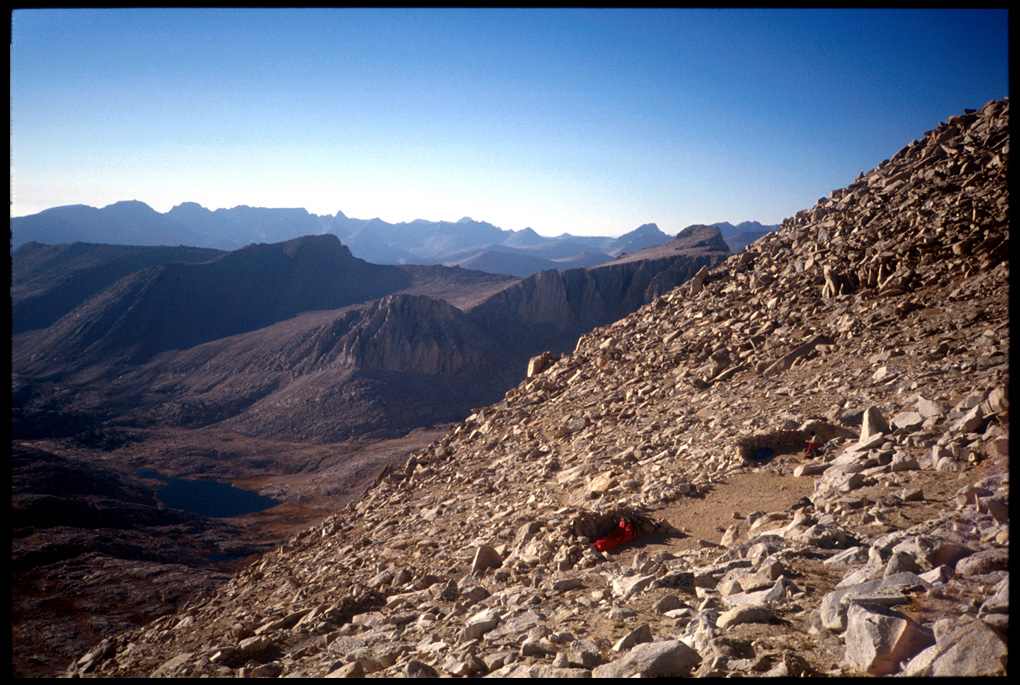
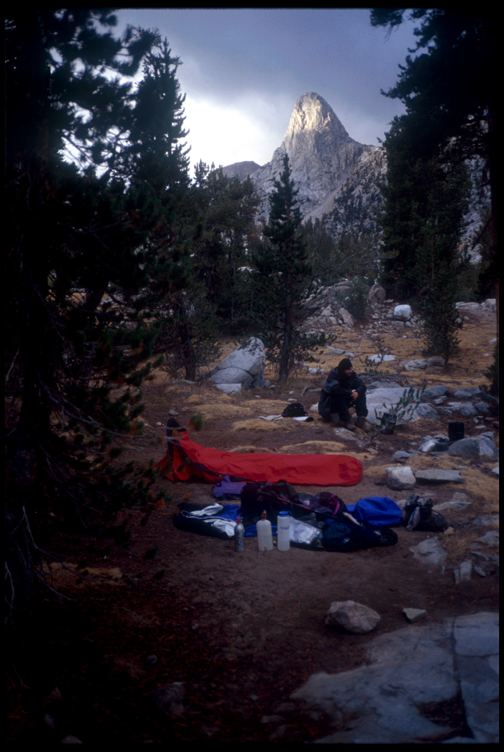
The guide book indicated a few campsites near the Trail Crest trail junction (13,500′): I could not find any sites. After about a half hour of looking, I looked back down the trail we’d just come up and saw a couple of flat spots not visible from the trail. I hollered at Todd, and we went back down and found a couple of well protected, well-worked campsites, with rock walls and flattened sleeping areas. There was nobody else in sight, so we each took one of these luxury “flats.” In this picture from above, you can see both sites hanging on the edge of the backside of Whitney—that’s me on the extreme right side, and that’s the obviously appropriately named Guitar Lake below.
west side of Whitney (13,450′)-Camp 20
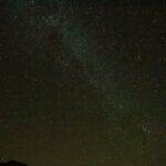
As I laid back in my sleeping bag, and tucked a water bottle into my bag (it was obviously going to be way below freezing that night) I was struck once again by the scenery. Well after sunset, the mountains were still aglow; behind me, close enough to reach out and touch, were the highest mountains in the continental U.S. Immediately to my left were more mountains and ice fields a thousand feet below (!) me. Miles away and below me was the valley of the Kern Canyon, and beyond that, and stretching into the distance to the north was the Great Western Divide. Once again I felt the loss of not having the camera with me that the scene demanded; instead, I focused on committing the scene to memory. In my notes for the day, I mentioned that Camp 20 was the most spectacular place I’d *ever* camped. I’ll admit, being so close to the finish after twenty days on the trail, I had a few butterflies in my gut and didn’t sleep so well.
The clouds had broken up during the night, and the weather was clear and cold. My water bottles were frozen solid. And all of our gear not under the tarp had a heavy layer of frost on it. We spread it out to catch the sun, which wouldn’t be up for an hour or so. While waiting, we chatted with the two older guys camped near us. One, the leader, said they had done this twenty five years ago and were attempting to do the same three or four day hike again. Apparently, with the same equipment. The other gentleman had a Red Sox cap on; we talked baseball for a while—turned out the impending baseball strike had been averted at the eleventh hour, and the Red Sox had promptly returned to their losing ways.
One of the men had a thermometer and mentioned it had been 21.9º that morning. As they packed up to go, he offered us some extra food; we declined (too much weight) and he left it in the bear box. They went on their way.
We had to wait until 10:10 for our stuff to dry out and for us to get underway. The previous night, I had figured we’d get to the summit of Whitney on Monday, September 9. (Today was Friday the seventh.) It really brought home how far I’d come, and how close we were. That, and the fact that I was now on Map #2 of the 13 map John Muir Trail series by Tom Harrison (the map numbers are from south to north, so Map #13 was Yosemite, and Map #1 was Whitney Portal). Also encouraging was the sign we saw today saying “Mt. Whitney 16 miles.”
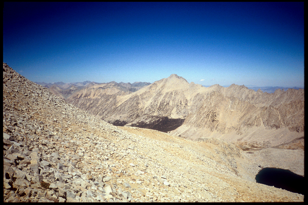
The first leg of today’s hike was to be Forester Pass, at 13,180′ the highest point on the entire Pacific Crest Trail, I believe. We left camp and ascended for an hour or so through the forest. Along the way, we catch up to our friends from the previous night; they’re examing a large pile of bear scat in the middle of the trail. They’re also pretty tired and are having second thoughts. I wish them luck and we continue on. The trail emerged from the trees and we began a long trek past a couple of alpine lakes, then an ascent straight up the side of Forester, which lies between Mt. Stanford (13,973′) and Junction Peak (13,888′).The trail is well-laid out and the grade is good, so without too much effort we make it at around 1:30. A gain that morning of 2,700′, but it seemed as nothing now. The views are as usual spectacular, both looking back where we’ve been, and looking ahead. The “looking ahead” picture shows the route of the trail, and the valley in the distance is the canyon of Tyndall Creek, which is also the beginning of Map #1—the end is near. Looking back the trail from the summit, we spy the older gentlemen making their way along the tundra, slowly but (it seems) surely, so we decided not to worry about them as we continued on.
Forester Pass (13,120′)Looking back from Forester
The weather was clear and chilly all day. As we descended to Tyndall Creek, we saw Fisherson sitting on a boulder near the turn-off for Lake South America. He looked despondent, and asked if we’d seen his dad. They were supposed to have met up the previous day and fish at Lake South America, but they’d missed connections and he hadn’t seen his father in over a day. We couldn’t help him; we wished him well and went on. I felt bad for him and hoped Fisherdad would turn up o.k.
Just a bit further on, we passed the turnoff for the Tyndall Creek ranger station, then began looking for the “frog ponds.” They weren’t marked officially on my map, but Bob back at Vermillion Valley Resort had suggested that area as a good campsite—I’d even marked it in pencil on my map. He’d said the sites were good there, and a bit off the beaten path; we’d have to look for them. It turned out to be exactly that way. We found the bear box there rather easily, then had to go over a ridge where we found a beautiful “pond”—actually a small lake, surrounded by a nice flat-topped mountain (in Texas we’d call it a “mesa”). (Me, cooking dinner.)
Up by 8:00, we circled around the very long, and very popular Rae’s Lakes, where there is a Ranger station and a few bear boxes. After passing those, the trail immediately ascends to Glen Pass. We reached Glen Pass (11,978′) by 11:00 or even earlier. The weather was windy and cold, and overcast with occasional sprinkles. Saw quite a few other hikers today.
Ascending Glen Pass (11,978′)
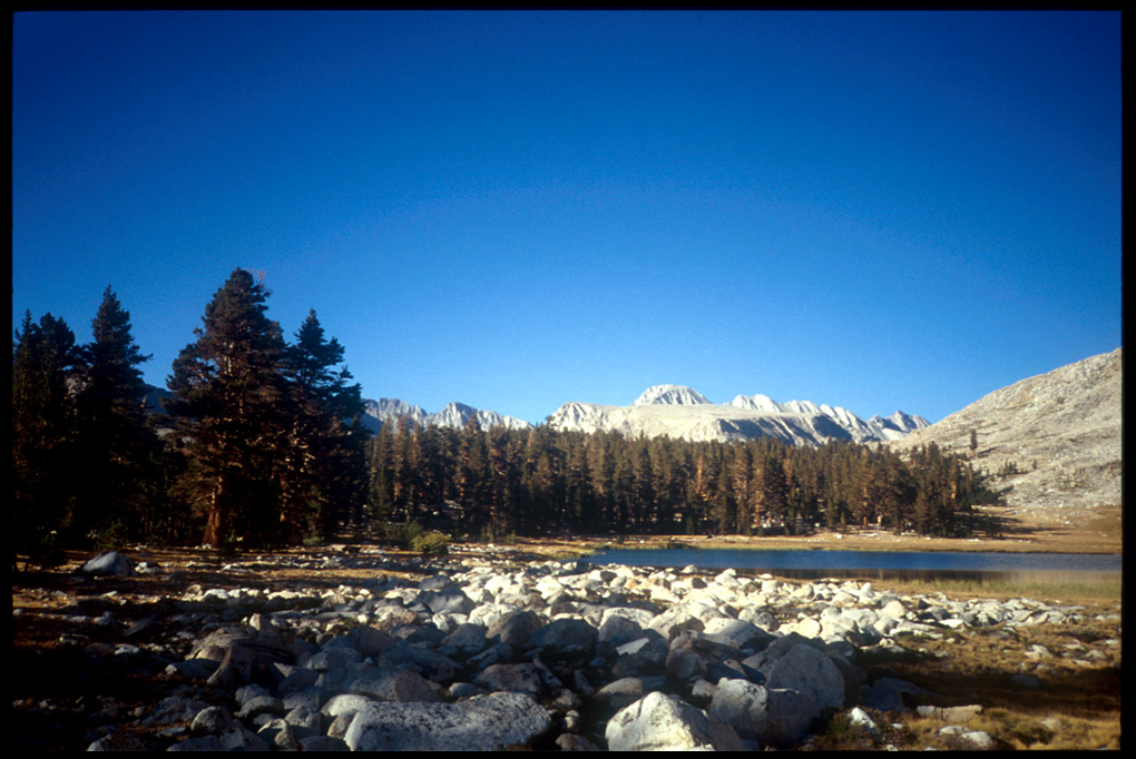
We reached Upper Vidette Meadows by 3:30, and decided to camp rather than risk bad weather at exposed campsites closer to Forester Pass. Lots of good camping sites close to the bear box; someone else was fairly close, but the temptation of level campsites, sandwiched in among protruding, flat granite boulders, and a few trees nearby frowm which to hang clothes made the site attractive. It’s hard to explain, but sometimes the camping in the Sierra can be downright luxurious. The granite boulders of varying size provide both walls and furniture. The larger, flat ones tended to separate “rooms” from one another, as well as providing a good spot to dry socks on or for a tired hiker to lie back upon. Smaller boulders are excellent chairs, as well as stove tops, tables, and other kitchen furniture. In a site like the one we chose this day, some of the bed sites have obviously been used hundreds if not thousands of times in the past. And popular sites also usually have a kitchen separate from the sleeping areas. Sure enough, there was an old fire ring and some seats set around an area under a large tree about 100 feet from the sleeping area. About the only amenity not handy at this site was water; although there was a rushing mountain stream (Bubbs Creek) nearby, the trail to it ran through some heavy undergrowth, and the stance at the edge of the stream one had to assume to pump water was a bit akward. But the view of Mt. Stanford made the chore a bit more bearable.
Back at camp, I watched low-lying clouds rushing up the valley and scraping along the Kearsarge Pinnacles. This was one of those times where I felt my handy Yashica T-4 camera woefully inadequate. I wished I’d had my Minolta with various lenses—a zoom would have alowed for some great pictures here; then I thought about the additional four or five pounds and regretted no more. I resigned myself to etching mental images, hopefully permanent, instead.
Outside the tent at the only other occupied site there are a couple of backpacks, they look a bit odd becuase they’re relatively old-fashioned. The proprietor of the tent, an older gentleman, invites us to chat but we decide to put it off until morning. Determined not to have a repeat of the sleepless night at Marjorie Lake, I use some nearby trees to rig up my tarp to cover equipment since there had been a few sprinkles the previous night; if it rains, I’ll just hunker down in my bivy bag. Todd is concerned that my tarp will flap and make a lot of noise if high winds return (even though he’s about thirty feet away). I secure and resecure the tarp as taut as I can.
In the morning, we were both freezing. Fixing breakfast and breaking camp, packing our packs, filtering water, were not easy tasks as my hands were frozen. Got out of there by 8:15. Made it to Pinchot Pass (12,130′) by 10:00. Saw Tim and Cheryl there, and they told us they, too had camped at Marjorie, only a bit above us. Go figure: I never would have thought there was anyone else at that exposed lake.
After Pinchot Pass, a long descent through occasional light rain, down through the Woods Creek junction, then up toward Dollar Lake. At Dollar, just after a pause, as we started up again a Ranger came down the trail checking out the “no camping” areas around the lake she was protecting by planting rocks in likely spots. We chatted a bit, partly about my obvious Texan aversion to turning over rocks with my bare hands, then she asked to see our permits. We complained a bit, having just reloaded our packs upon our backs, but secretly I thought it was nice to finally have someone check the permits after so much time had been spent securing them.
We continued on up to Arrowhead Lake, where there are a few people taking up the few campsites. We find one decent one, rather close to a few other folks. We halted, and camped here at about 6:00. From the camp here, there are nice views of nearby Fin Dome. Also, a couple of hikers I’ve met before come in late and camp too close, embarassingly close, to the lake shore. (That’s a flagrant violation.)


