Admin | Backpacking | Camping | Essays | To-Do | Trip Reports
-
-
Admin | Backpacking | Big Bend | Camping | Hiking
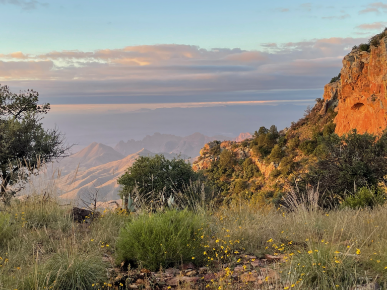
TR-BBNP Backpack Northeast Rim (and more)-October 2022
One night Seminole Canyon State Park; in Big Bend National Park two nights Cottonwood Campground, one night backpack to NE4, two nights Paint Gap 4 Gear, Lessons learned One characteristic of aging is that you can get great pleasure from revisiting experiences of your youth. Separated by decades, you forget the details of such experiences…
-
To-Do hikes
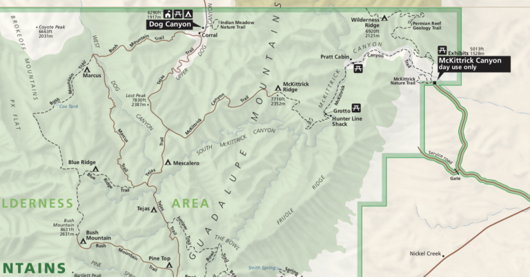
Marcus/Bush Mtn Trail Update: I finally did the Marcus trail in April 2025 but got snowed out of my following Blue Ridge/Bush Mountain backpack. I really want to finish up all the hiking trails in Guadalupe Mountains National Park. I’ve never been up the Permian Geology trail to the Wilderness Ridge BC site. I’ve never…
-
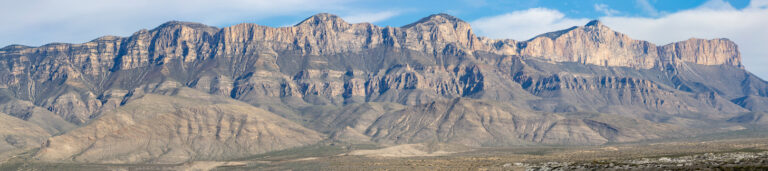
TR-Guadalupe Mountains Dog Canyon & Gypsum Dunes November 14-16, 2019
Wednesday the 13th I left Austin after work and some final packing around 6:00 P.M. and got to Ozona around 10:00. Next morning I kind of let Google navigate me, wanting to stay well away from US 285; ended up going East and North of it, to near Odessa, then coming into the Guadalupe Mountains/Lincoln…
-
Guadalupe RIdge trail
https://backpackinglight.com/forums/topic/guadalupe-ridge/
-
Hiking | New Mexico | Places | Trip Reports
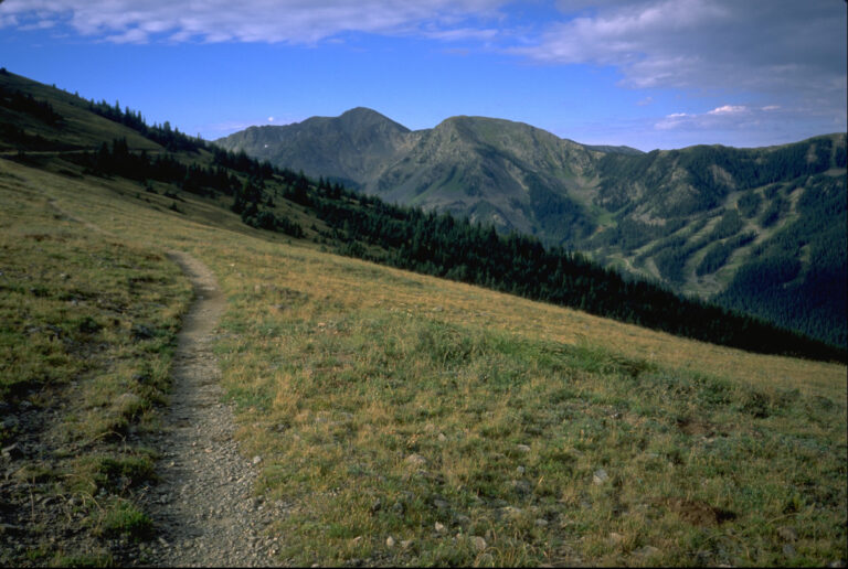
TR-Wheeler Peak-New Mexico Highpoint 8/31/97
[Original date August 31, 1997] Trip report from a hike to the summit of Wheeler Peak, the highest point in New Mexico (13,161′) undertaken August 31, 1997. Wheeler Peak is the highest point in New Mexico at 13,161′. The hike to the summit via Bull of the Woods is about 15 miles round trip, and…