Camping: Paint Gap 4 10/19/22–10/21/22 | Flickr album
One characteristic of aging is that you can get great pleasure from revisiting experiences of your youth. Separated by decades, you forget the details of such experiences but recall that you enjoyed them immensely. In my case this holds true not only for books but also for my outdoor experiences. Going back decades later over trails previously trodden can be as full of joy and discovery as it had been the first time.
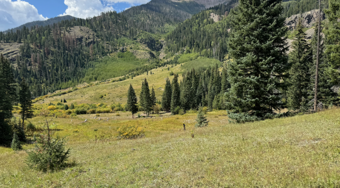
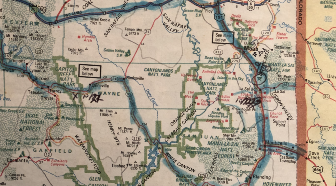
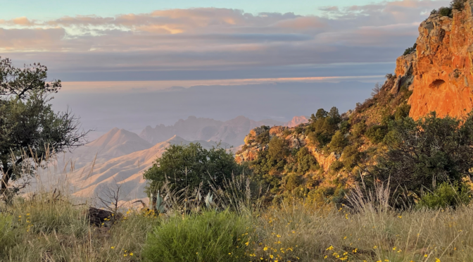
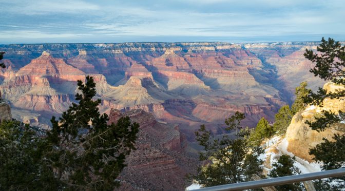
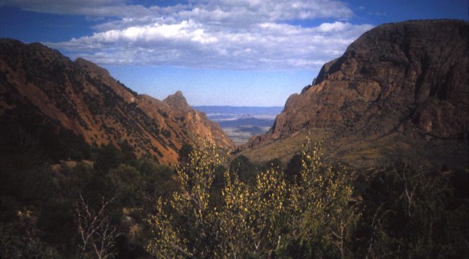
With this in mind I wanted to do an overnight to the South Rim, including the East Rim (which I don’t believe I’d been on before). I took advantage of online camping reservation systems and I booked a trip for October 15–21, starting with Seminole Canyon State Park and ending with three days at Paint Gap 4, probably my favorite primitive site in Big Bend National Park. In between was an overnight to ER4 (East Rim #4), a backcountry site on the Rim in the Chisos Mountains. My last backpack in the Chisos had been, I think, 1999. My last trip to the South Rim had been a day hike with friends in January of 2009, and I don’t know that I’d ever been to the east rim side as it’s seasonally closed for the Peregrine Falcon. (My first South Rim hike had been as a nine-year-old with my family in 1968.)
While at the Grand Canyon Visitor Center at the end of 2007, I’d overheard a couple discussing with a NPS ranger backcountry permits for the Bright Angel site, at the bottom of the canyon near Phantom Ranch. I made a mental note to consider this in the near future. It’s a popular overnight and back hike; some folks pay $$ for the indoors at Phantom Ranch or a cabin but I was only interested in the backcountry sites. (My parents had hiked down and stayed at a cabin in 1978.) Aside from New Year’s Eve, there were almost always walkup available permits for Bright Angel this time of year. I made a mental note to come back soon for an overnight hike to the bottom and back. I returned for this trip in January of 2011.
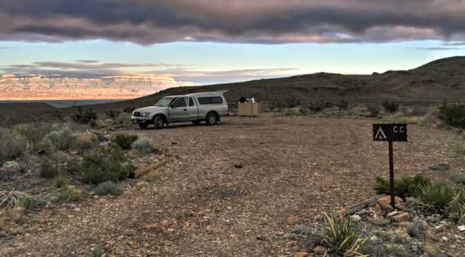
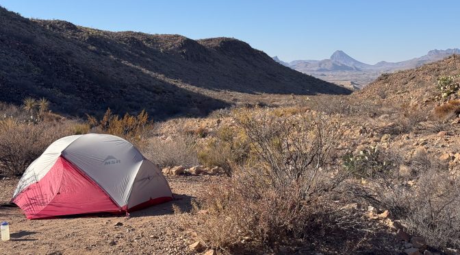
Not much to report here; I’d booked two nights at Paint Gap 3 (formerly Paint Gap 4, note the name change) to be followed by three more over at Fresno Vista in Big Bend Ranch State Park. I’ve stayed at both of these spots many times.
So things on this trip didn’t end up as planned, in many ways. But that’s o.k.–what’s the saying, “a bad night in the backcountry is better than a good day at work”? Yeah, I know that’s not it but whatever.
Things started roughly, out of Austin. As I was checking the air in my tires before departing I discovered a sheet metal screw in the tire. I went down the street to a local shop and got it repaired quickly. Fortunately it wasn’t too close to the sidewall.
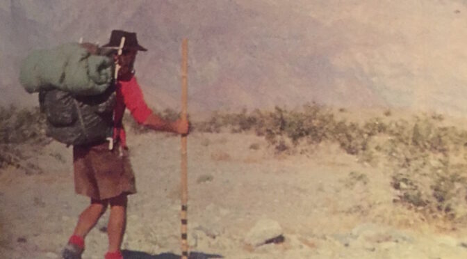
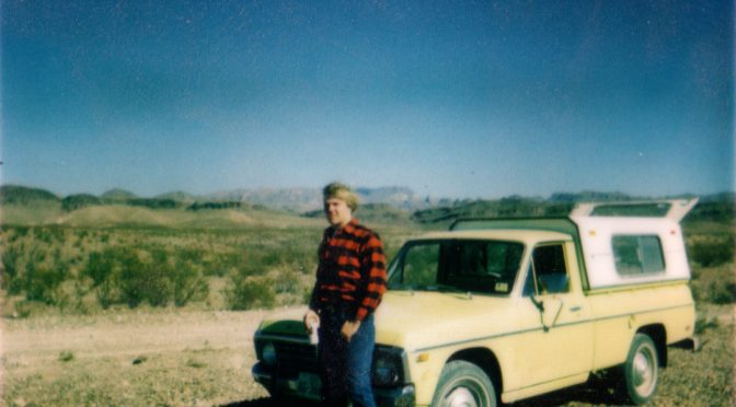
In late 1977–probably during semester break in December–my high school friend and baseball teammate Kelly and I took a camping trip to Big Bend National Park. I write this almost fifty years after the trip; I have no notes, just some foggy recollections, a handful of Polaroid prints, and possibly a roll of 35mm film somewhere around here that hasn’t yet been digitized. We’d done some winter camping on some property owned by some friends’ of Kelly’s family. I wouldn’t say we became expert campers, but we learned some things; how to manage all the Coleman fueled items (stove, lanterns), how to pitch my ancient, huge Sears canvas tent, how to stay reasonably warm. It would be my second trip to BBNP, and I was itching to return.
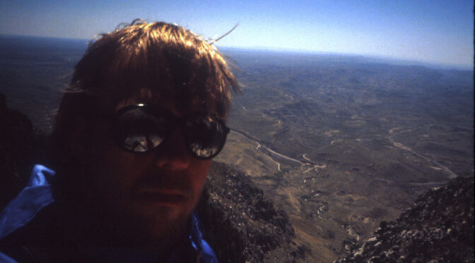
A note about some of the photos here–I scanned many of these slides thirty years ago when I had to squeeze them onto floppy disks, so their resolution is poor.
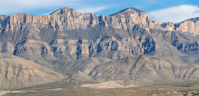
I was twenty-six years old, still in the middle of my offshore oilfield career. I had read the old “Trails of the Guadalupes” guide, published by the Carlsbad Caverns Natural History Association, backwards and forwards while working on out in the Gulf of Mexico and had decided I needed to go see Guadalupe Mountains National Park (GUMO) and climb the highest mountain in Texas. But I also wanted to go back to the place I first fell in love with the desert mountains, Big Bend National Park. My last trip there had been when I was still a teenager with my friend Kelly, in 1977. I had also been reading, repeatedly, the Hikers Guide to Trails of Big Bend National Park. I was working offshore at this time, but had a week off and that may explain my odd departure times.
It’s been quite a while since my first climb up Texas’ highest point, Guadalupe Peak (8,751′ now, was listed at 8,749′ then). I have basically no notes from that trip; just fuzzy memories and some fuzzier photos from an old point & shoot Nikon I used to borrow from my dad. I have just enough to piece together the itinerary.
Planning
I was twenty-six years old, still in the middle of my offshore oilfield career. I had read the old “Trails of the Guadalupes” guide, published by the Carlsbad Caverns Natural History Association, backwards and forwards while working on out in the Gulf of Mexico and had decided I needed to go see Guadalupe Mountains National Park (GUMO) and climb the highest mountain in Texas.
Took a trip out to Guadalupe Mountains National Park last week. I’d reserved Sunday and Monday nights at Pine Spring, Tuesday/Wednesday/Thursday nights at Dog Canyon. I intended on climbing Guadalupe Peak again Monday, then I was planning on a backcountry stay on Wednesday night, possibly at Blue Ridge (as discussed here; https://bigbendchat.com/tentative-plan-for-one-night-backpack-dog-canyon-b-t18146.html).
I’d been getting in pretty good shape over the past six months, doing cardio, hiking, and most recently hiking with a pack to start conditioning myself for backpacking. But I had an unexpected trip to take my 89-year old mother to California to meet her new great-granddaughter from New Zealand who was visiting family in Berkeley…but I digress. Bottom line is I was out for a week, then home for only a couple of days before leaving on my trip.
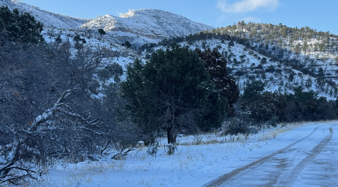
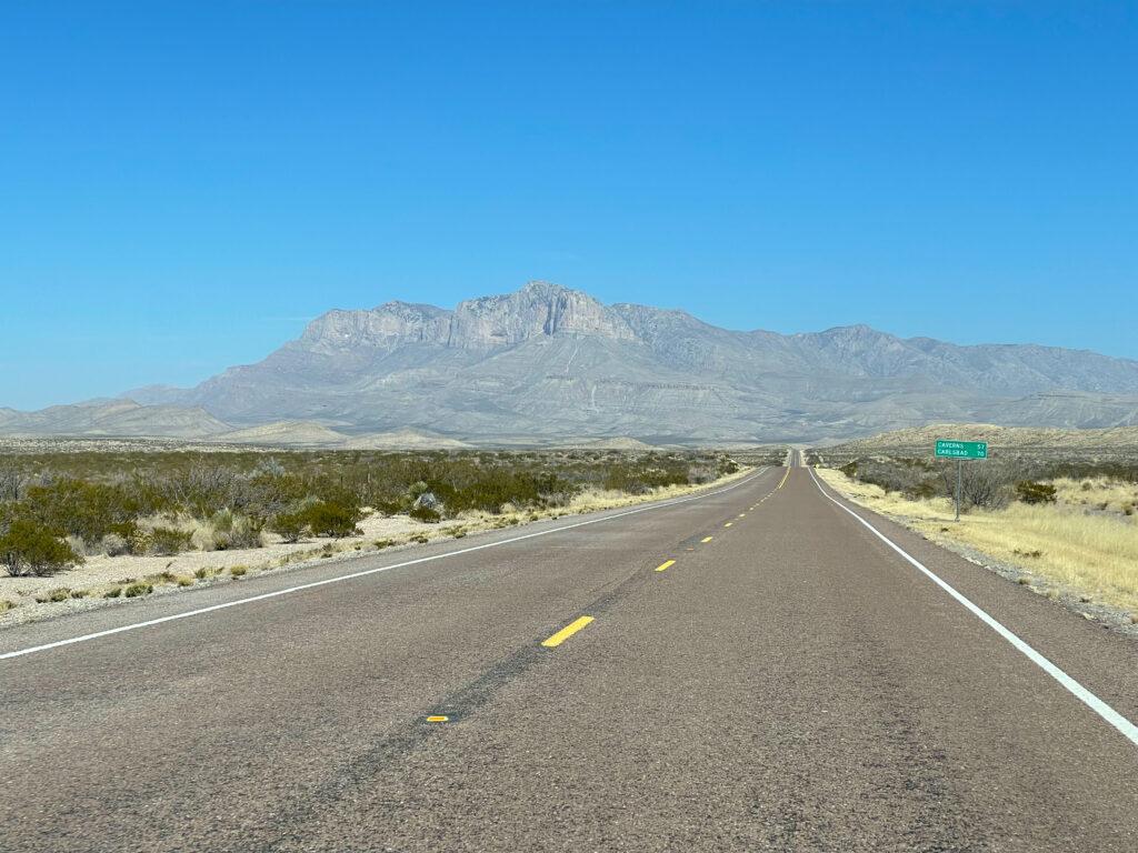
I left Austin around 4 pm arriving Ozona around 8 pm. I began this habit of breaking up the drive to GUMO a few years ago; gives me plenty of time to pack, take care of chores, and hardly feels like any time at all for the first day. And then it’s nice to get to my campsite early enough to where I don’t have to rush to beat sundown (especially in Winter). I got to GUMO just before 1:00–oops, Noon Mountain time; went to the visitor center to make sure I didn’t have to check in or anything (got that Senior Pass heh heh, and had already booked the camping) and wanted to confirm I could get my Wednesday night backcountry permit here on Tuesday morning as I left (I could).