TR-Grand Canyon Backpacking January 2011
(There is a separate Trip Report for the car camping on that trip here.)
Gear, Lessons learned
Route
South Kaibab-Bright Angel Campground-Bright Angel Trail
- 1/10/2011 (10:41 a.m.1) South Kaibab Trailhead->Bright Angel CG (4:15 p.m.)
- 1/11/2021 Bright Angel CG (9:39 a.m.) to Grand Canyon Village (5:27 p.m.) via Bright Angel Trail
Locations/Elevations Mileages
South Kaibab Trail
| Location2 | Elevation | Distance |
| South Kaibab Trailhead | 7260′ | start |
| Cedar Ridge | 6120′ | 1.5 miles |
| Skeleton Point | 5220′ | 3.0 miles |
| Tipoff | 4000′ | 4.4 miles |
| Bright Angel Campground | 2480′ | 7.0 miles |
Bright Angel Trail
| Location3 | Elevation | Distance |
| Bright Angel Campground | 2480′ | start |
| River Resthouse | 2480′ | 1.8 miles |
| Havasupai* Gardens | 3800′ | 5.0 miles |
| Three-Mile Resthouse | 4748′ | 6.5 miles |
| Mile-and-a-Half Resthouse | 5729′ | 8.0 miles |
| Bright Angel Trailhead | 6860′ | 9.5 miles |
Planning
While at the Grand Canyon Visitor Center at the end of 2007, I’d overheard a couple discussing with a NPS ranger backcountry permits for the Bright Angel site, at the bottom of the canyon near Phantom Ranch. I made a mental note to consider this in the near future. It’s a popular overnight and back hike; some folks pay $$ for the indoors at Phantom Ranch or a cabin but I was only interested in the backcountry sites. (My parents had hiked down and stayed at a cabin in 1978.) Aside from New Year’s Eve, there were almost always walkup available permits for Bright Angel this time of year. I made a mental note to come back soon for an overnight hike to the bottom and back. I returned for this trip in January of 2011.
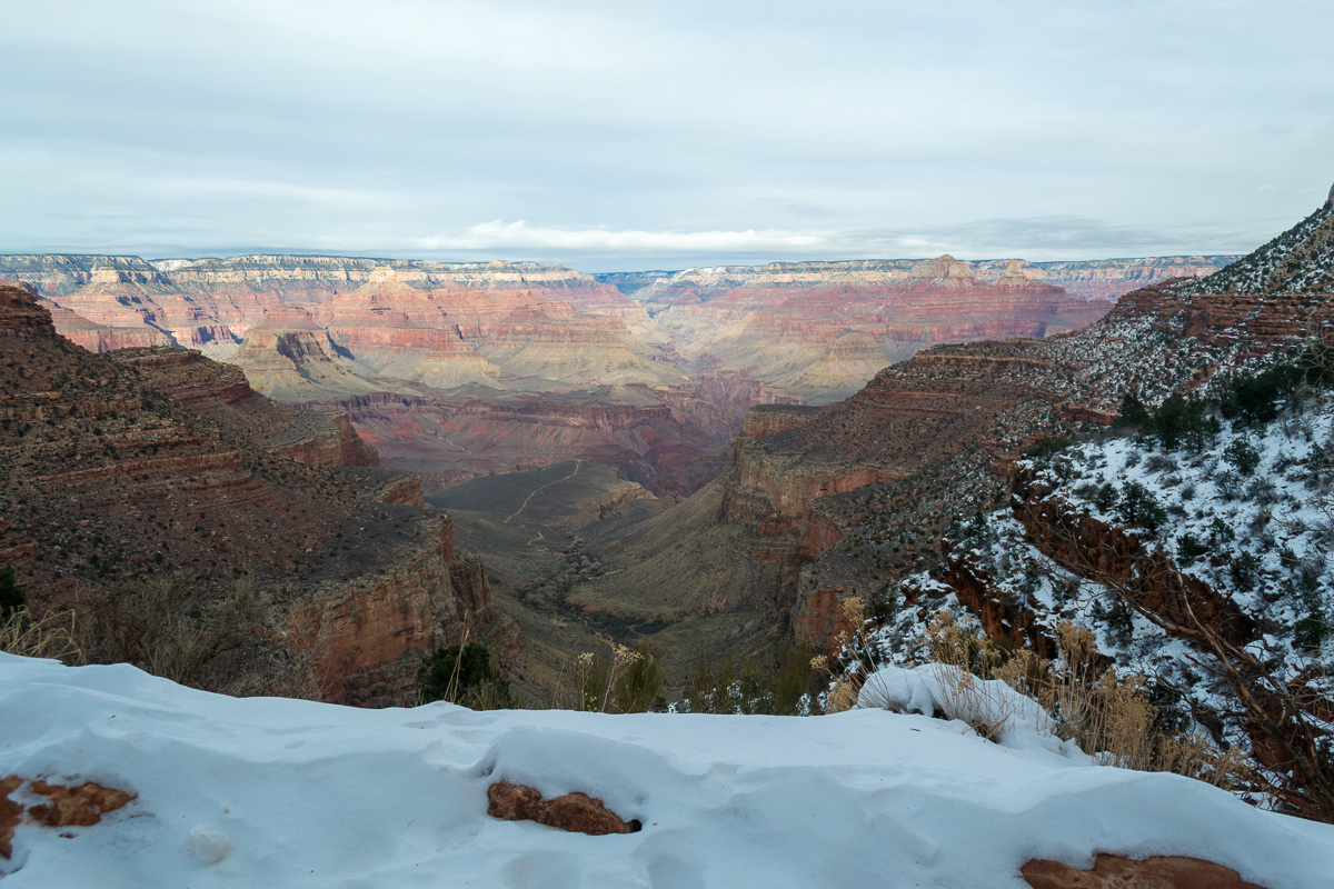
I would be doing the classic route. Descending the South Kaibab Trail (more exposed but more scenic) and returning via the Bright Angel Trail. I knew it would likely be cold. They’d had record cold just a week earlier on the South Rim and the current forecast, while not quite that cold, still indicated temperatures in the teens with possibly snow for the afternoon I was to emerge, Tuesday the 11th .
I anticipated (correctly) ice and snow on the upper elevations of the trail. I didn’t have much experience hiking on ice; as a kid in Norway I’d done a lot of cross-country skiing over deep snow and ice but this would be different. I actually bought two different types of footwear at the Grand Canyon Village store and experimented with them around the campground. I ended up going with the microspike type–rubber straps with tungsten inserts. I felt these were easier to put on/take off than the more crampon-like style.
The Trip
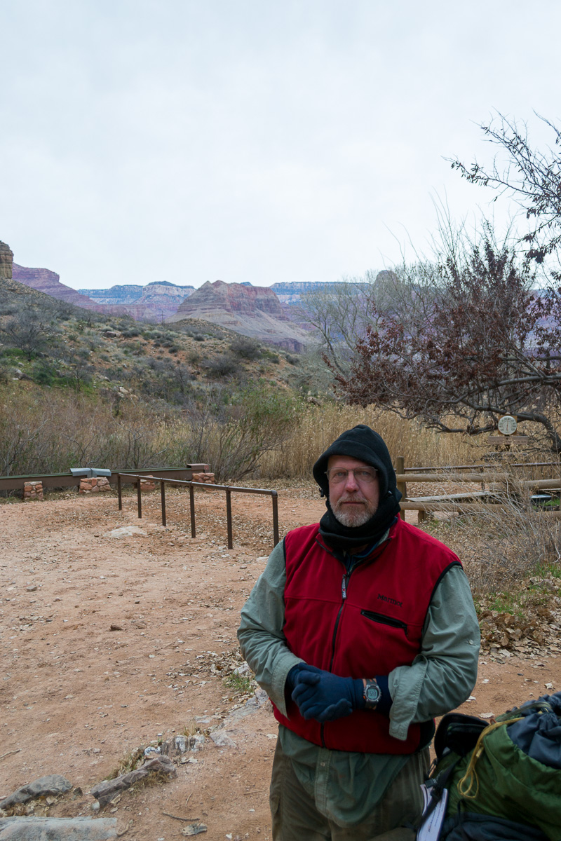
I got my backcountry permit at the Backcountry Information Center, and I think I caught the hiker’s shuttle near there. According to my GPS tracklog4 which has some wild swings (not sure if adjusted to Mountain Time Zone or not) I departed South Kaibab trailhead at 10:41am 1/10/11.
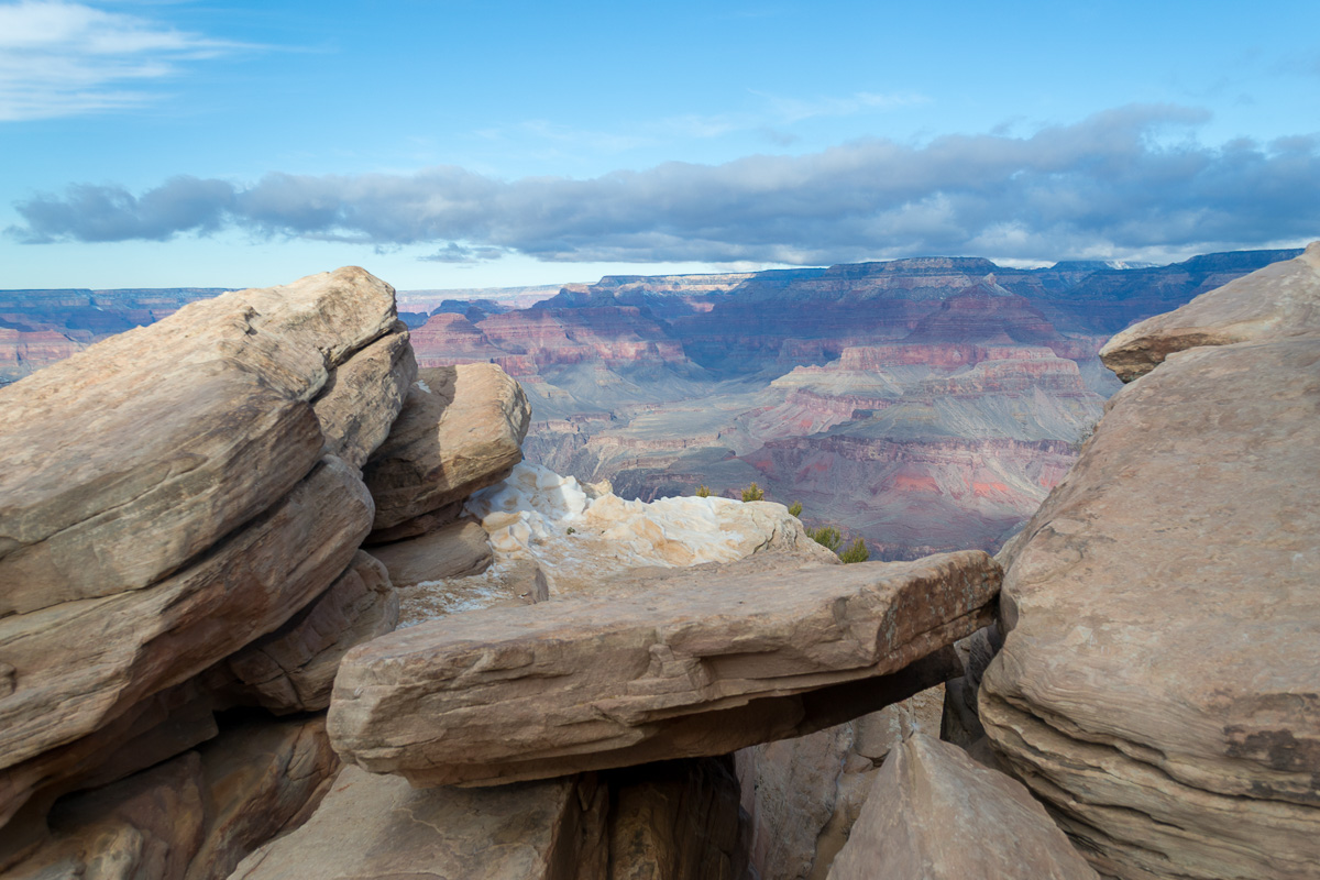
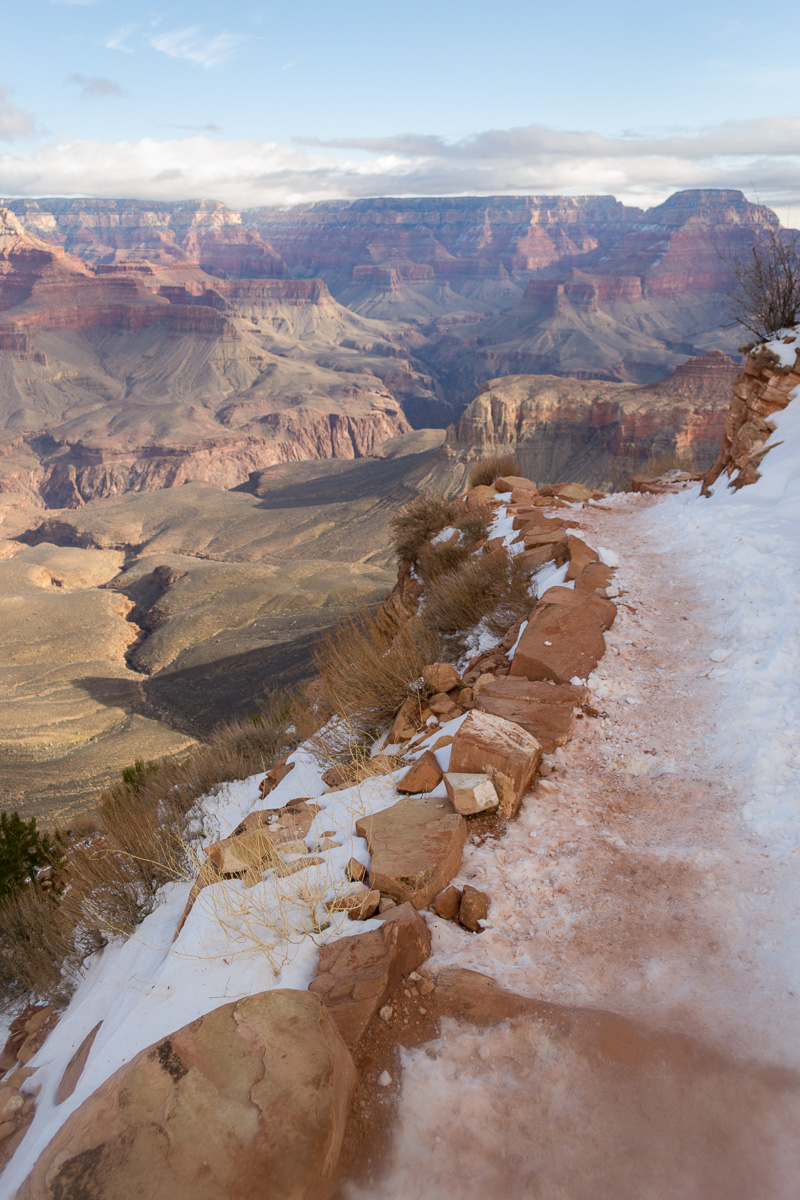
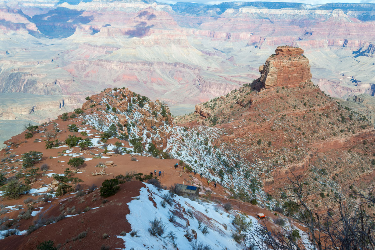
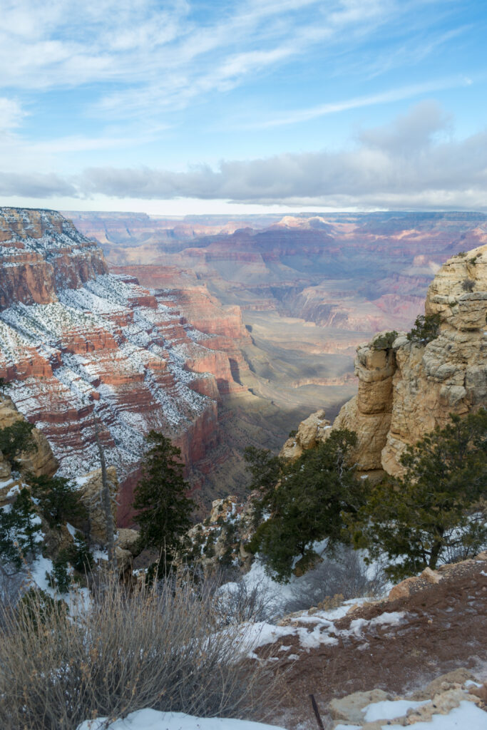
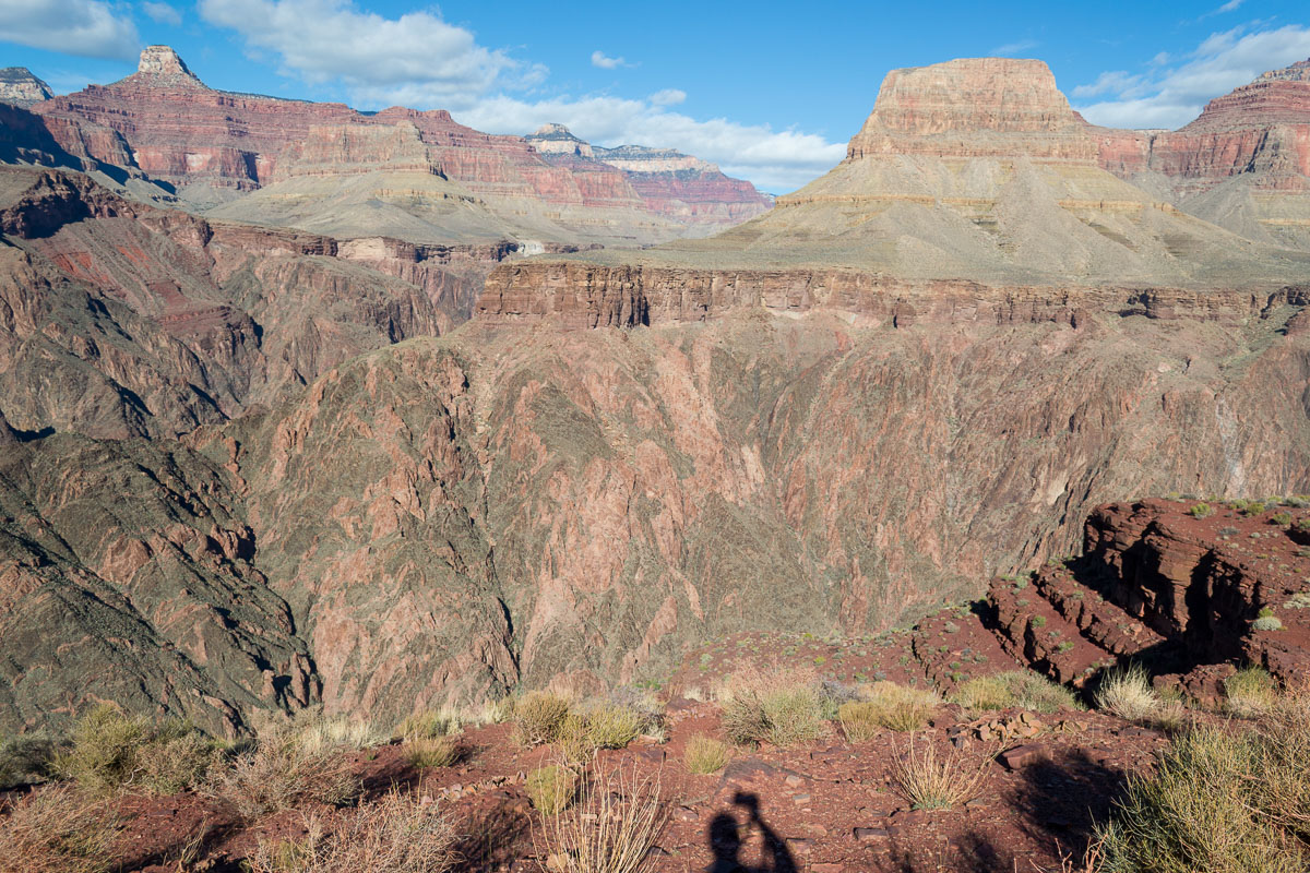
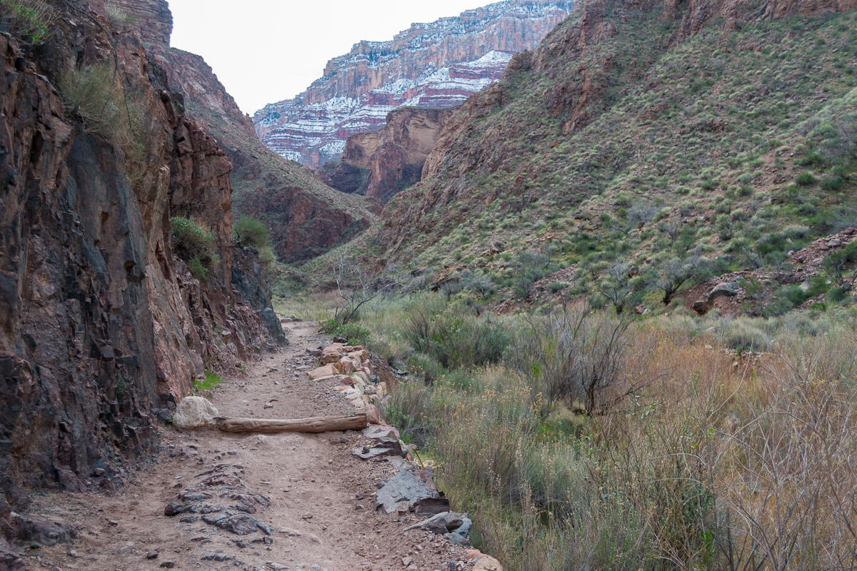
The trail was indeed covered with a think layer of ice and some snow. Sometimes the snow was quite deep depending on the orientation of the trail. The steeper the canyon wall, the more ice there was as the sun shone less on that trail portion. Every step I took I was mindful of keeping my balance. I looked up occasionally to see the spectacular panorama but nearly every time I did I would slip so I mostly kept focused on where I was placing my boots.
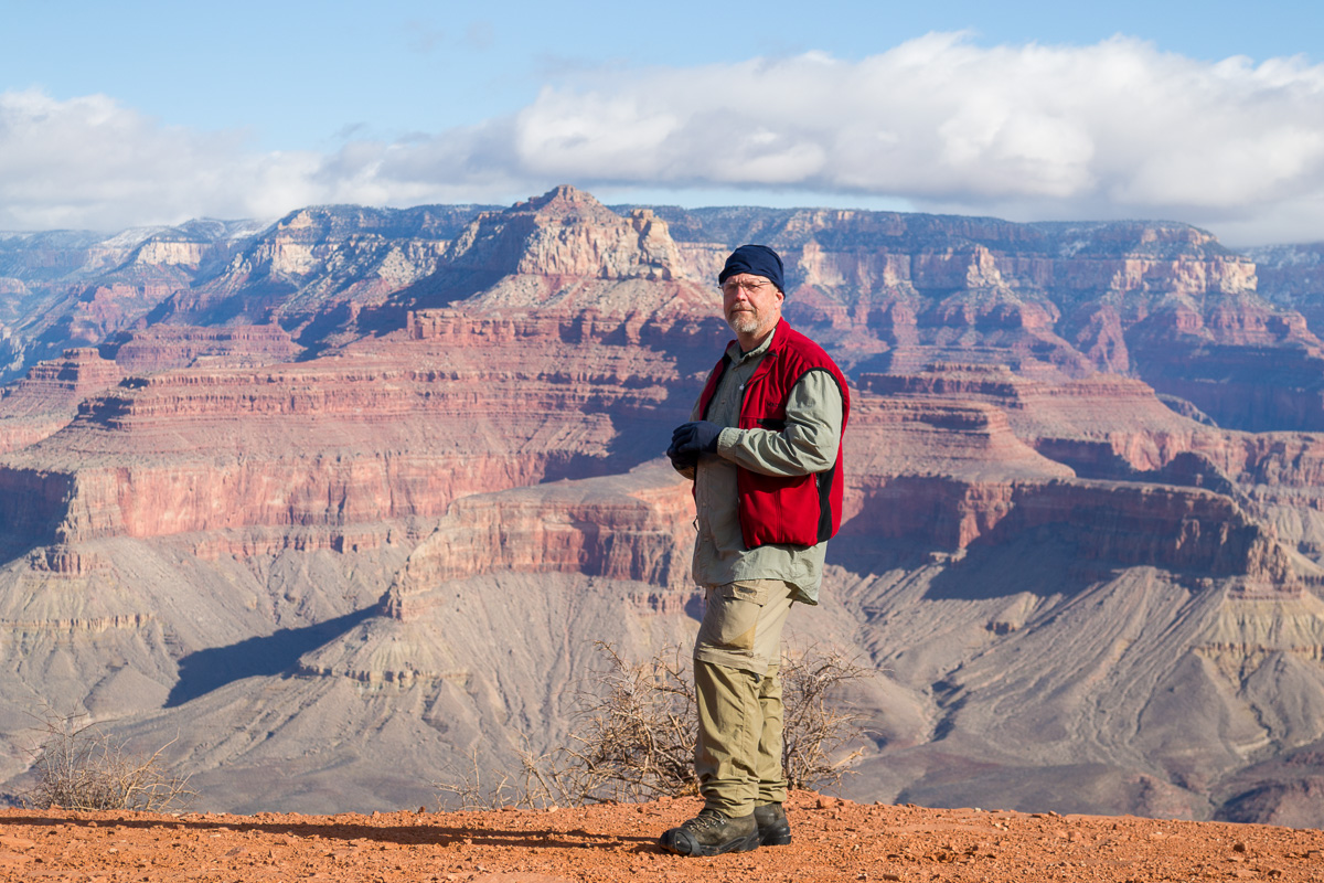
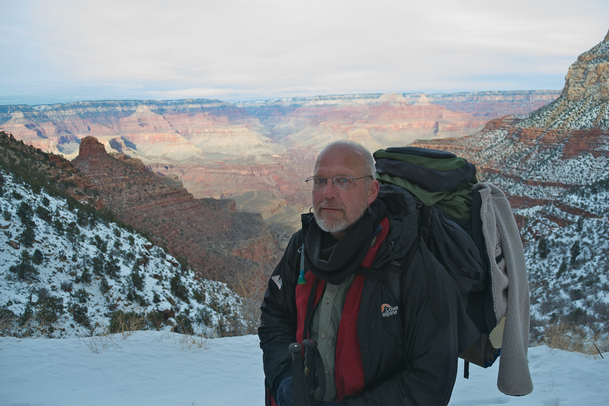
Both South Kaibab and Bright Angel trails have “resthouses” about every 1.5 miles, large restrooms and some have water–but not during Winter. The first one, Cedar Ridge, is a popular turnaround for day hikers and I could see several people milling around as I approached from above. I took a break for about twenty minutes, removing my pack. A couple of women were there and one volunteered to take my photo. She snapped one, “Oh, that’s no good. I’m a professional–I should do better!” and she took a couple more.
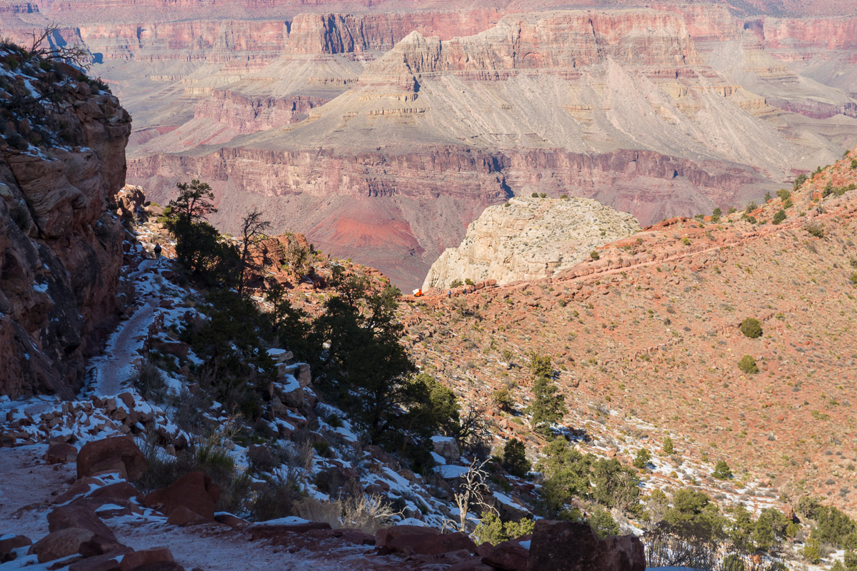
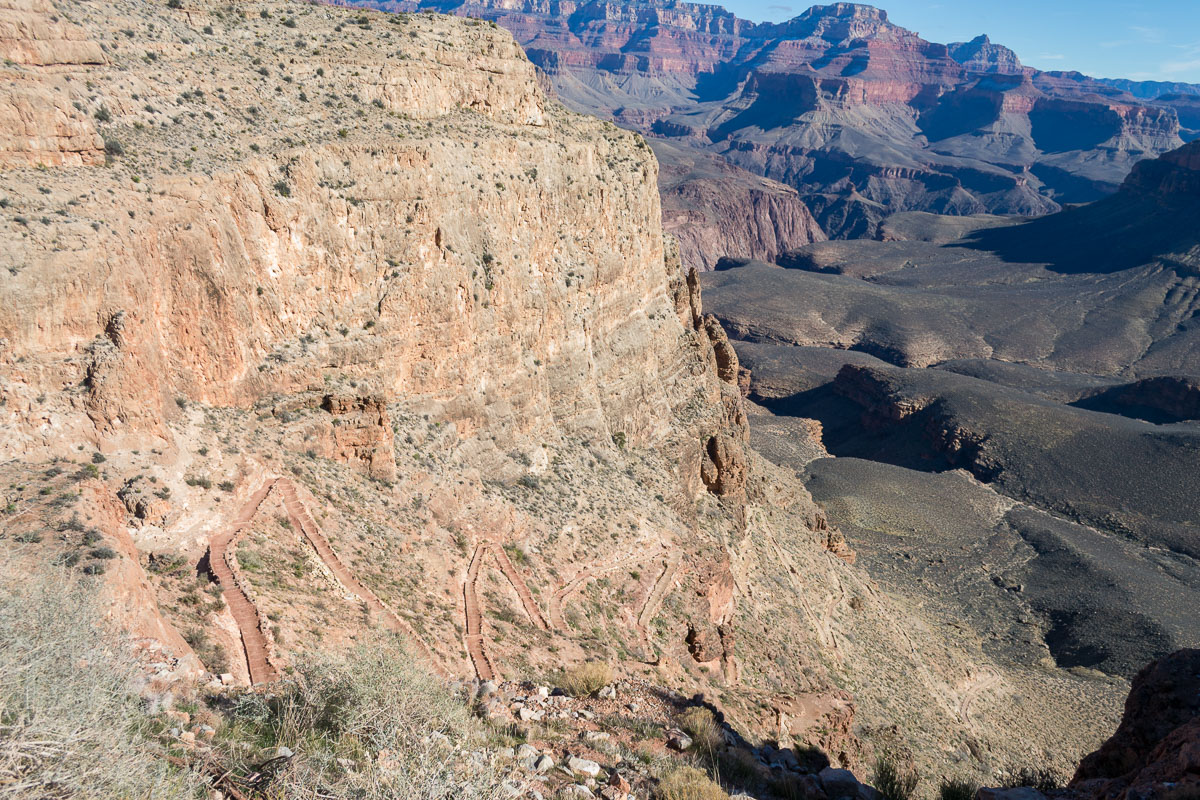
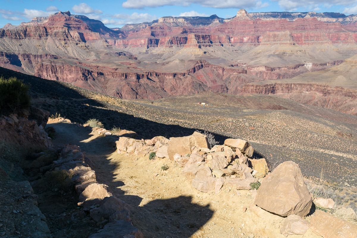
Somewhere around O’Neil Butte, there was one last stretch of icy trail; then it veered out onto the sun drenched plateau, a straight path lined with rocks. I stopped and removed the microspikes. The plateau lasted about a half hour or more, then I came upon a series of steep switchbacks. (I believe this was near Skeleton Point.) I should mention something about my conditioning. I was in very good shape, cardiovascularly speaking. I ran three half-marathons in first part of the year so I was doing a lot of running and cardio-fitness work in the gym. I’d even trained some with my backpack. I was feeling great, not winded in the slightest.
However, I was starting to feel pain in my right foot. As I descended these switchbacks it increased to become a significant issue. I slowed down, then started side-stepping on the way down. Anything I could do to alleviate the agony I felt in the sole of my right foot. It felt as if the pad of my right foot was in a vise and every step down with weight on it sent pain shooting up from a point somewhere around my middle toes. (“Metatarsalgia” I believe they call it.) I actually considered alternatives, such as cutting the trip short, but that seemed pointless. But it did affect my time calculations for arriving at the campground.
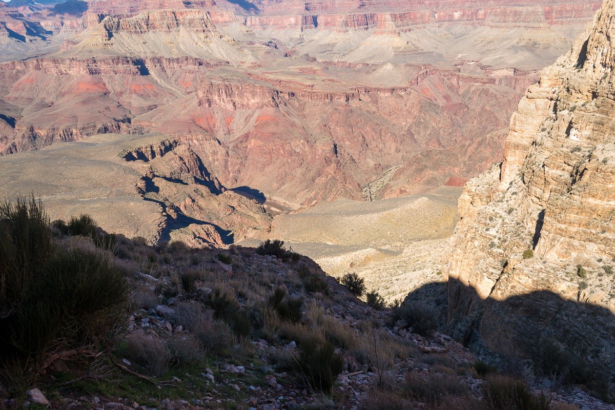
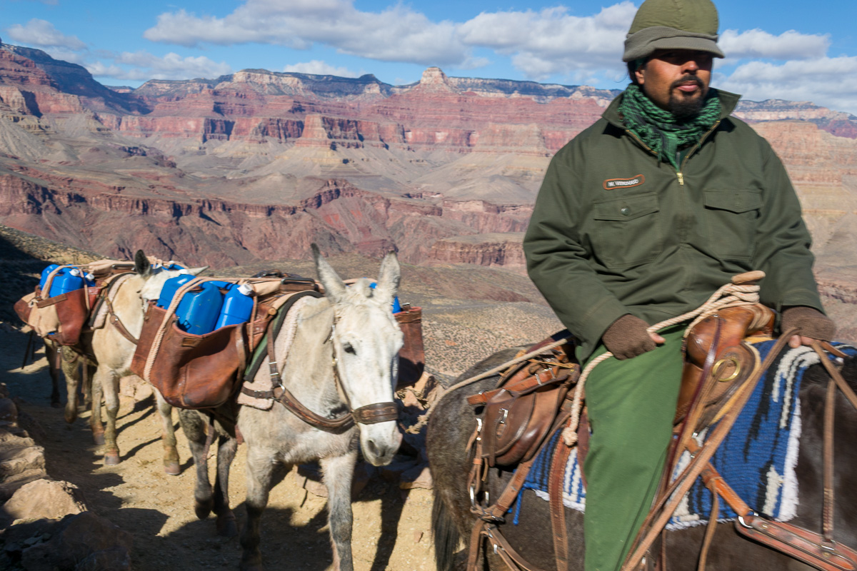
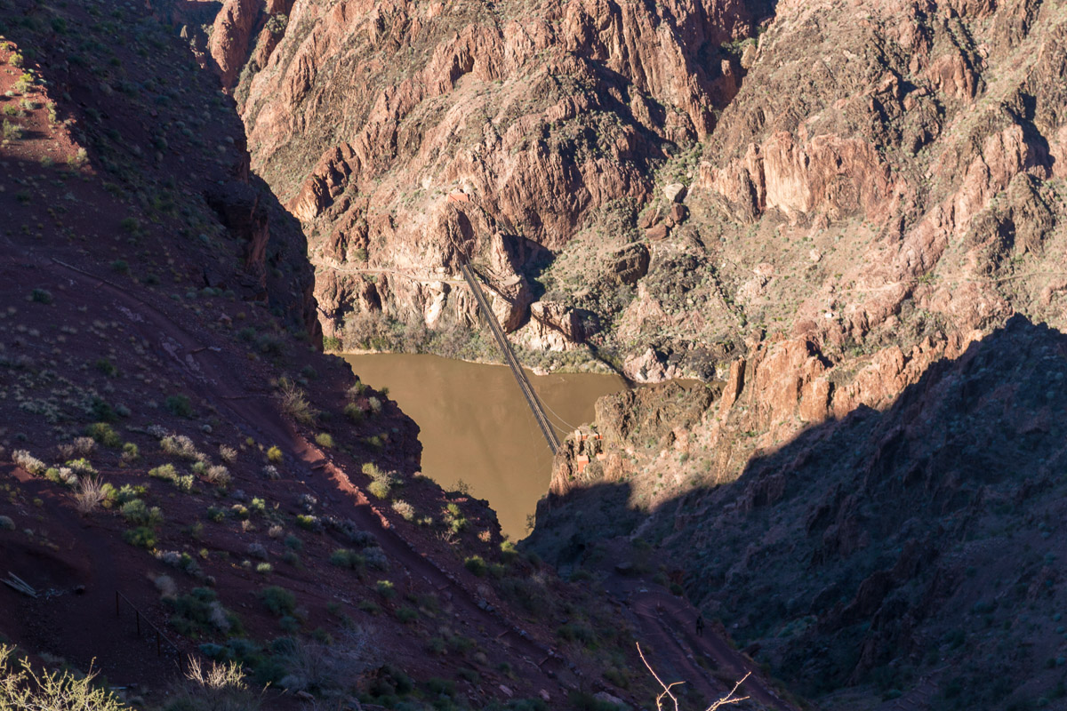
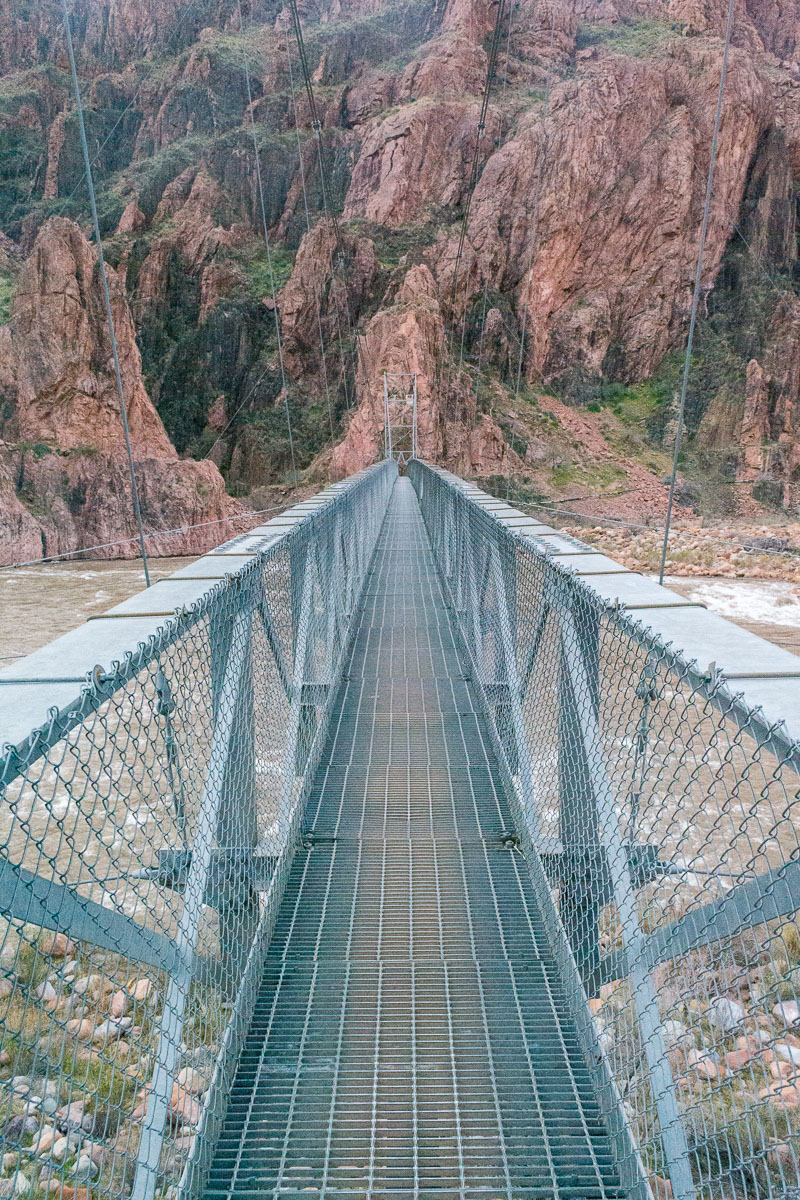
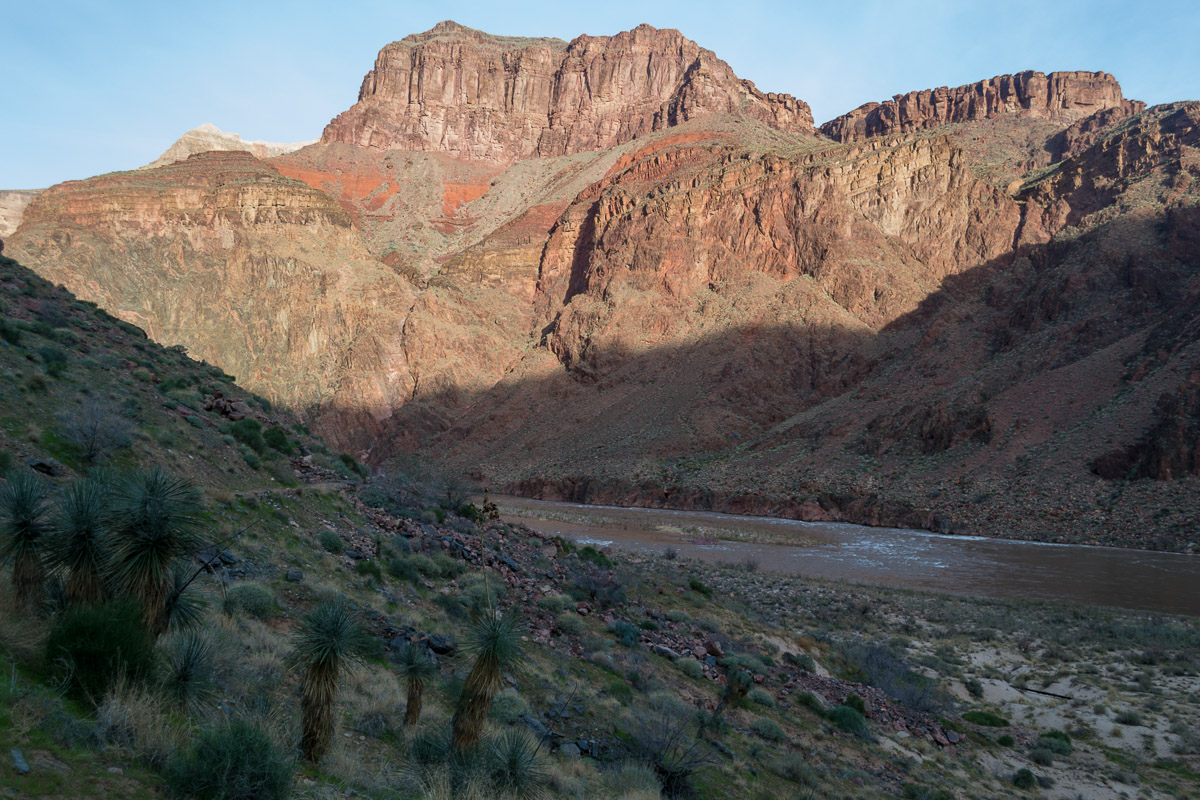
Somewhere along here a mule team carrying supplies for Phantom Ranch passed me. The trail leveled out again and I arrived at a resthouse at “The Tipoff,” where I arrived about 2:30. I continued down another series of switchbacks where I could hear the roar of the river below. Down through the deepest part of the great gorge, down the final 1,500’, down some more switchbacks, down through a tunnel and finally a bridge appeared and I crossed the Colorado at straight up 4:00 pm.
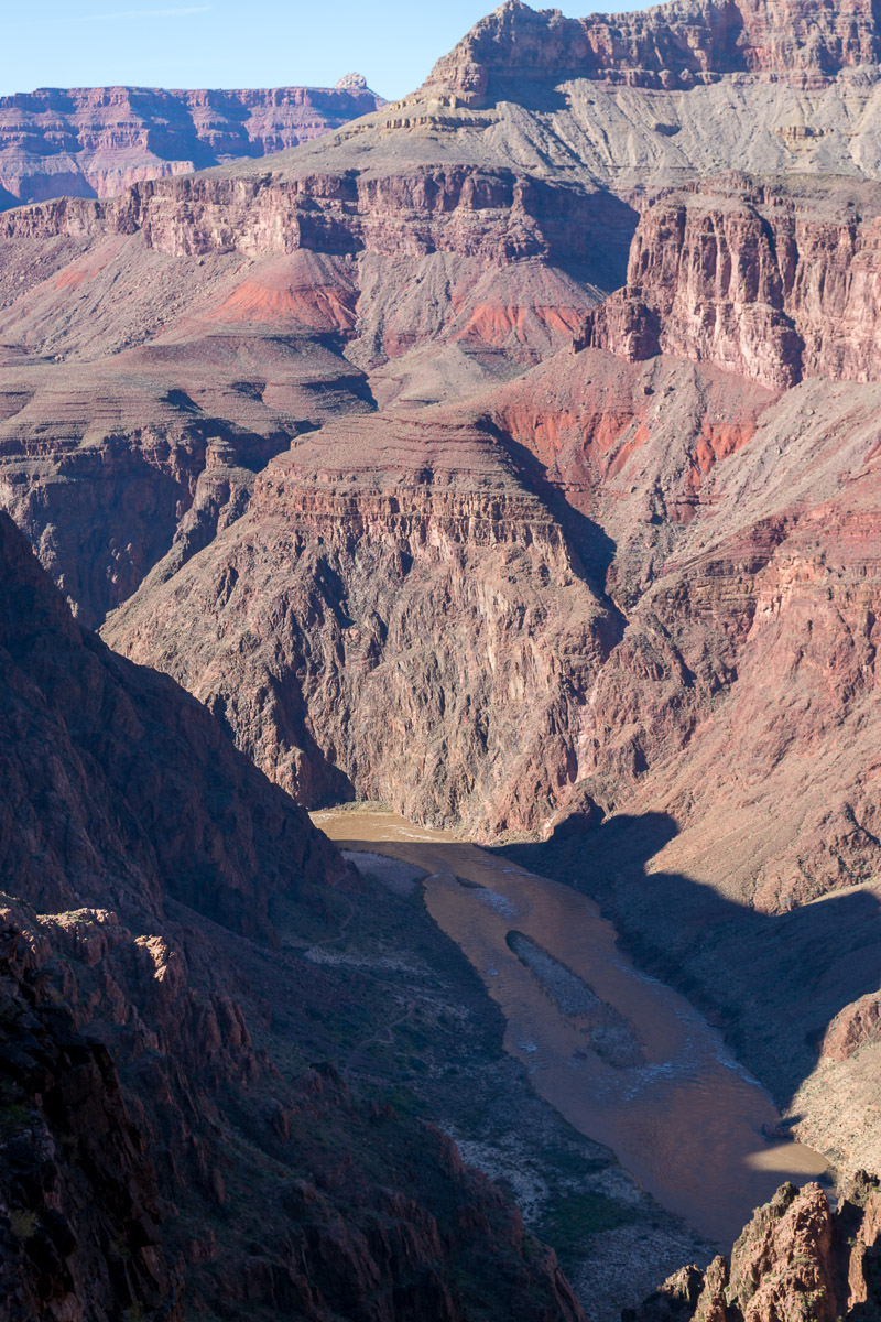
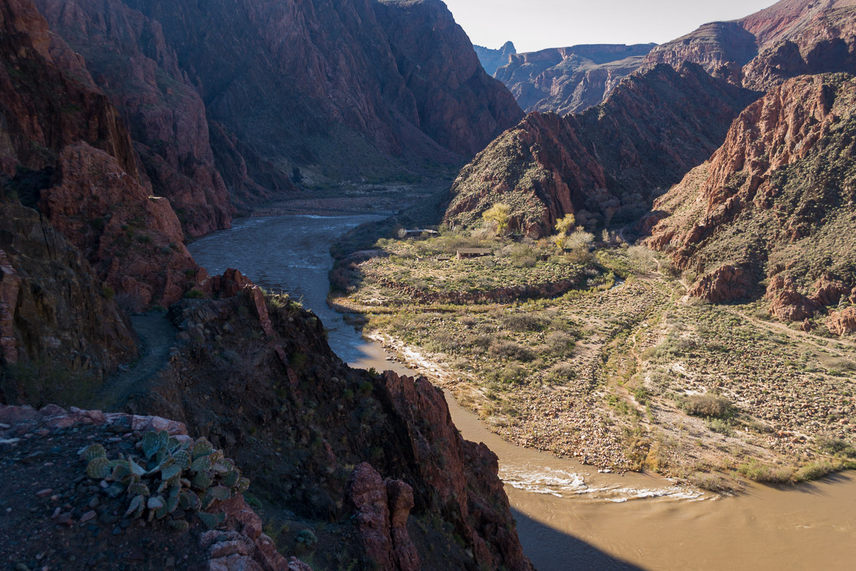
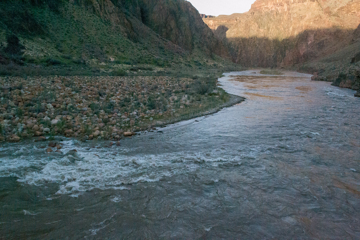
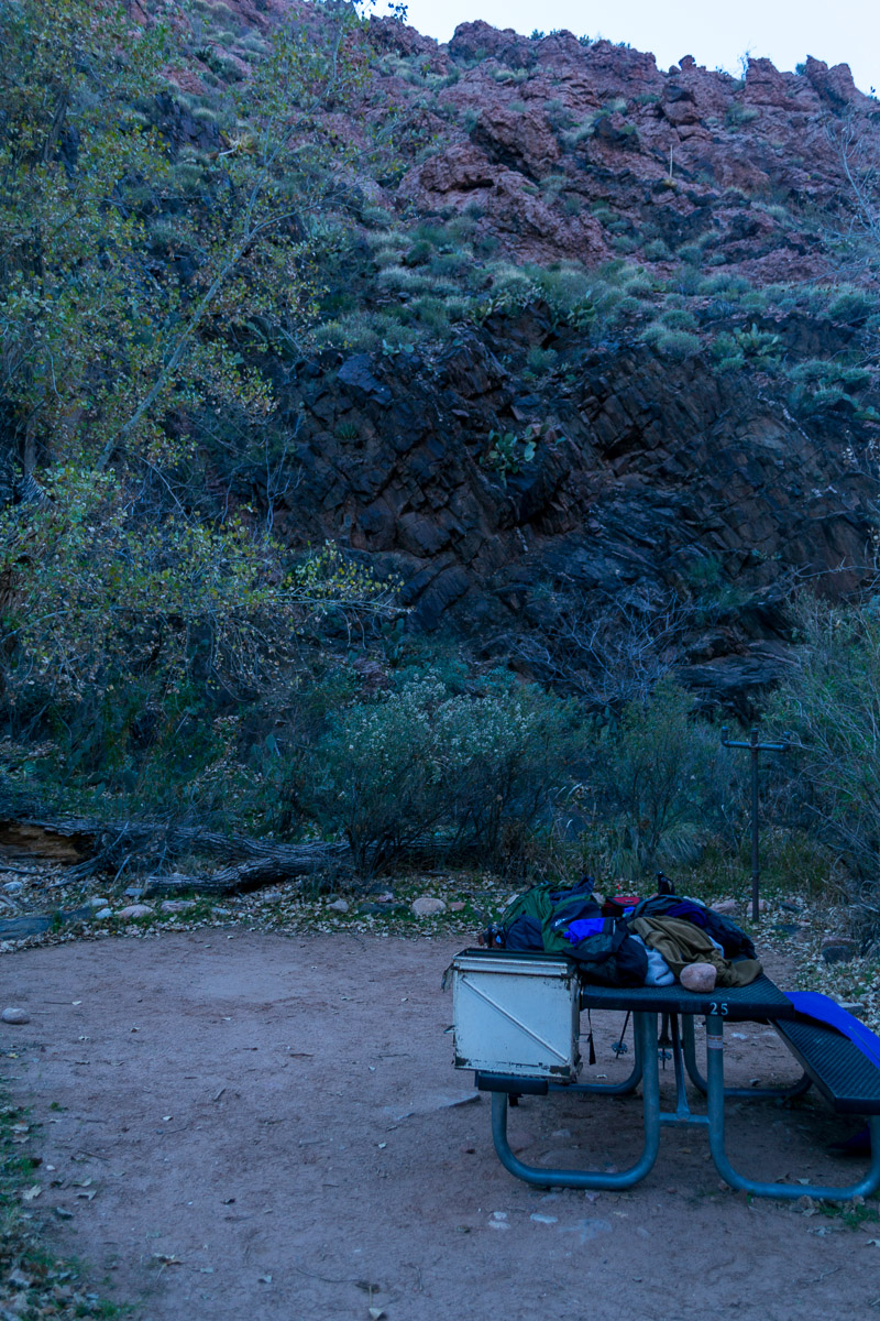
Went past the Ranger station and picked out a campsite at Bright Angel campground around 4:20 and set up my very basic camp. Walking on level ground didn’t seem to aggravate my foot injury, but I was sure anxious to get my pack off. I did, then moseyed around the campground and Phantom Ranch (I think the Cantina was closed by the time I got there), and then back to the river. I took a few photos. I only saw a handful of other hikers or campers. I certainly felt I had the place to myself. The weather was nice as I recall; calm, cold, mostly clear.
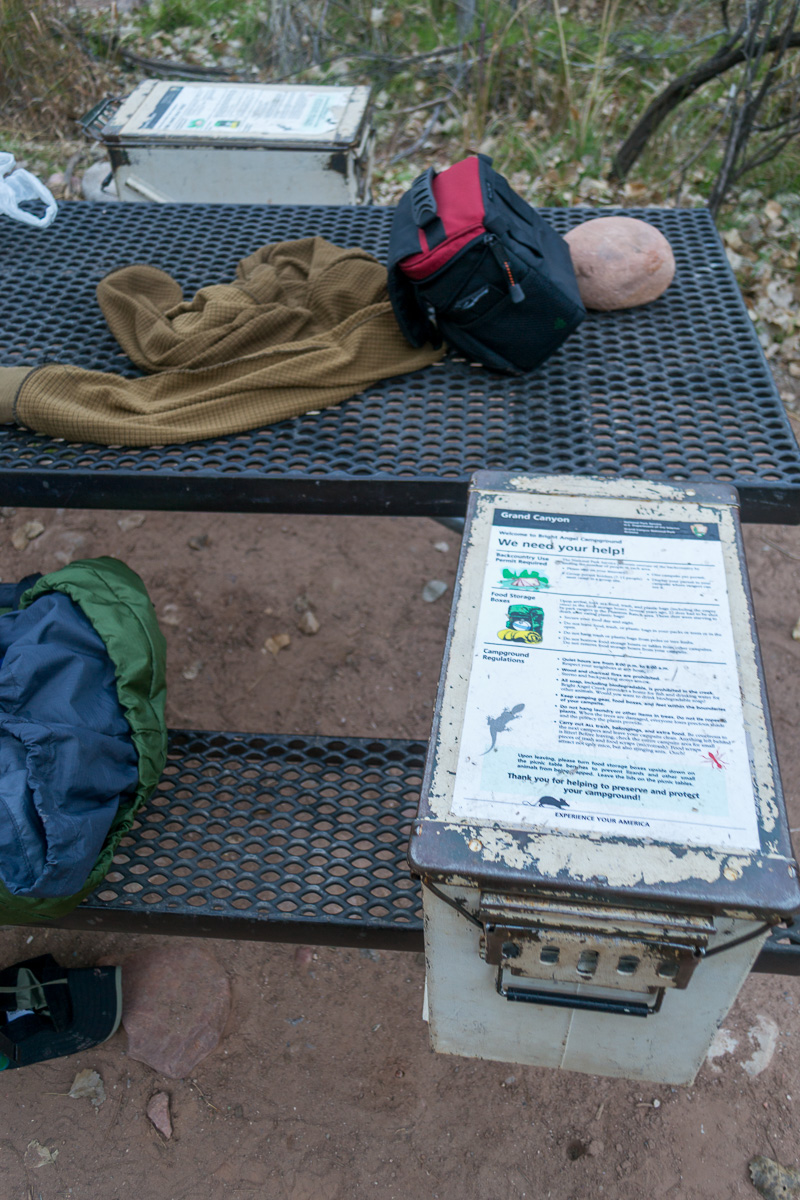
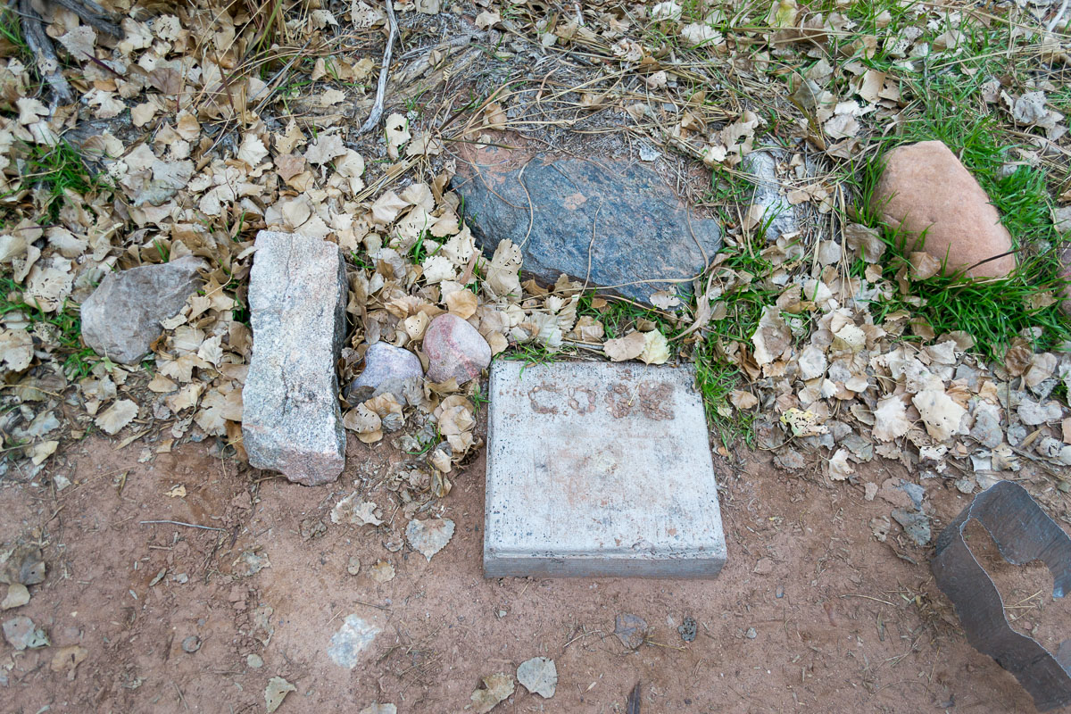
A ranger came by on patrol, I think to check my permit, and we chatted a bit. She kind of chuckled that I’d actually put my stove on the little concrete “cook” pad. I didn’t have a tent, just my OR Bivy, so went to bed under the stars, listening to an NCAA championship bowl game (Auburn/Oregon).
I was as on the trail the next morning by around 9:30 am.
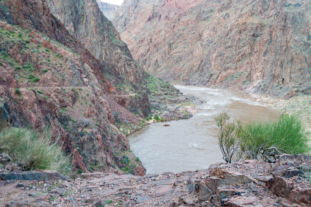
Took a few videos as I went across the bridge, then joined the River Trail and headed down river for a little over a mile.
I don’t recall exactly what I was thinking about as I went along the trail, with the canyon wall reaching up to my left, and the river down below to my right, but out of the corner of my eye I spied something large and black right next to the trail. For a split second I thought it was a large black garbage bag caught in a bush. Suddenly the trash bag spread its wings; I saw an enormous black bird with a large numbered tag attached to it. It quickly flew off as I struggled to get my camera up and take a photo. I failed. Somewhere in my notes I have the tag number of that Condor.
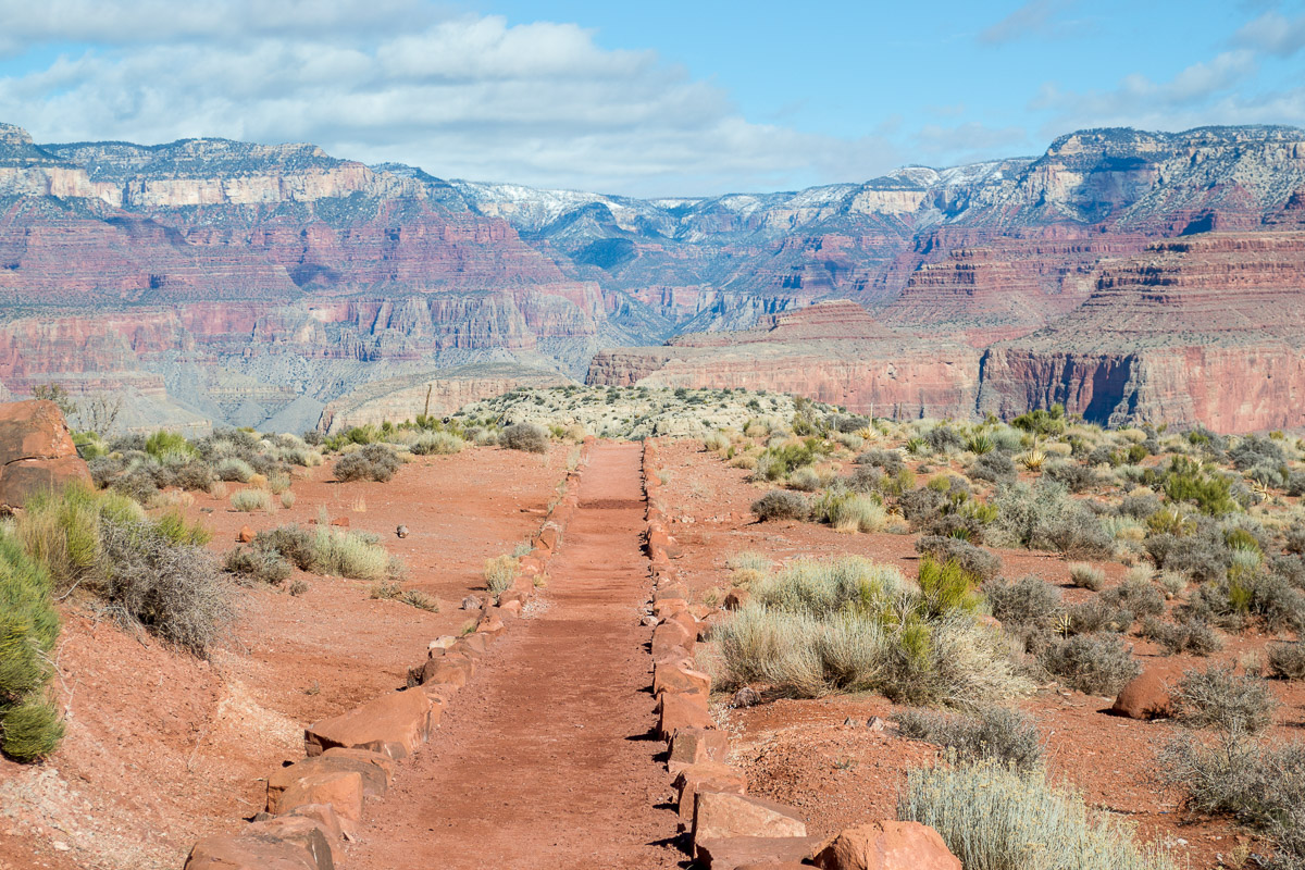
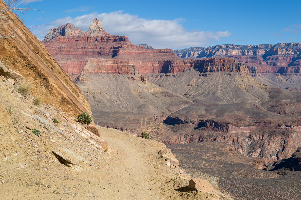
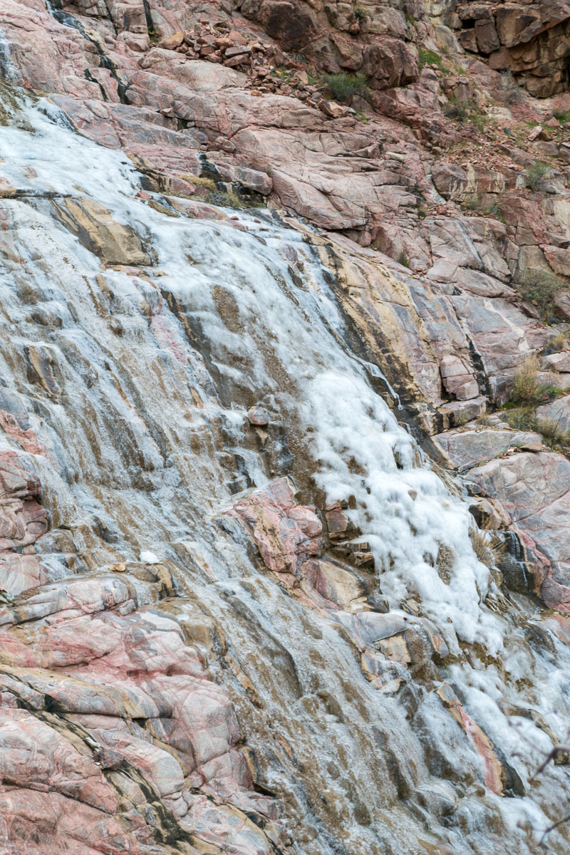
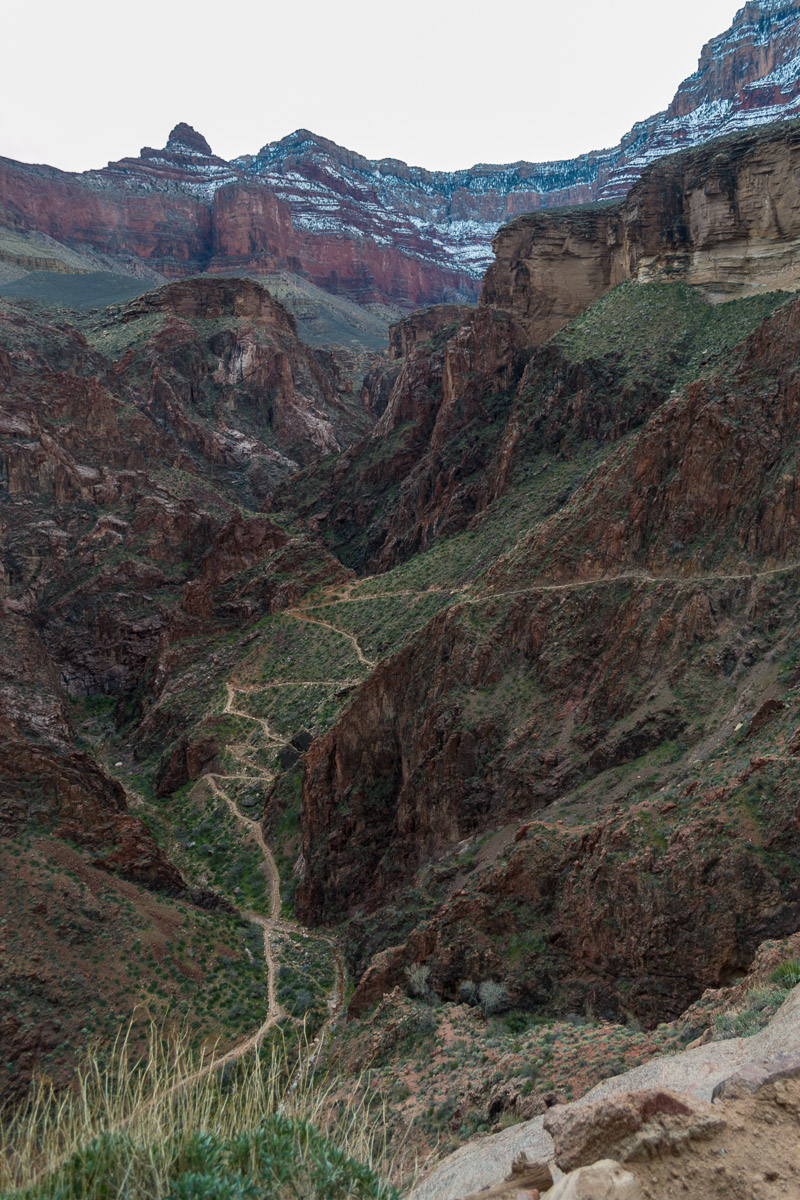
Around 10:30am. I bade farewell to the river and turned off the River trail to join the Bright Angel trail, the alternate route to/from the South Rim to the river. Clouds had moved in, and I was a bit concerned for the weather near the top, at Grand Canyon Village. I didn’t waste a lot of time on the way up. The trail mostly follows Garden Creek, and in a few spots frozen cascades lined the trail. An overcast had set in, and while the trail is mostly sheltered from the wind I suspected it might be blowing up high.
I continued up, feeling fairly strong with no vestiges of the foot pain I’d felt coming down.
Just after Noon, the trail finished a series of steep switchbacks as I exited the deepest gorge of the canyon, and by 1:00 I’d reached Indian Gardens, a popular campground for backpackers. I paused for a thirty minute break. 3,000’ to go!
It’s about 4.5 miles from there on to the top. The trail quickly gets quite steep, and eventually I entered the ice and packed snow zone for the final 3 miles. The hike was somewhat of a slog, always minding my footing on the ice, carrying about 50 lbs probably and always mindful of how late in the day it was getting. I trudged on, and I know I went slowly but with a sense of urgency as there is a gap of 2:45 between my photos at Indian Gardens and the subsequent one.
I passed 1.5 mile Rest House just after 4 p.m. and stopped to take some pictures and a video. (I should have taken my long johns off here at the rest house as I was sweating profusely.) About twenty minutes later, a couple of young men from Michigan State passed me on the way up. We chatted a bit, I was impressed with their pace, they were impressed with my age. They snapped my photo, offered me encouragement and we continued on our way. They soon left me behind. The snow here was quite deep in spots and the footing as treacherous as any I’d encountered, but I made my way up. About an. hour later I was surprised to see someone hiking down without a pack and in tennis shoes; she and her friend were giggling at how slippery the ice was, and I knew I’d reached the end of the trail.
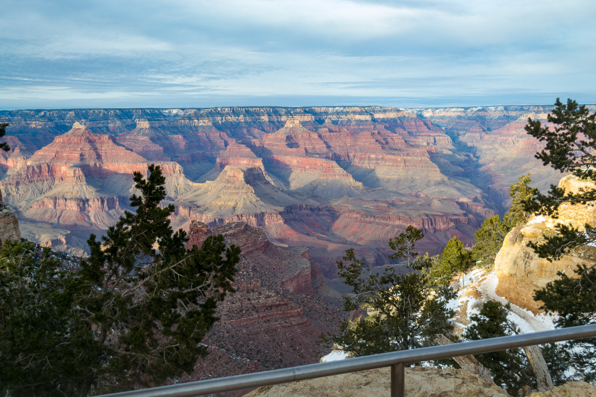
A handrail appeared, and I carefully walked up the final switchback thinking “don’t fall now you idiot you’ve made it this far.” I took a while to enjoy the spectacular view. The winds were whipping up there, and it was well below freezing, so only a few people were around the usually crowded Lodge area. I crossed over an icy parking lot to the bus stop and waited a few minutes for the shuttle. For the first time I felt cold; the winds and my sweaty clothes were really doing a number on me. I got back to my truck, changed out of my boots, and headed south; it took another twenty minutes or so driving my my hands to finally warm up.
Epilogue:
Oh, I almost forgot to mention: I don’t recall my foot hurting at all on the way back up. It only seemed to be on the downhill/descent parts. And I haven’t had an issue with that since.
Gear:
- Pack: Gregory Mt. Whitney
- Boots: Montrail AT (?) (size 13)
- Sleeping: OR Advanced Bivy
- Microspikes-not sure of brand
Lessons learned:
- I should have listened to my inner self and taken off a heavy layer before starting the final ascent. Did not need the heavy bottoms and the associated sweat.
- Time of day are from GPS tracking and camera; Not sure if I’d adjusted for timezone or not. ↩︎
- South_Kaibab_Trail.pdf (NPS March 2024) ↩︎
- Bright_Angel_Trail.pdf (NPS February 2024) ↩︎
- Same as footnote 1. ↩︎
Discover more from Phil's Phieldnotes
Subscribe to get the latest posts sent to your email.