TR-Guadalupe Mountains National Park camping and (canceled) backpacking-April 2025
Camping and backpacking at Dog Canyon campground; heavy snow made the backpacking impossible
- Camping: April 2-7 | Flickr album (and more videos)
Gear, Lessons learned
Trip Report
Planning
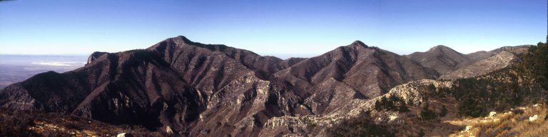
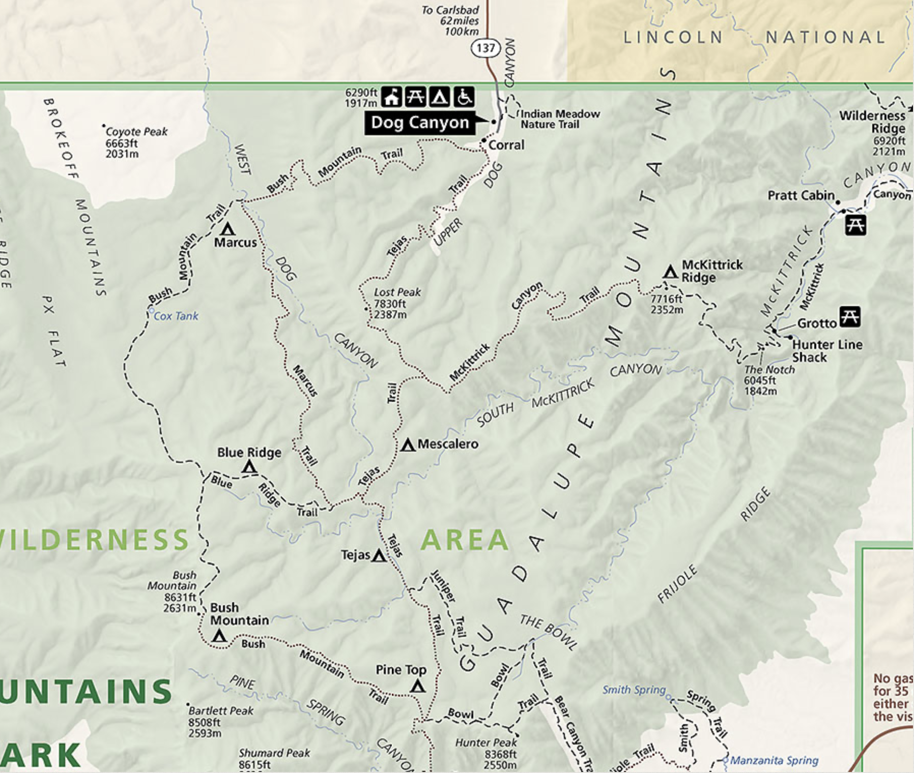
This trip was supposed to go something like this: camp at Dog Canyon campground in Guadalupe Mountains National Park (GUMO) then a long day hike followed by a rest and packing day, then an overnight backpack to Blue Ridge backcountry site, one of only 3 I haven’t backpacked to yet. Another goal was to hike the Marcus trail and the far northwestern section of the Bush Mountain trail, neither which I’d ever done. I had five days at Dog Canyon CG reserved and a backcountry permit for Blue Ridge on Saturday night, April 5.
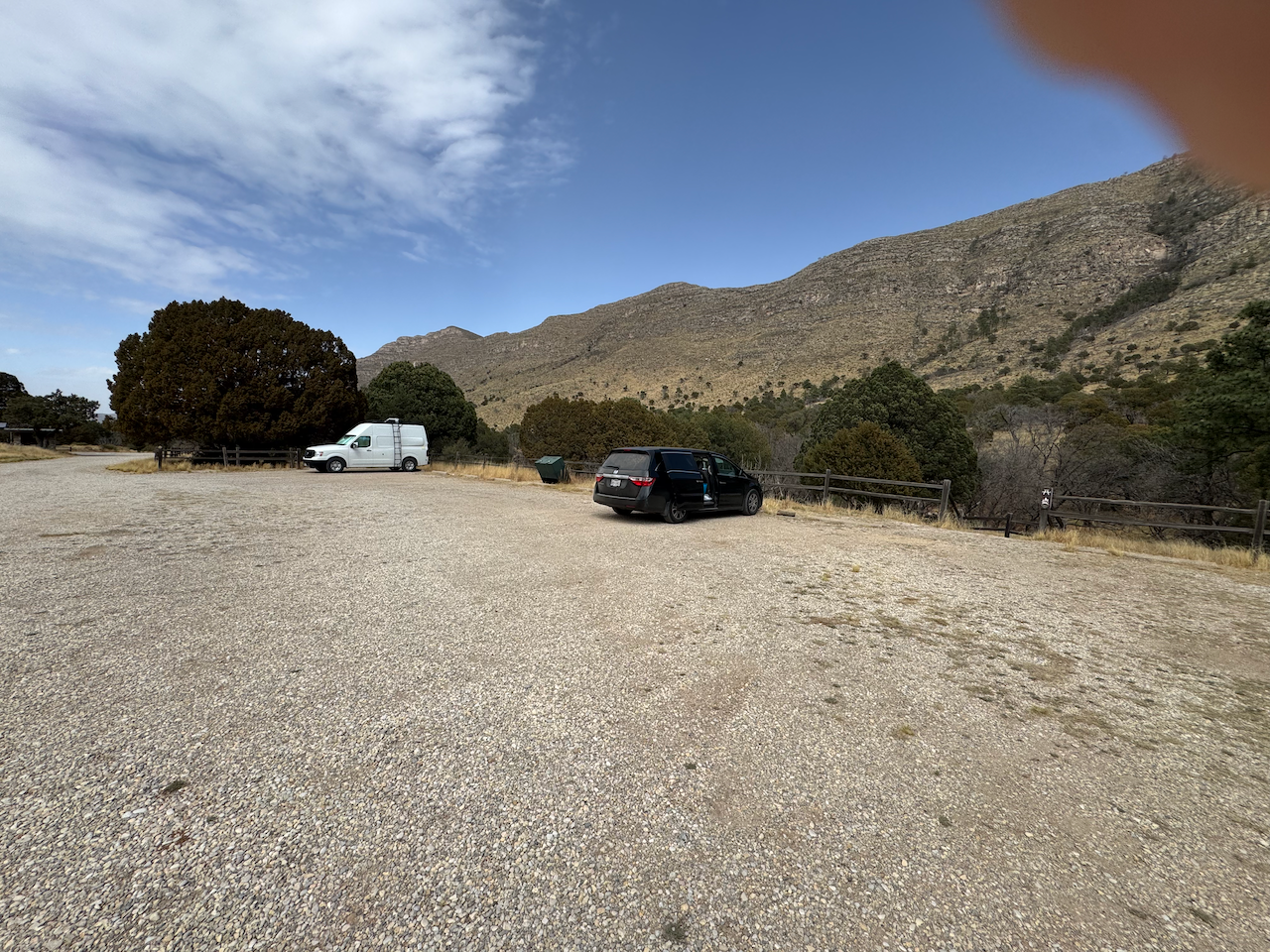
Once again I had issues with the Tacoma (clutch) so once again took the Odyssey. I took out one of the seats giving me quite a bit of cargo space and elbow room in that thing. (Would prove handy.)
I stayed in Ozona Tuesday night April 1, then on to the park Wednesday. I wanted to get to HQ plenty early enough to get my backcountry permit ok’d for Saturday night. The entire way from Austin was very dusty, and Wednesday morning most of the way to Van Horn was under dusty skies.
I’d been keeping an eye on weather forecasts for GUMO and there had been a hint of bad weather coming, especially on the days of my backpack. But they rarely mentioned much snow, or unusual cold. “Snow showers…Lows upper 30s”.
Getting settled
By the time I arrived at GUMO HQ Wednesday around noon, the forecast was showing a possibility of snow in the mountains but little accumulation. At HQ i got my permit, and discussed my itinerary with the staff. One pointed me to a more experienced gentleman behind the counter when I asked about the difficulty of navigating Marcus and/or Bush Mountain trails around the Blue Ridge backcountry site and if they thought the trails would be hard to pick up. He said it was indeed not as well maintained and sometimes difficult to follow, especially if it snowed, but should be able to discern the general route from Blue Ridge down Bush Mountain trail. So not too bad. They warned me of the upcoming weather forecast, of which I was already aware, and assured them I’d not be taking any chances.
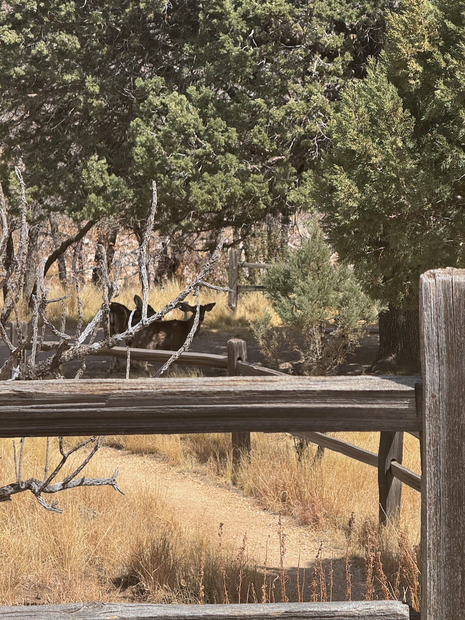
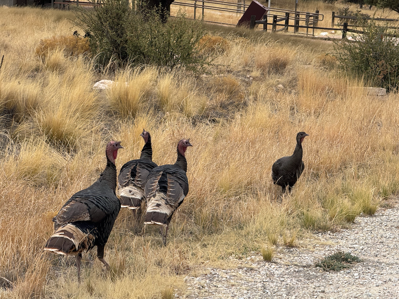
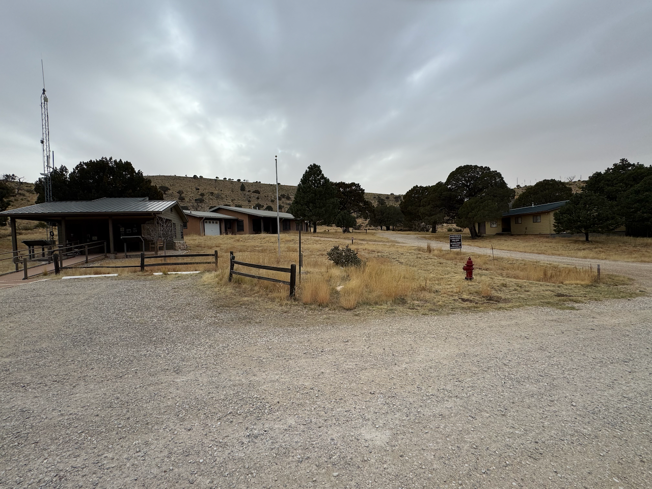
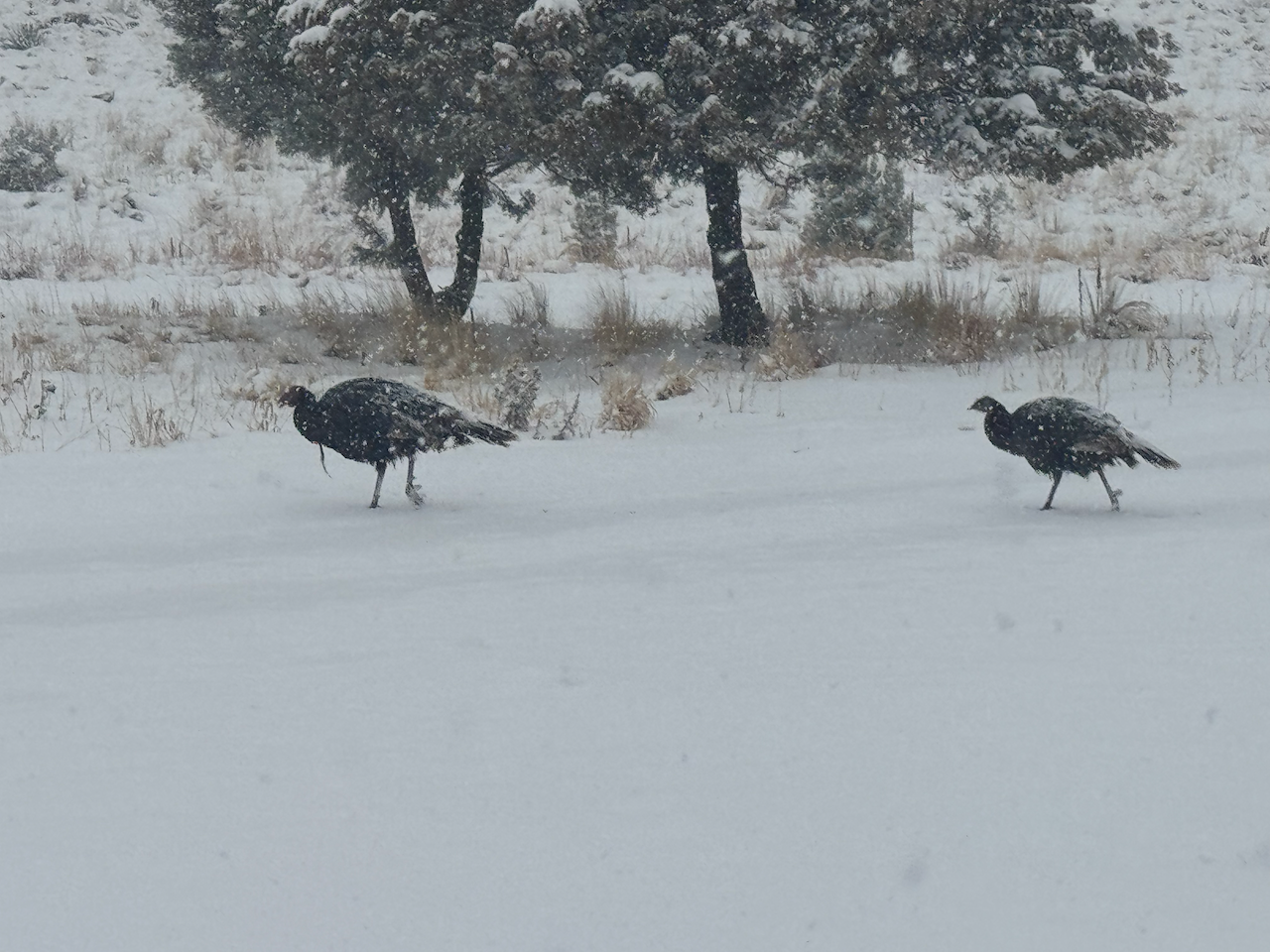
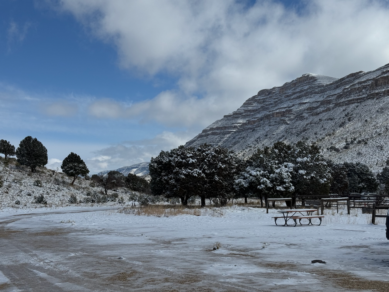
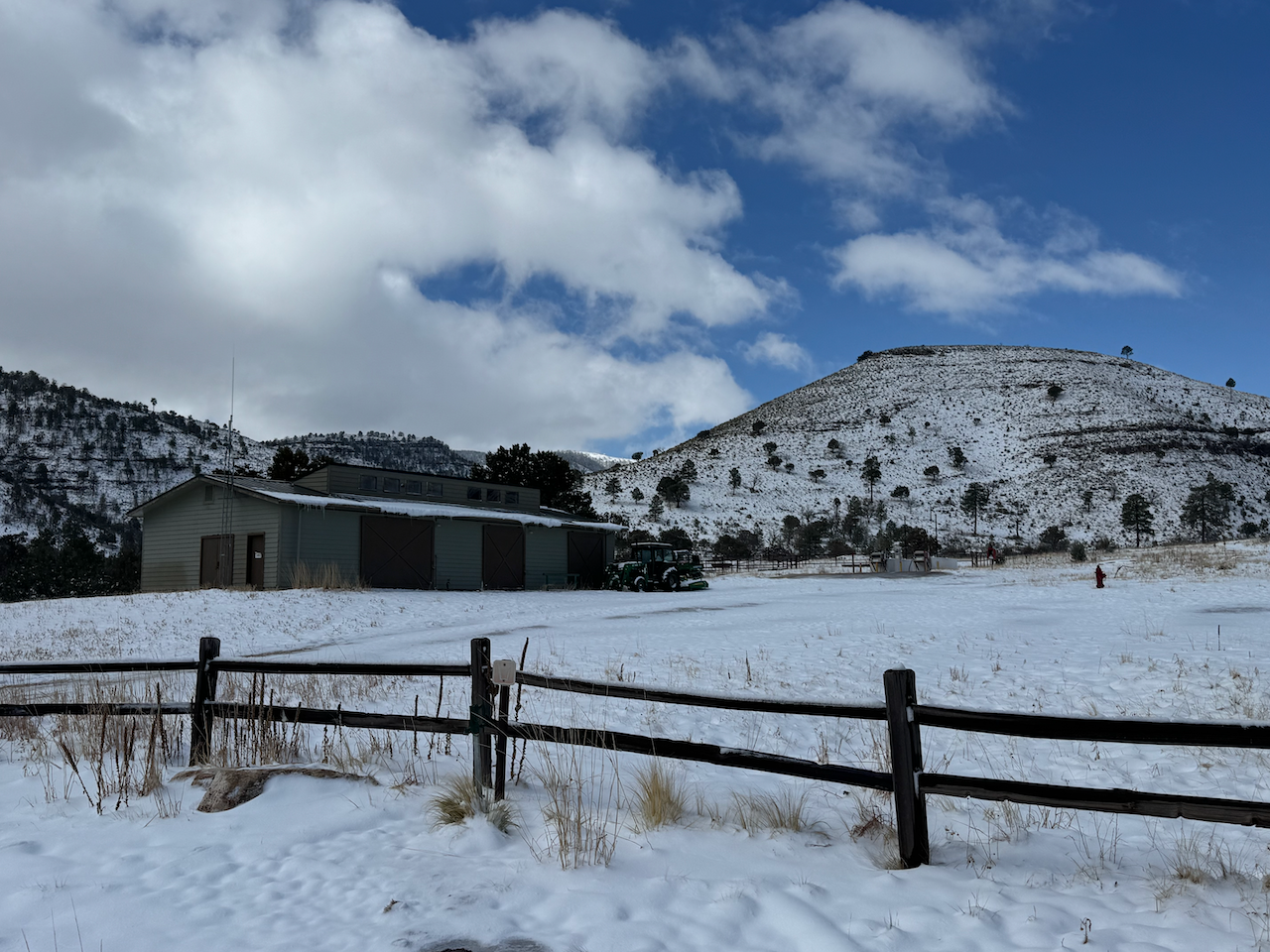
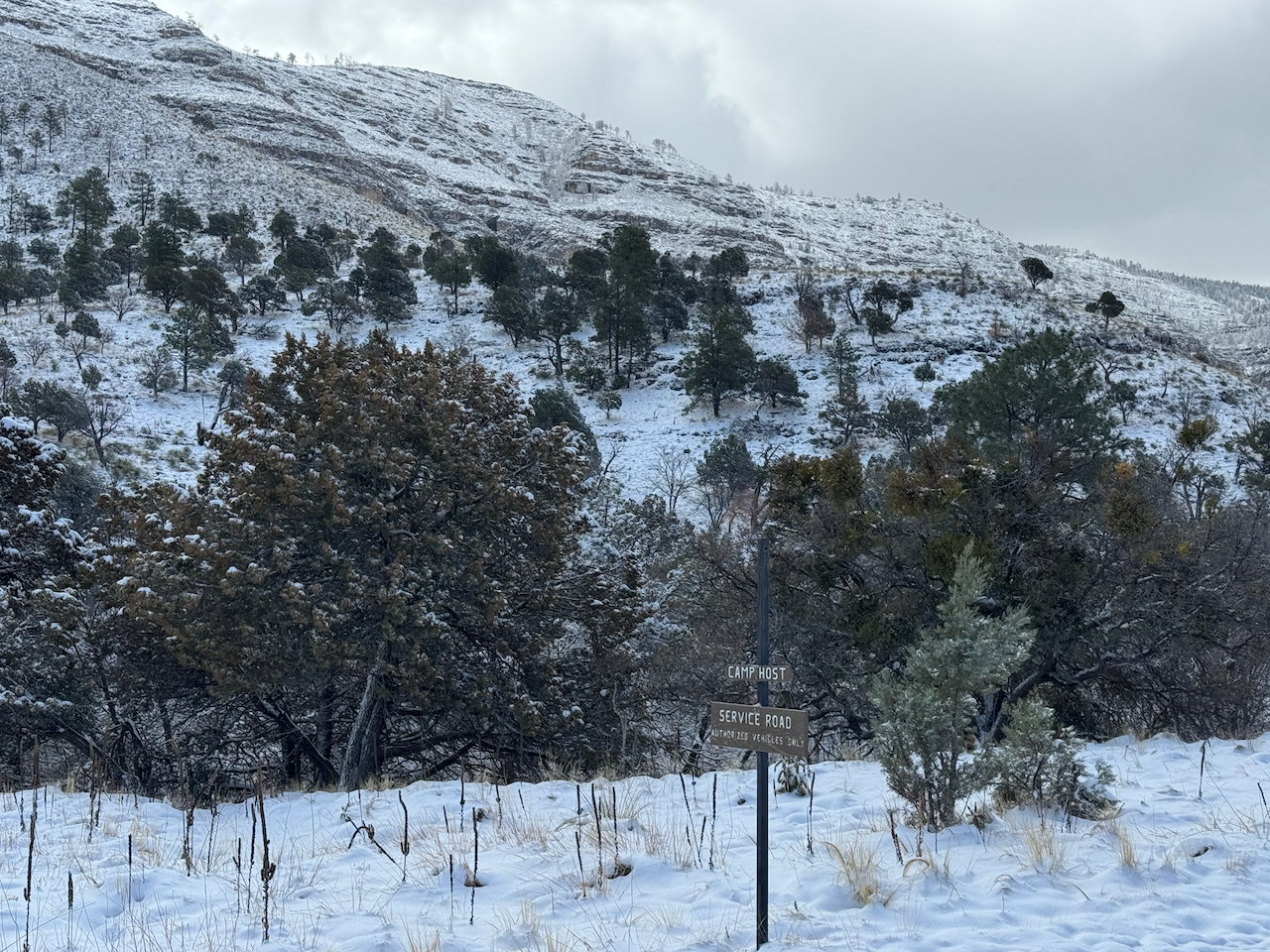
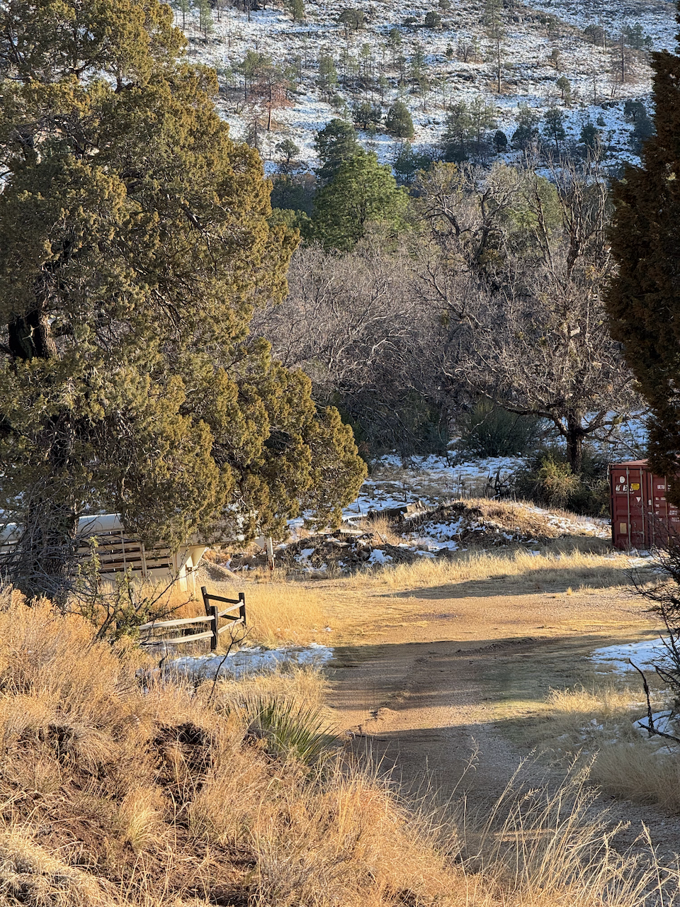
I continued on the familiar route to Dog Canyon; it’s only a 12 mile hike but over 100 miles to drive. I got there around 2 p.m. I set up in my preferred site (no.6) after shooing away a herd of deer hanging out on the tent pad and walked around for a bit. There was only one other vehicle there. I’ve been there many times when I was the only visitor around, and the ranger station unmanned, but there were usually at least a couple of staff around somewhere. This time though it had the definite feel of being an abandoned site. Not only was the station unstaffed but obviously had not opened any time recently; weeds grew around the few residences up the road. No activity at the maintenance shed. Wild turkeys abounded.
I considered my goals for the week, and I began to become a little concerned about the weather forecast for the weekend, especially above 7,000’. You lose cell coverage for good about 20 miles out of Dog Canyon (unless you’re on a mountain top), but I got occasional forecast updates via my inReach satellite messenger, which were pretty basic but beginning to mention “heavy snow” Saturday, although temps seemed reasonable (lowest temp was 27, winds mild.) I also spent quite a bit of time messing with the iPhone satellite capabilities. I’d briefly tried it while in the park in December, and had gotten it to work but inconsistently. This time i figured out how to maximize the connectivity so I was able to text a few friends for real-time weather forecast updates if needed.
I spent the rest of the day focusing on upcoming plans. The next day (Thursday) would be a long shakedown hike of some sort. I would use it to get acclimated to the altitude and make sure my feet were fine. If I felt good maybe I’d stretch out and explore something new and check out the trail conditions around the Marcus/BR junction. Friday would be a rest day, spent loading my backpack and finalizing plans. Saturday would be an early start. I’d consider the weather and go up either via Marcus Trail or the longer but more familiar (and better maintained) Lost Peak route. Saturday night at the Blue Ridge site. I wanted to see the overlook to the west again, a view I hadn’t had for forty years. Sunday morning I’d return via Bush Mountain trail–all new to me until passing the Marcus backcountry site, then back to DC.
Lost Peak/Marcus Trail loop hike
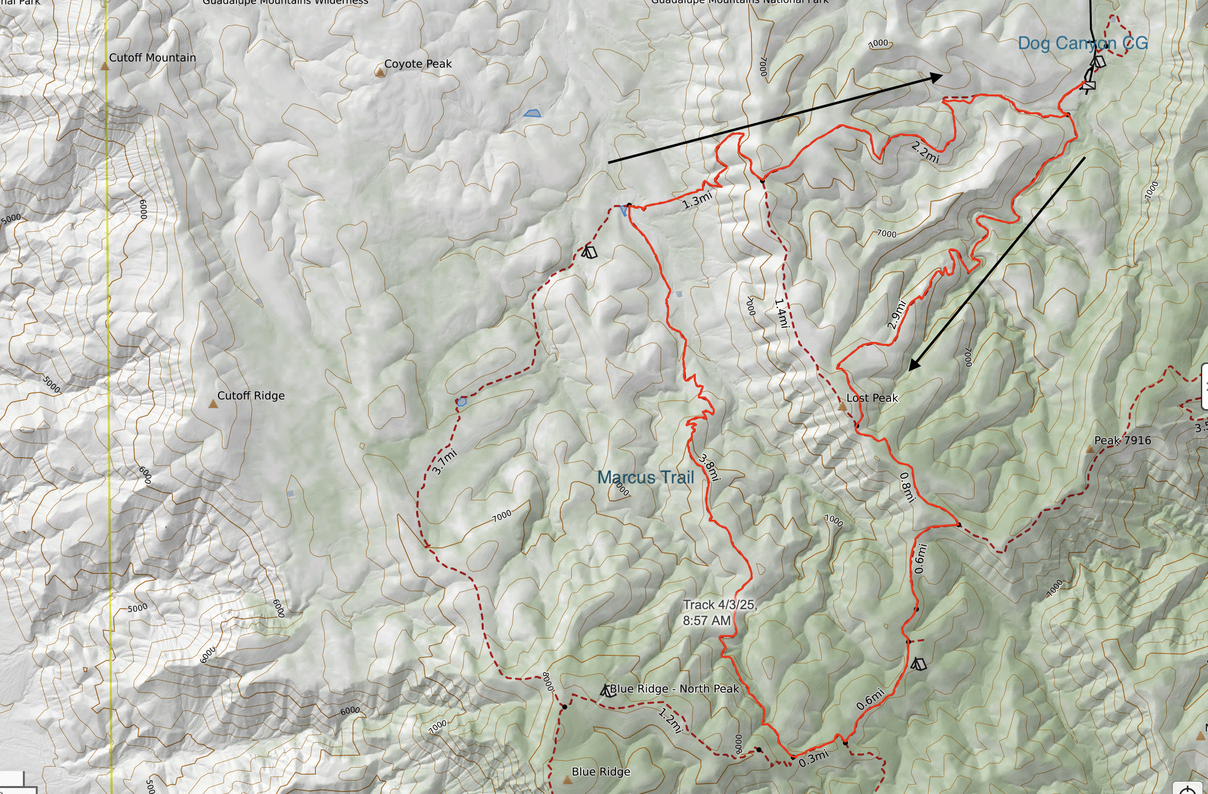
| Time (MDT) | location | mileage (approx.) | Elevation |
|---|---|---|---|
| 9:00 AM | Trailhead | 0.0 | 6,300′ |
| 9:31 | First wash crossing | 1.0 | |
| 9:40 | Second wash crossing | 1.3 | |
| 9:46 | Third wash crossing | 1.5 | |
| 10:00 | Rest area | 1.7 | |
| 11:07 | Lost Peak saddle | 3.3 | 7,680′ |
| 11:42 | Tejas/McKittrick Ridge trail junction | 4.0 | 7,650′ |
| 1:40 | Tejas/Blue Ridge trail junction | 5.5 | 7,520′ |
| 1:52 | Blue Ridge/Marcus trail junction | 5.8 | 7,650′ |
| 3:07 | Marcus/Bush Mountain trail junction | 9.6 | 6,230′ |
| 4:24 | Marcus overlook | 10.9 | 7,150′ |
| 5:30 | Bush Mountain/Tejas trail junction | 13.2 | |
| 5:36 | Trailhead | 13.4 | 6,300′ |
There was a bit of rain overnight, then I got started on the Tejas trail at 9 a.m. My plan was somewhat vague–head up past Lost Peak, see how I felt, then go on to the trail junction with Blue Ridge. From there if time permitted I’d continue on towards the Blue Ridge backcountry site, likely not going as far as the site but returning back down Marcus trail which I’d never been on. I packed plenty of water, enough to ensure safe travel and then some.
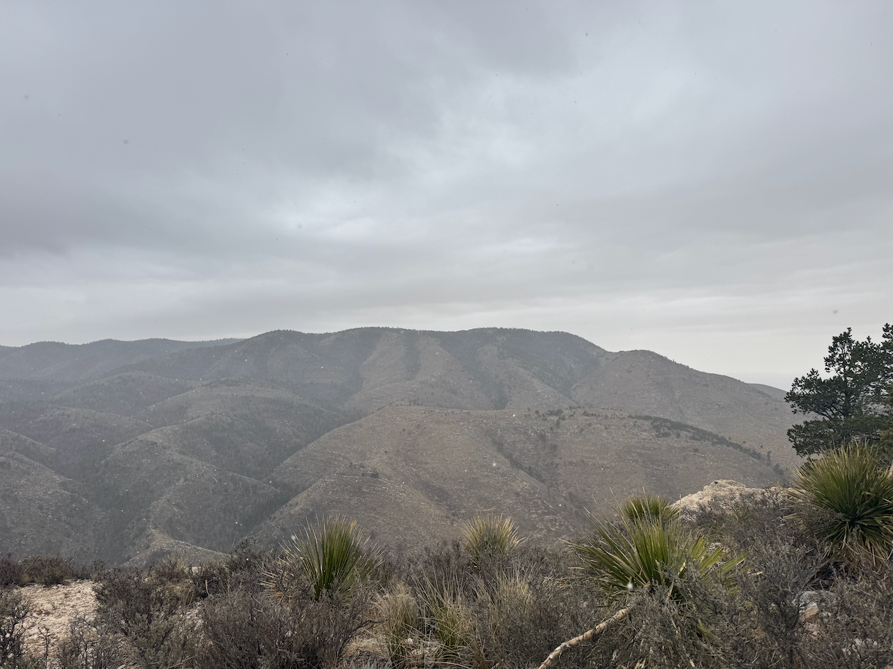

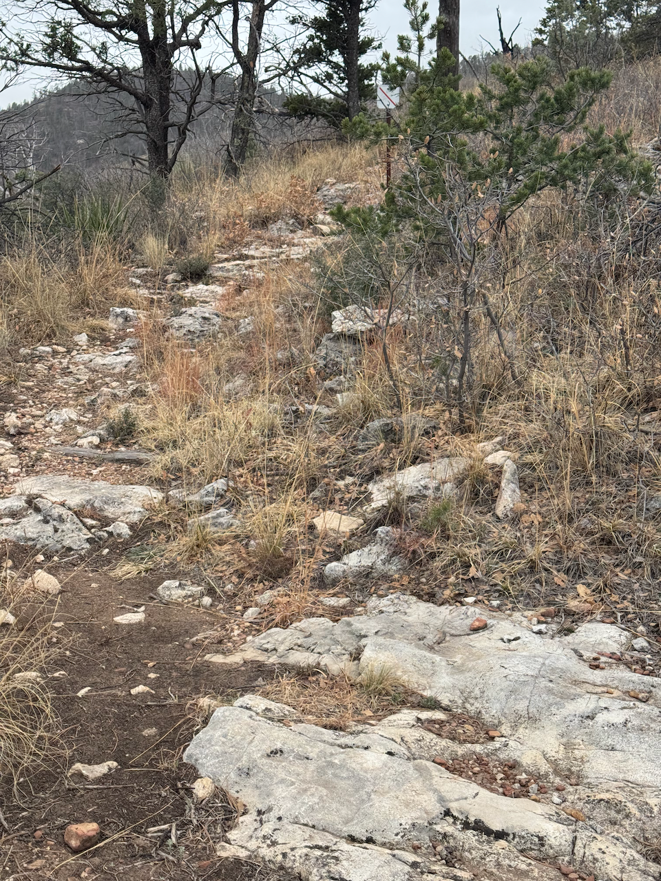
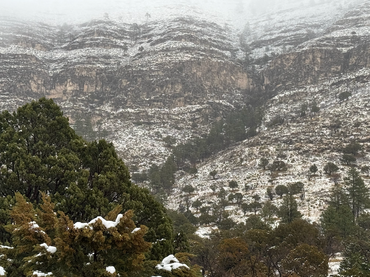
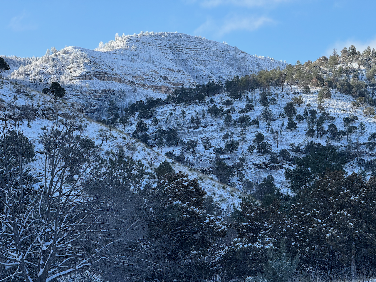
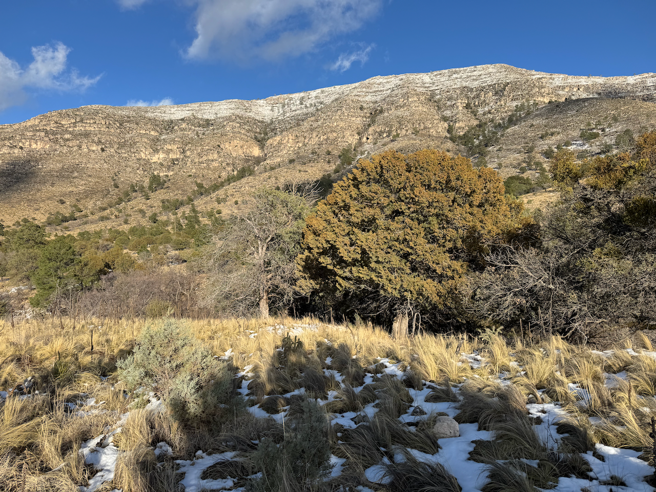
After about an hour I took a short break at one of the good resting spots at a switchback coming out of the canyon. Reached Lost Peak saddle around 11 a.m., and right there it began to sleet and snow, with just a slight accumulation. I was plenty comfortable though, save for my hands which kept going numb due to my Reynaud’s syndrome. For the next few miles I was on trail segments I hadn’t been on for almost forty years. In some sections it seemed to pass through some burn areas. The trail was well-maintained and easy to follow and not particularly rough. I continued on up to McKittrick trail junction with it sleeting/snowing most of the way. It was fairly windy when exposed. Taking a right turn, I went through a denser forest that seemed to be suffering somewhat. I saw lot of deadfall, and occasionally deadfall across the trail that didn’t seem recent, judging by the use trails around them. I chuckled as I passed the spot where Ranger Craig and I had been surprised by an angry Rock Rattler in 1986. When I passed the turnoff to the Mescalero backcountry site I resisted the temptation to go check out the site I’d stayed on that same trip in ’86. I’d also been on the Tejas trail around there on two other 1986 backpacking trips, including one where I’d stayed at Mescalero and day-hiked past the Blue Ridge site and made a loop around Bush Mountain. I recognized some of the views from those ancient trips (whether from memory or from the slides I took it’s hard to say).
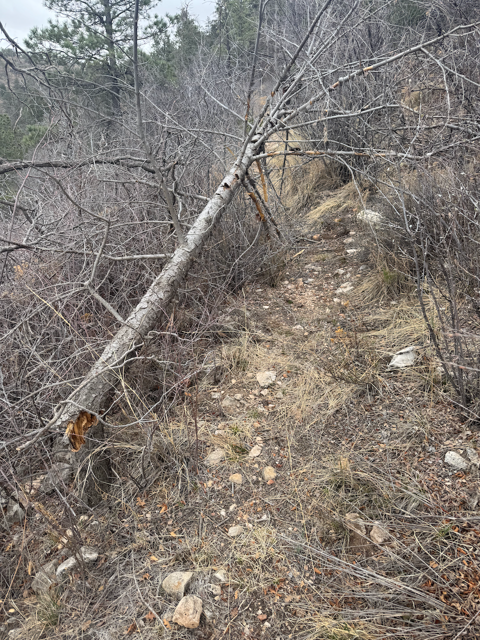
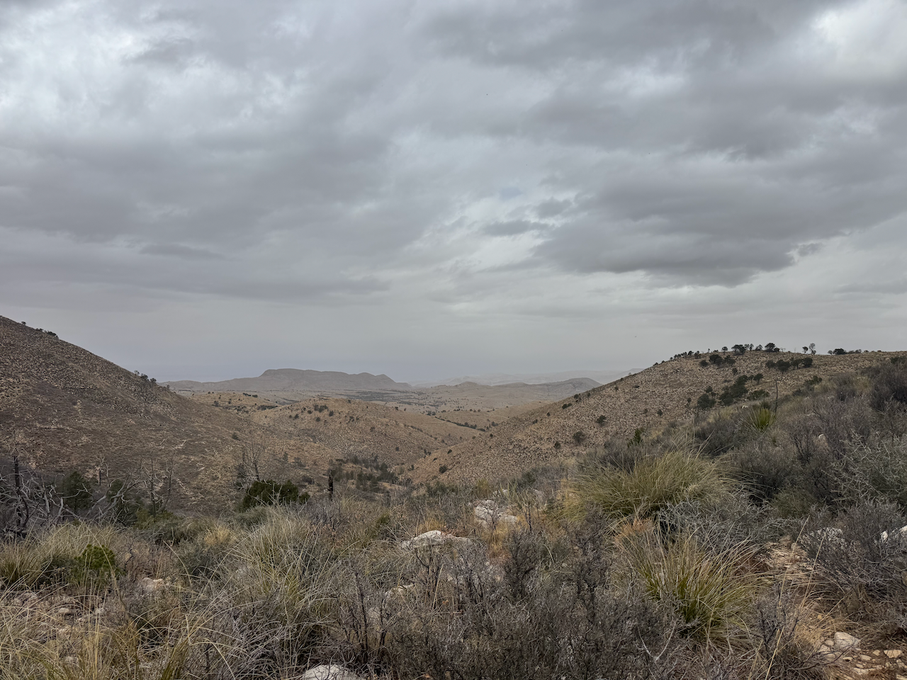
I made it to the Blue Ridge/Marcus junction at 12:50. I took a little break and quickly decided I’d return down the Marcus trail as there wasn’t really a lot of time to venture farther on Blue Ridge. Sunset was about 7:22 MDT and I didn’t want to cut anything close. I could tell the Marcus trail was much less traveled and maintained. I started the descent down Marcus and wound through a forest I found a little different than the higher elevations–maybe a bit more “mixed” and with seemingly less undergrowth. Bypassed a downed tree that didn’t have much of a use trail bypassing it. After a while the trail descended out of the forest and into mixed desert scrub, and more scenic vistas spread out before me. I’d seen this trail from above many times but it was neat to finally walk along it. Well, except for the time I face-planted when a fallen sotol reached out and tripped me. My iPhone went flying out of my pocket but wasn’t damaged. No harm no foul, just a bruise that would show up the next day.
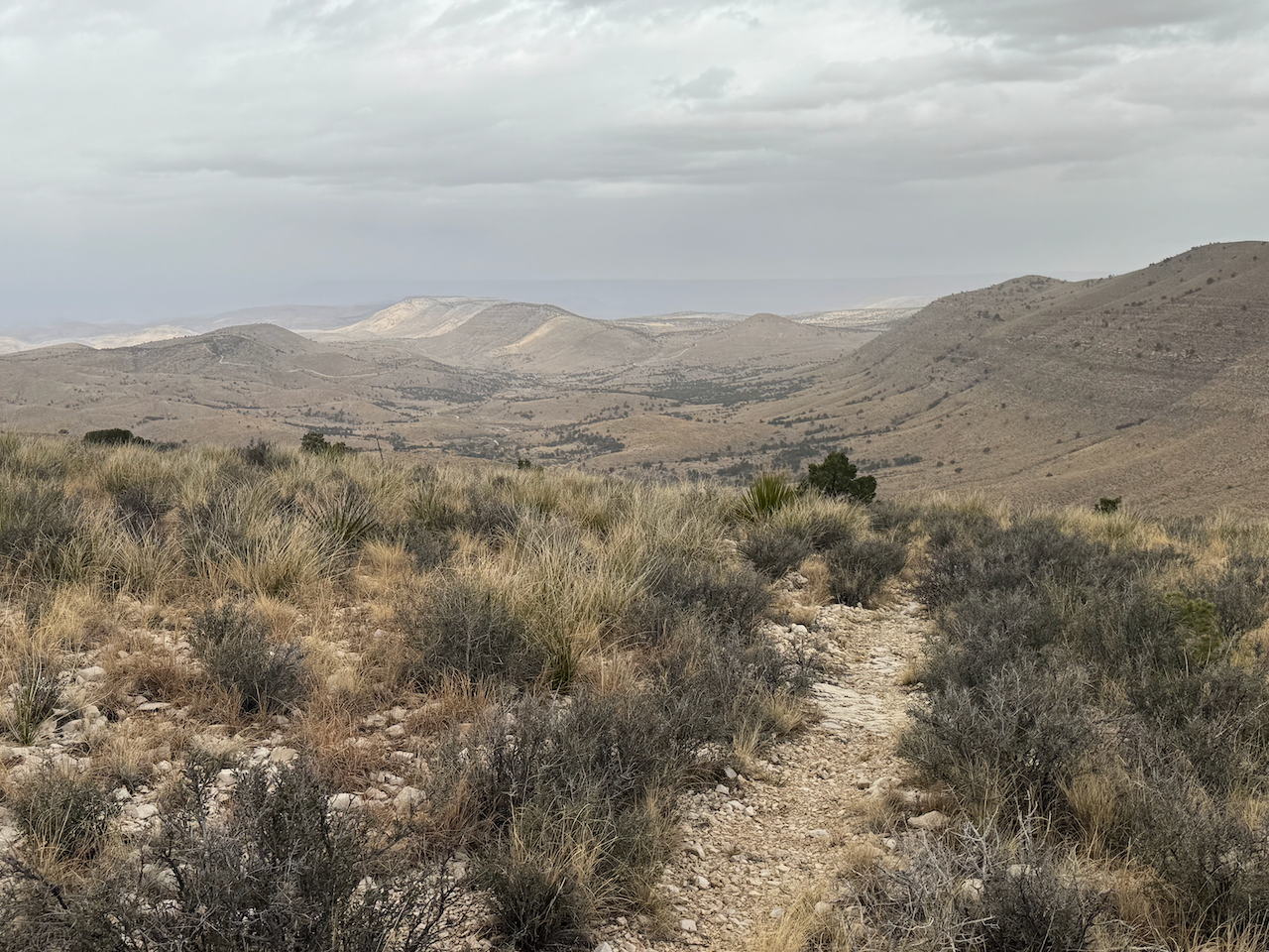
Descending down the ridge towards the lower levels of West Dog Canyon I scanned the mountains to my immediate east for familiar landmarks I picked out Lost Peak and the saddle at Marcus overlook whence I’d often stared at the trail I was now walking. The vistas to the North, Northwest and somewhat West were expansive and I occasionally stopped to admire them. My pace/progress was good and my only concern, if even that, was the upcoming trudge back up the east side of the canyon from the low point where the Marcus trail hit the Bush mountain trail. But I knew that trail well and even if some misfortune befell me I didn’t sweat coming into camp after dark.
Speaking of sweat, coming down the canyon I began to feel quite warm. There was little if any breeze, the sky was transitioning to partly cloudy from partly sunny, and I was looking forward to taking a long break at the trail junction coming up and shedding a layer. The last half mile or so wends through fairly flat bottom land, among dried mud holes and extensive remnants of an old homestead. I kept my eyes peeled for the trail junction (although I recalled it being easy to spot) as a backpacker had missed it a year or so ago and hiked off into oblivion, requiring an eventual rescue.
I did find the junction as expected, took my daypack and shell off and sat down on a rock step along the dried up wash for an extended pause. Enjoying the silence and solitude I took the time to relax, munch a few energy snacks, hydrate fully, and then transfer some water from my water bottle to the hydro bladder so I wouldn’t have to be concerned with doing it while hiking back to Dog Canyon.
After about twenty or so minutes I started heading up out of the canyon toward the Marcus overlook. I kind of dreaded the start. I don’t like the trail from the wash up to the switchbacks along the opposite wall; it’s kind of straight where I’d prefer some switchbacks (YMMV) and sometimes runs through fairly deep ditches. It’s like walking up a creek bed at times. But it is what it is, and I survived and continued up the last ascent of the day, starting to feel a hankering for supper and a relaxing evening back at camp.
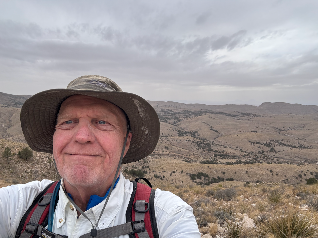
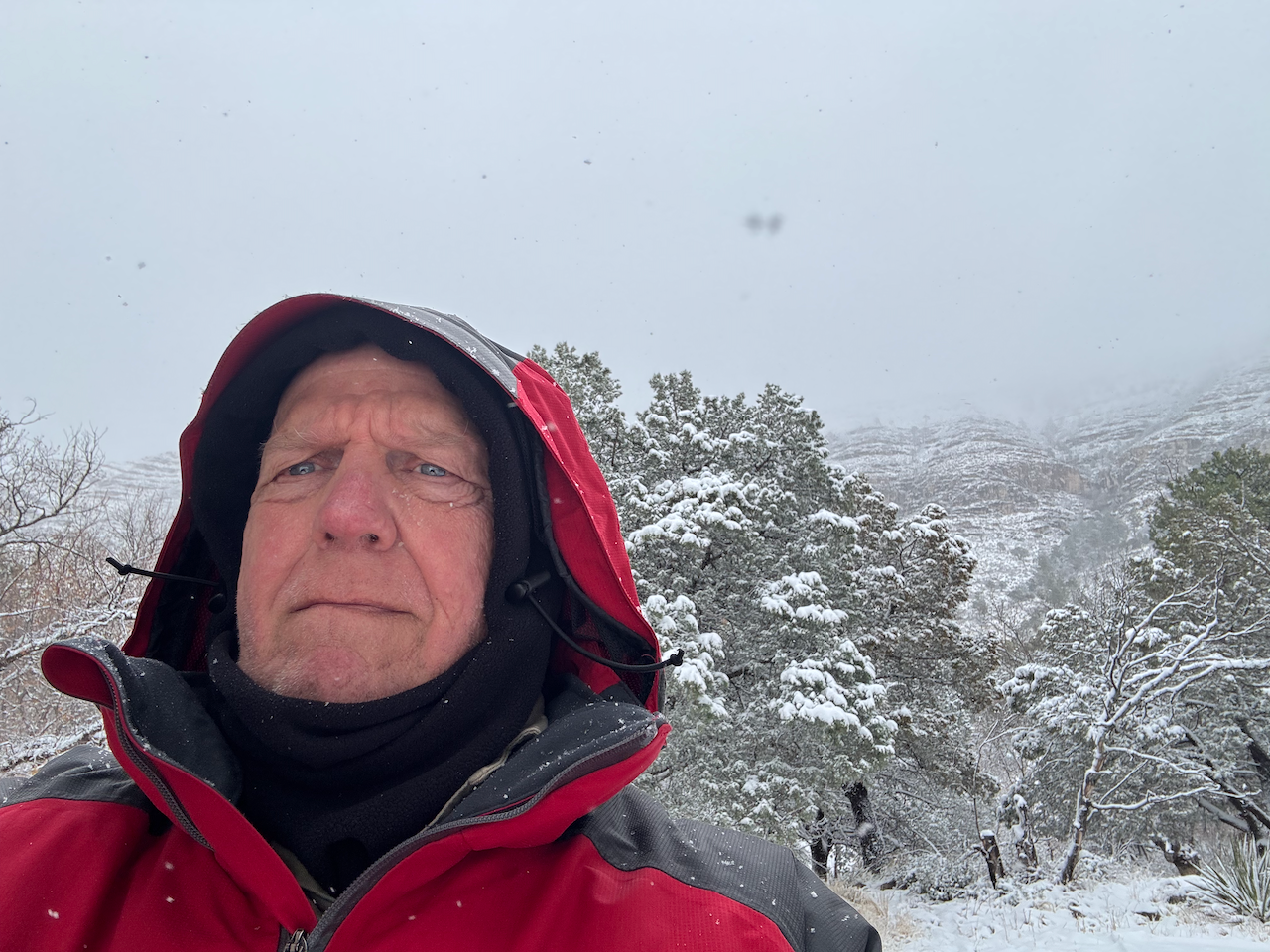
I finished the final climb reaching the overlook saddle at 4: 24 and hardly paused. I snapped a selfie then commenced the downhill trek to the campground. Along the way I noticed something that I may have noticed before and just forgotten (old man). The trail has been re-routed along the east-west wash that starts about a mile out of Dog Canyon trailhead, and instead of hugging and crossing the wash it is now a bit higher and easier and stays on the higher ground to the south. I may have remembered discussion of this on Big Bend Chat but couldn’t recall. One thing that might be a downside is the trail is smooth dirt in that section which may prove muddy at times.
At 5:30 I strolled into Dog Canyon campground. I felt very good. It had been a long day, 13.4 miles in about 8 1/2 hours total. I’d completed one of the few trails I hadn’t done in my 40 years of visiting the park. I felt my conditioning had served me quite well. My feet felt good, my energy was good and I had a pretty good idea of how I’d approach my backpack in two days after a rest day Friday, weather permitting.
(Attach “he said ominously” here.)
Change in the weather
There was a couple from Colorado camped up in the RV/Corral area; I chatted with them a bit and I suggested a good introductory hike might be up to Marcus overlook.
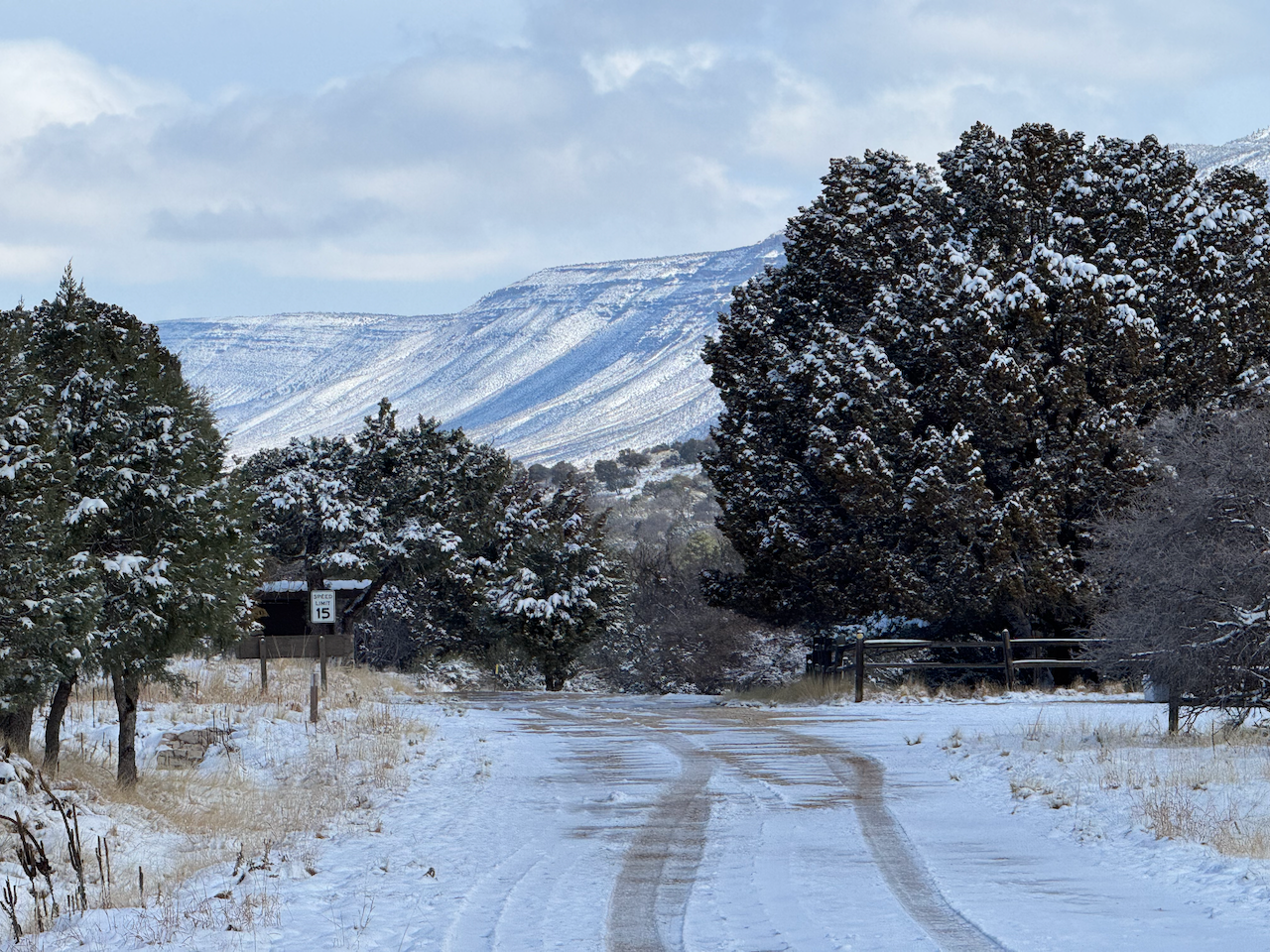
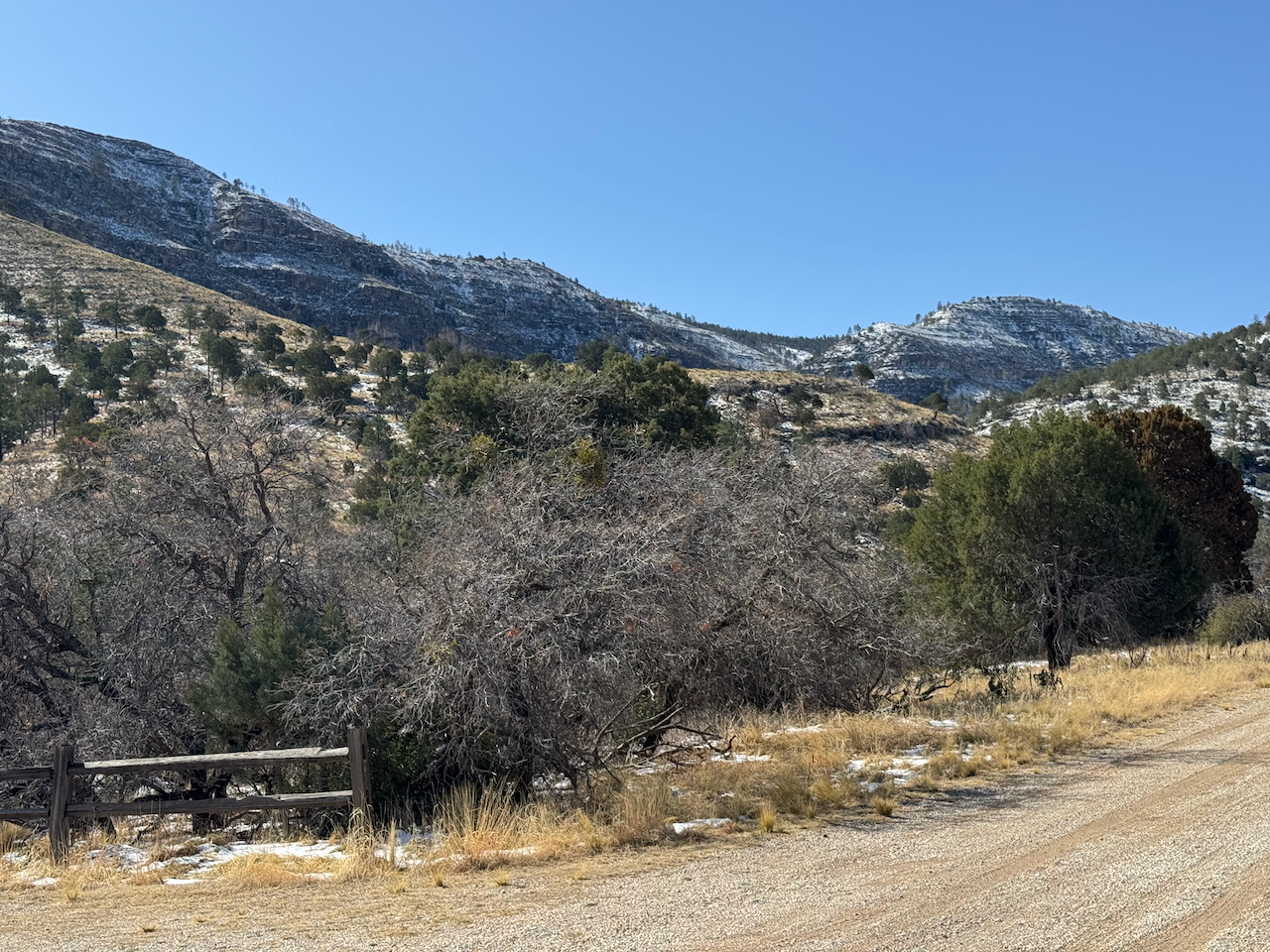
Friday was to be my rest and pack-the-backpack day, but I was already having second thoughts due to the preliminary weather forecasts and decided I’d drive out to the cell coverage spot (exactly twenty miles north of Dog Canyon, just past Queen) and get an up to date and detailed weather forecast for the high country. It didn’t look great.
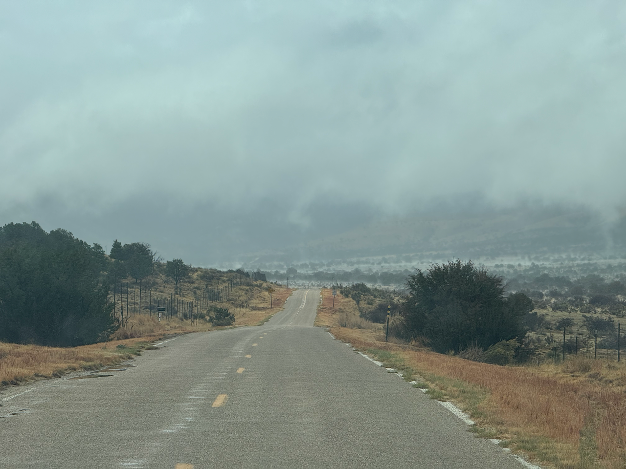
Driving back, I encountered spotty freezing precipitation, and could see accumulations starting in the mountains. A combination of snow, graupel, and rain fell off and on in the campground. By afternoon I was sitting in the Odyssey waiting out a fairly steady downpour. Nearly everyone else had left the campground in the morning.

I made the decision that the overnight to Blue Ridge the next day was a no-go. I just couldn’t imagine the difficulty and discomfort of hiking those trails under snow and a loaded backpack (especially the unknown Bush Mountain trail section), and the same went for the conditions overnight. While preparing for this trip I really hadn’t planned on extreme winter conditions. I was prepared for cold but 50 mph winds and who knows how much snow above 8,000’ dissuaded me. In the end, it was a decision based largely on “well I *could* do this maybe, but do I really want to?” I consoled myself with the thought I’d at least achieved half of my goal, the Marcus trail.
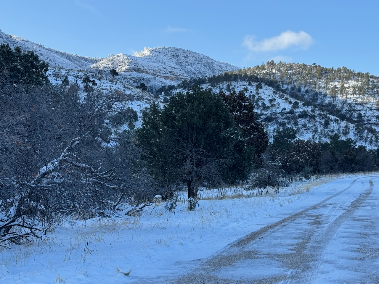
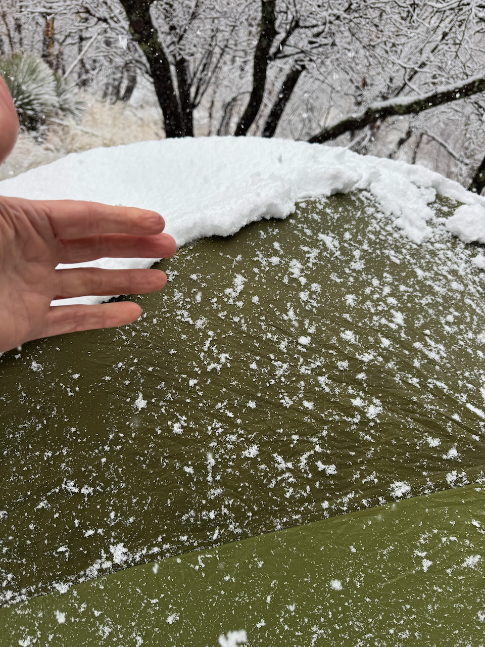
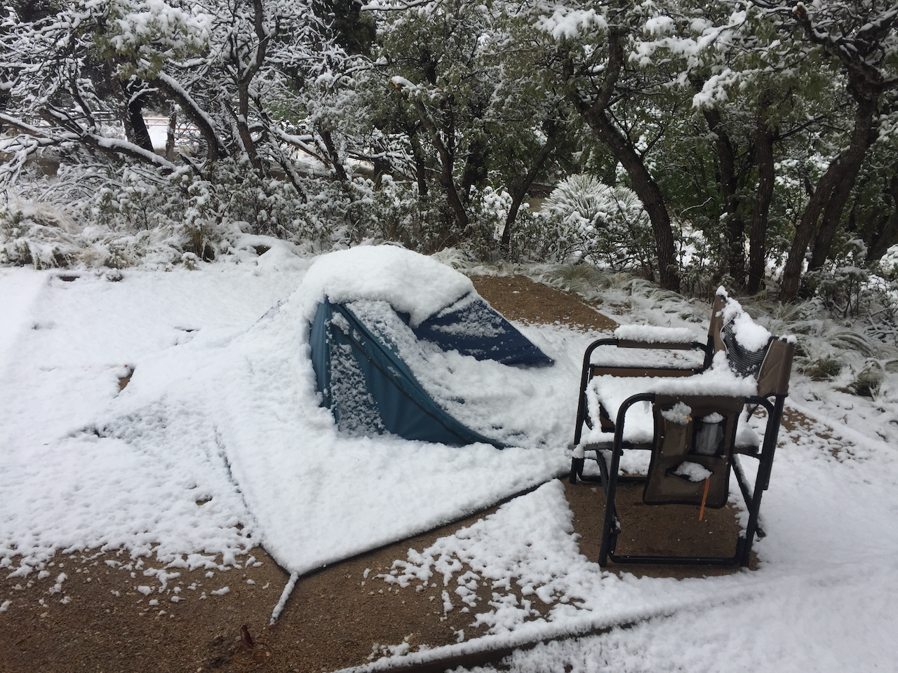
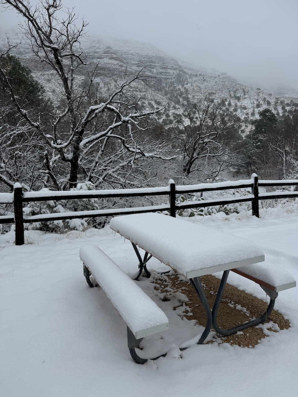
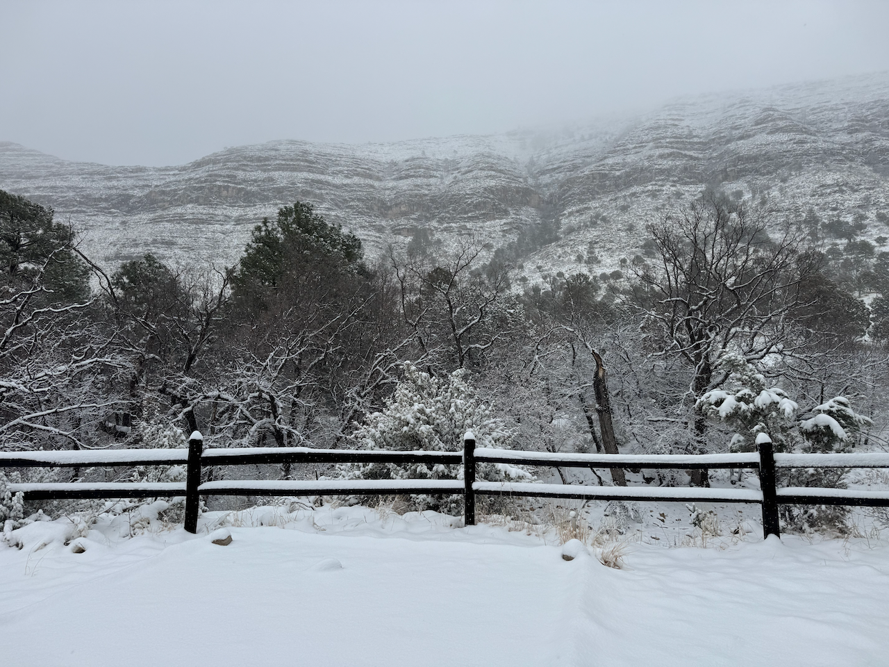
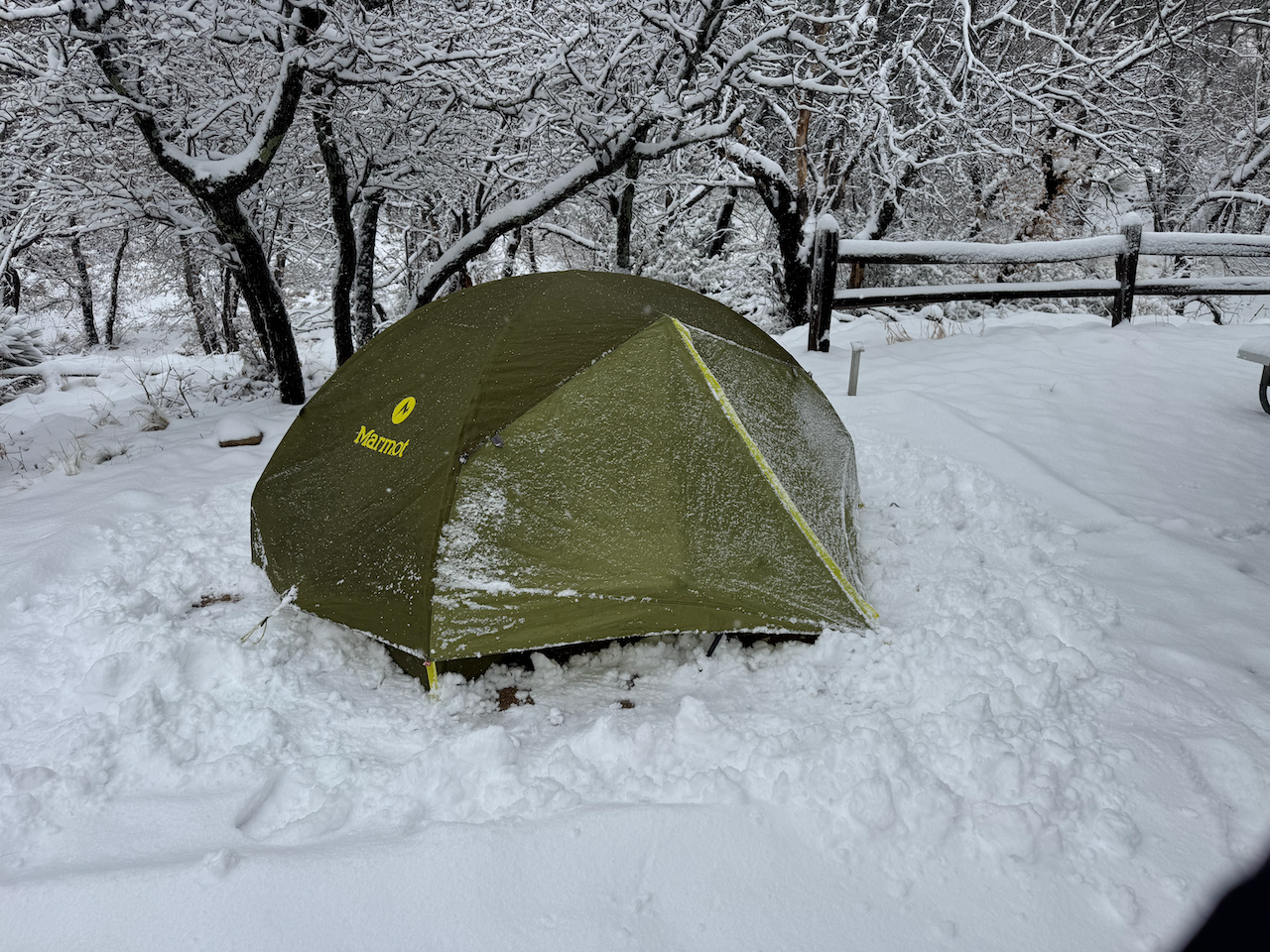
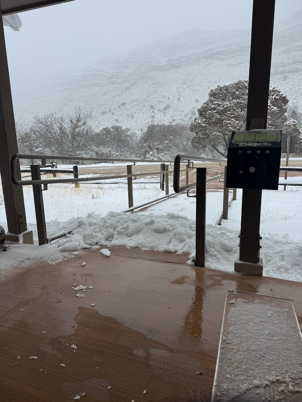
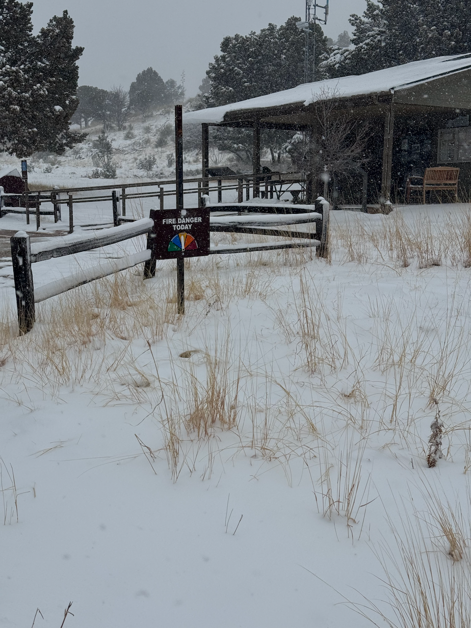
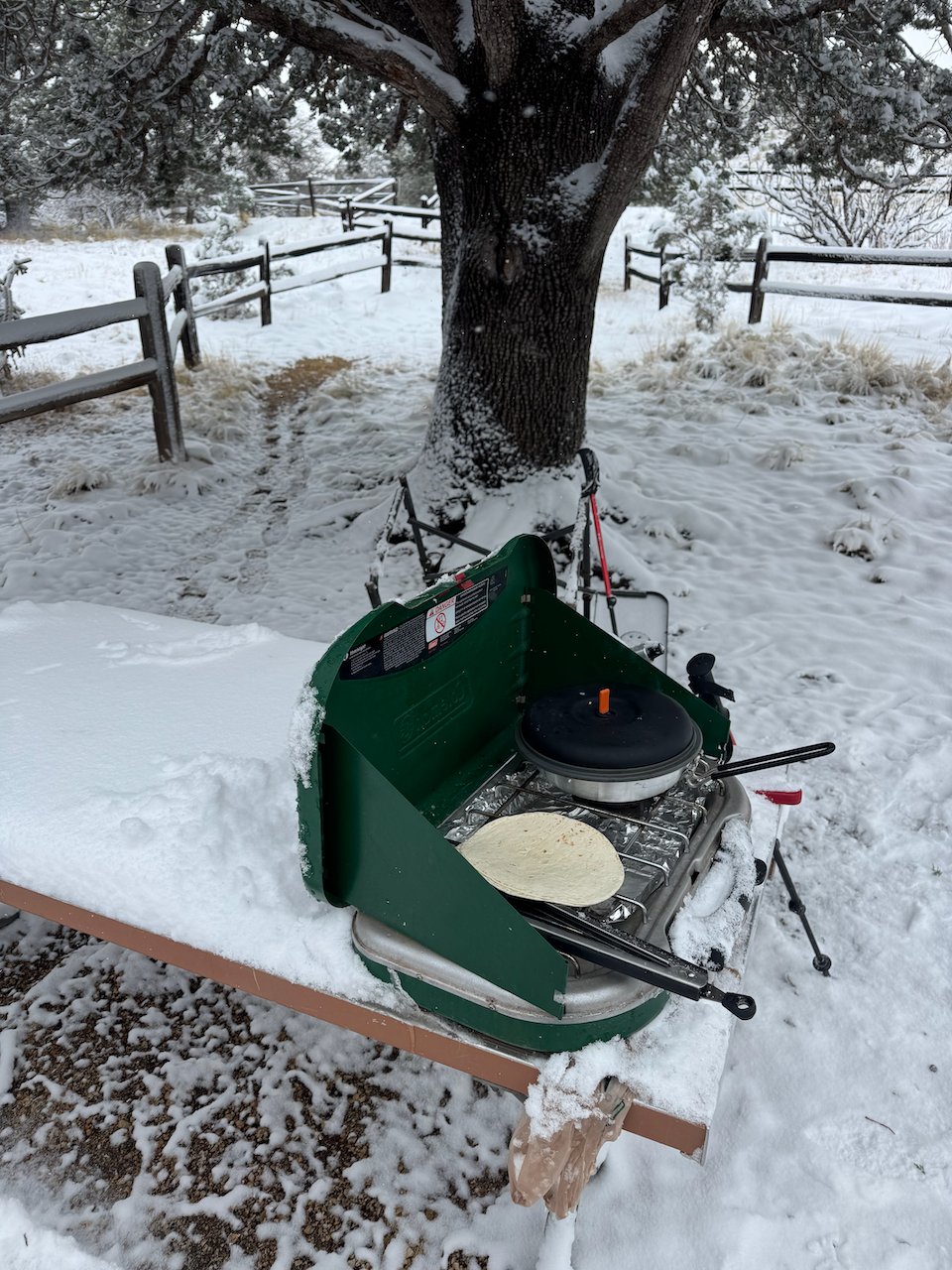
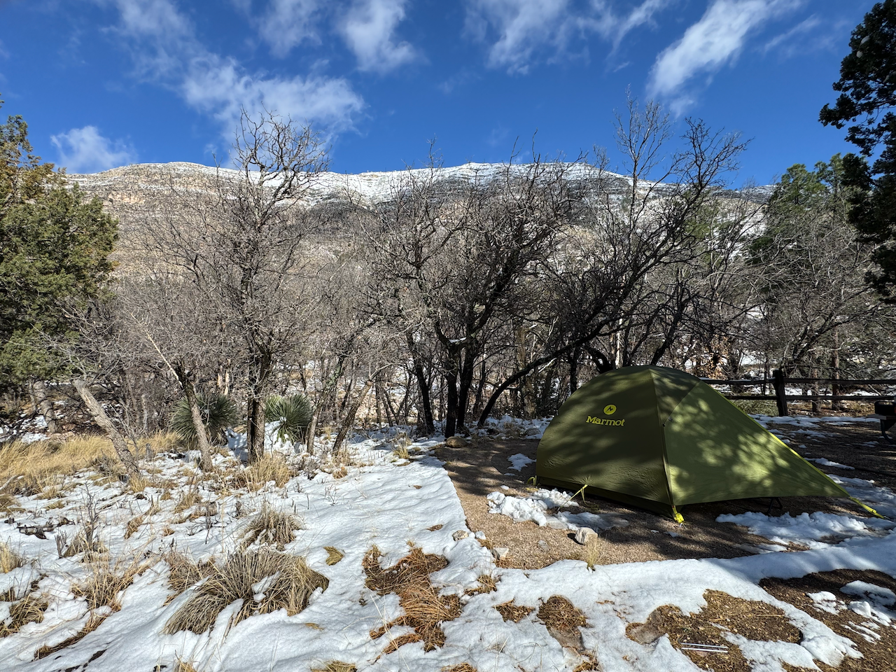
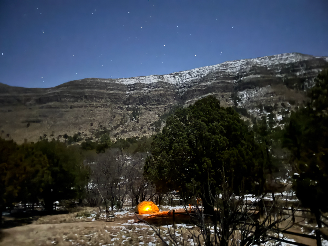
Around 3:00 the precipitation had turned to a pretty heavy snow, big sticky flakes coating everything. This April snowstorm in Dog Canyon certainly wasn’t unprecedented–I’d experienced one myself there in 2017. From that experience I knew my 3 season tent was about to undergo stress, so I started periodically whacking the tent poles, sliding the accumulated snow into piles around the perimeter. The snow coated everything so for dinner I walked down to the closed ranger station and cooked dinner there on the porch.
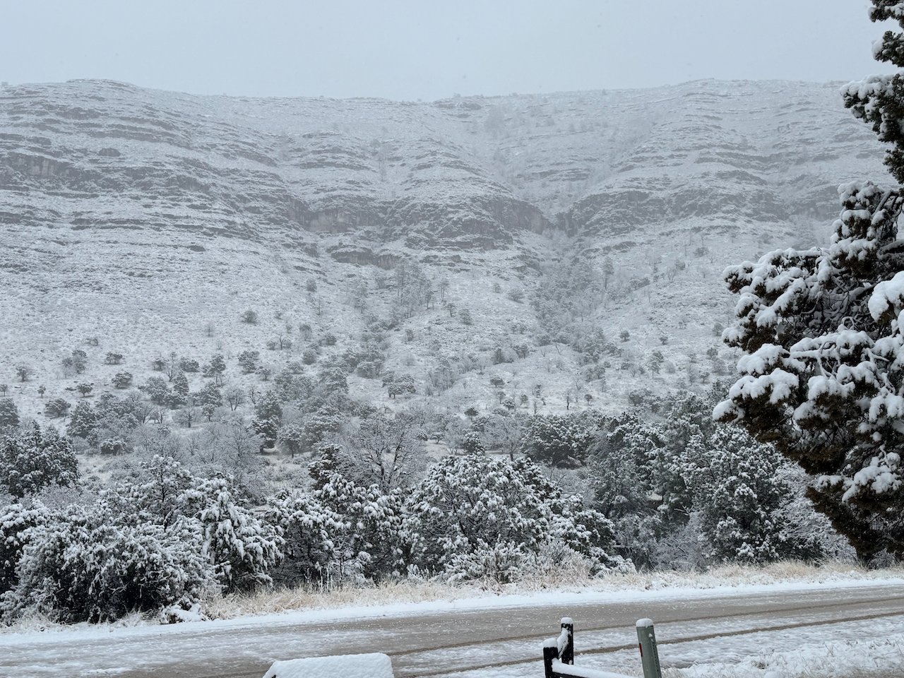
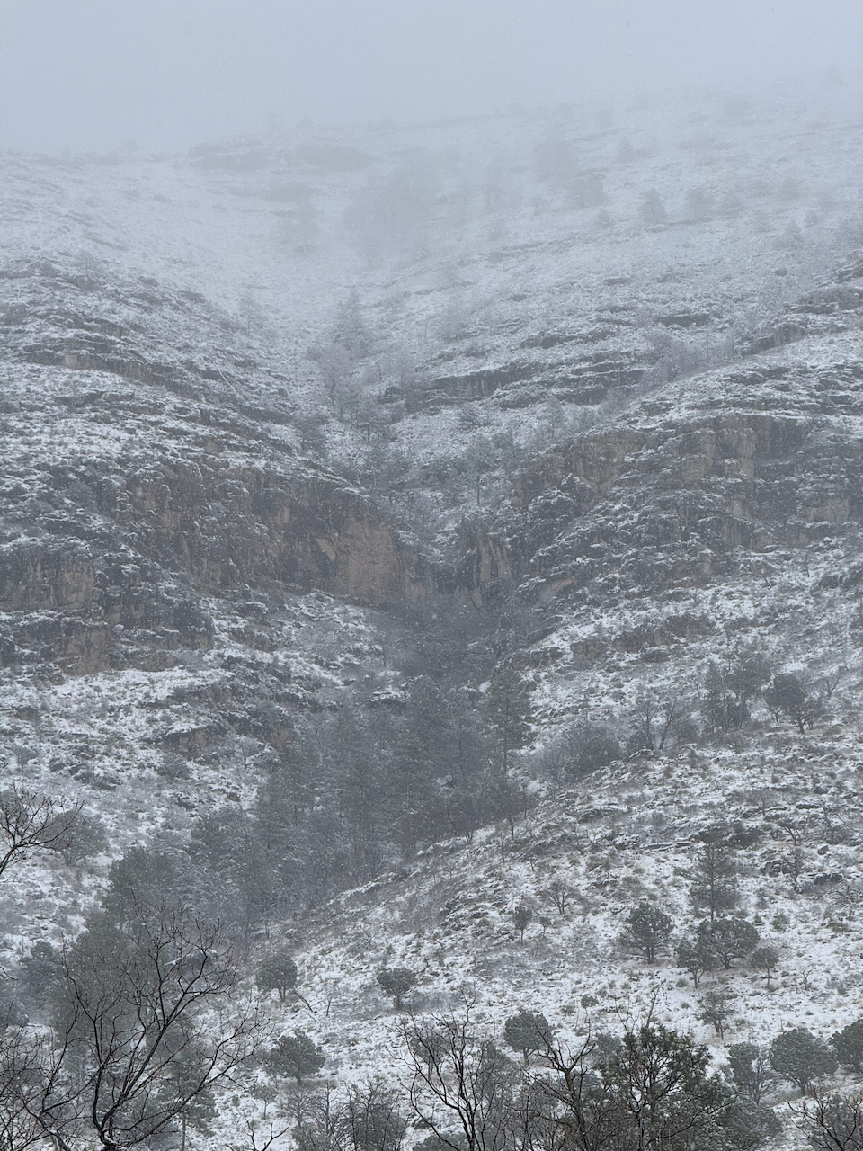
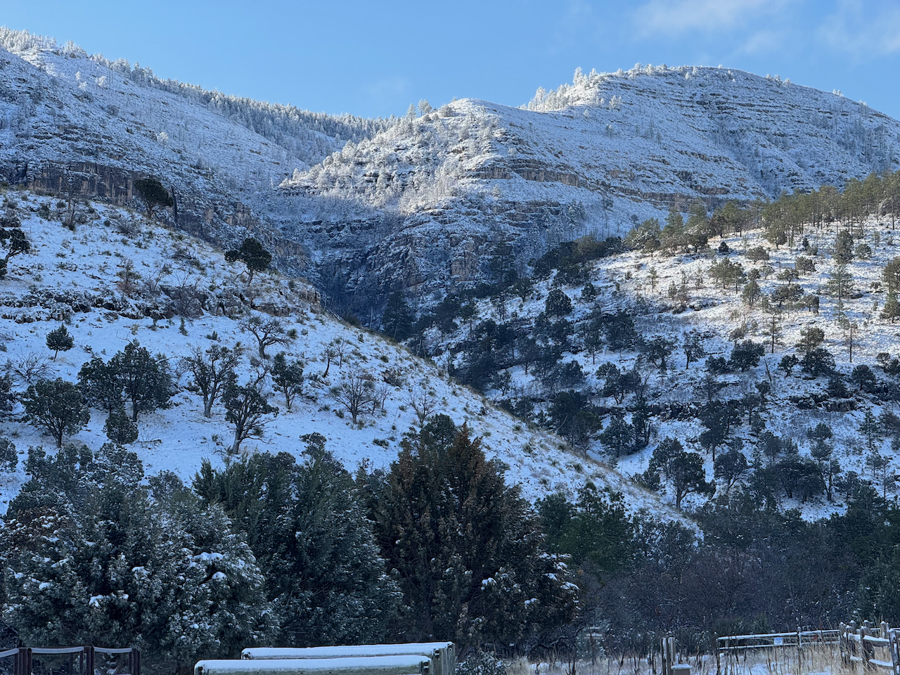
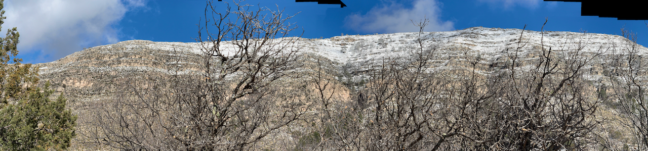
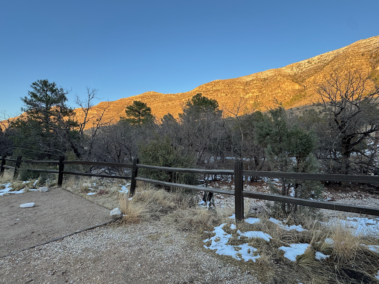
By sunset, the snow flurries had mostly stopped, and the sun even shone for a bit illuminating the top of the eastern wall in a bright pink. I think by this time we’d gotten three to four inches accumulation although a couple of inches had melted off on many surfaces.

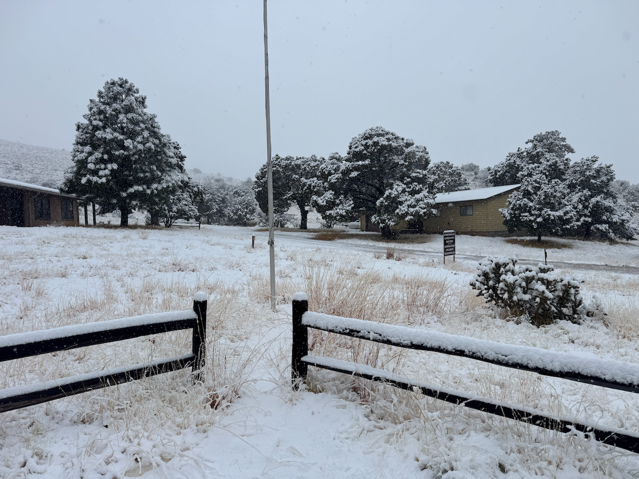
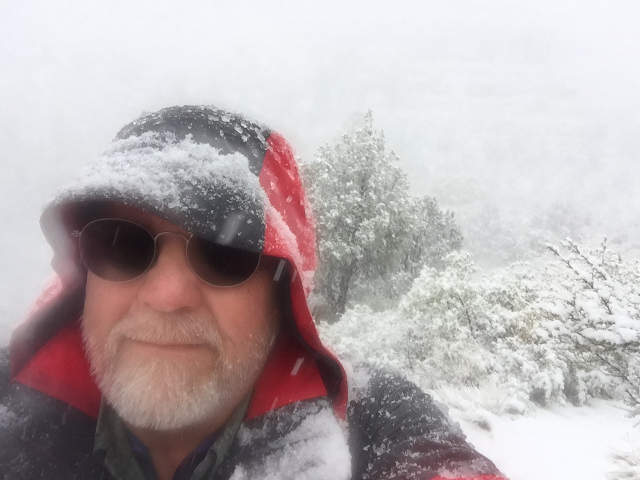
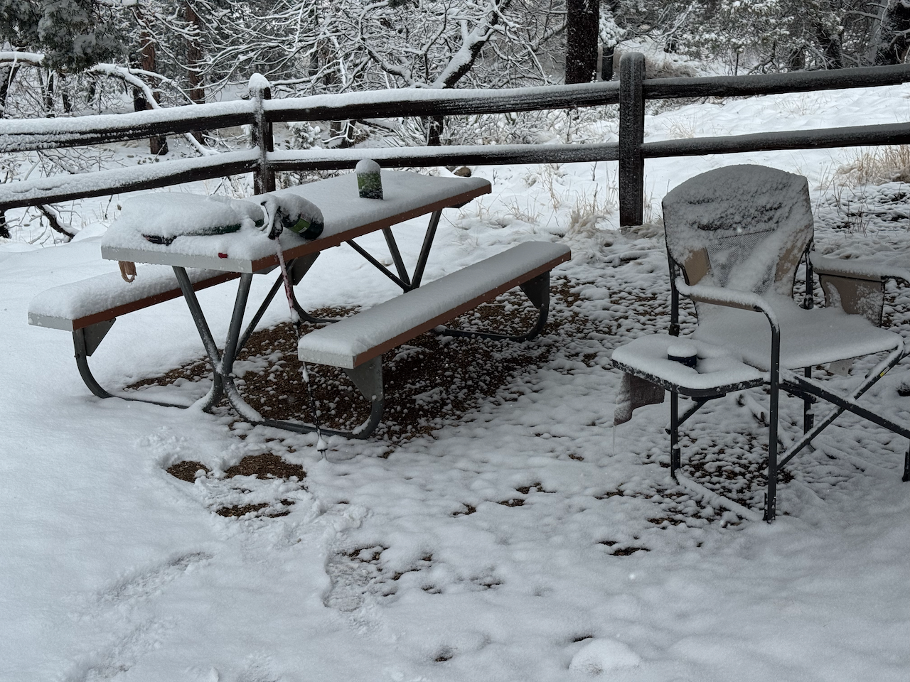
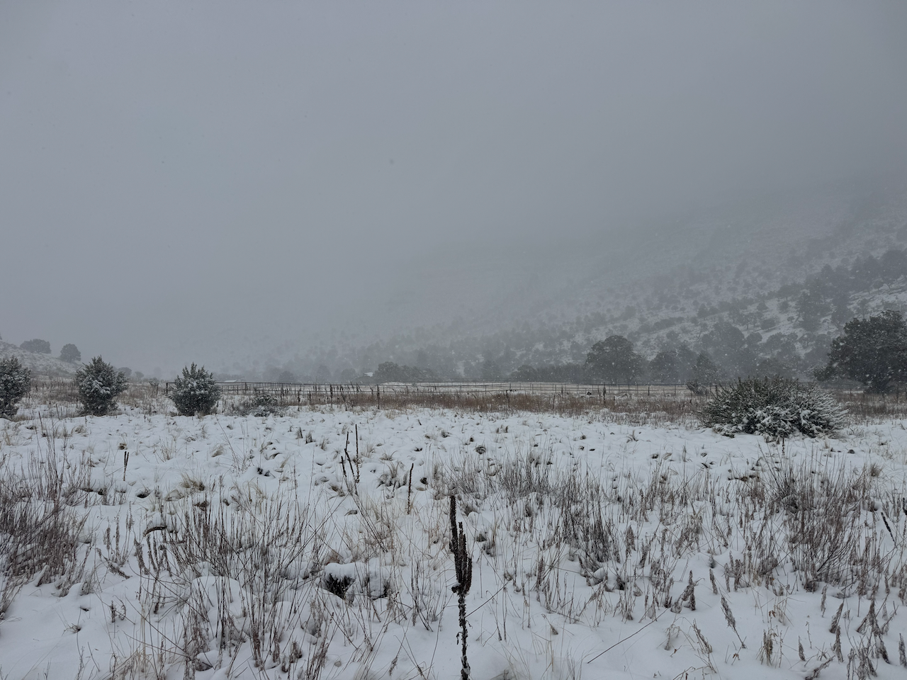
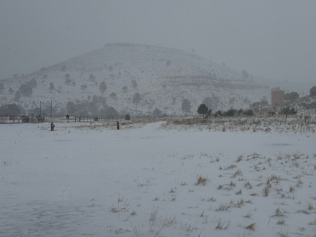
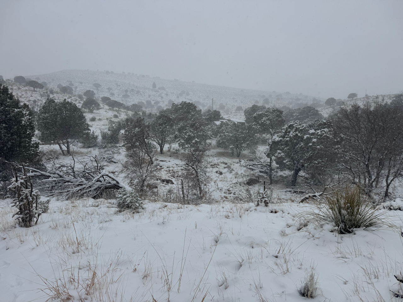
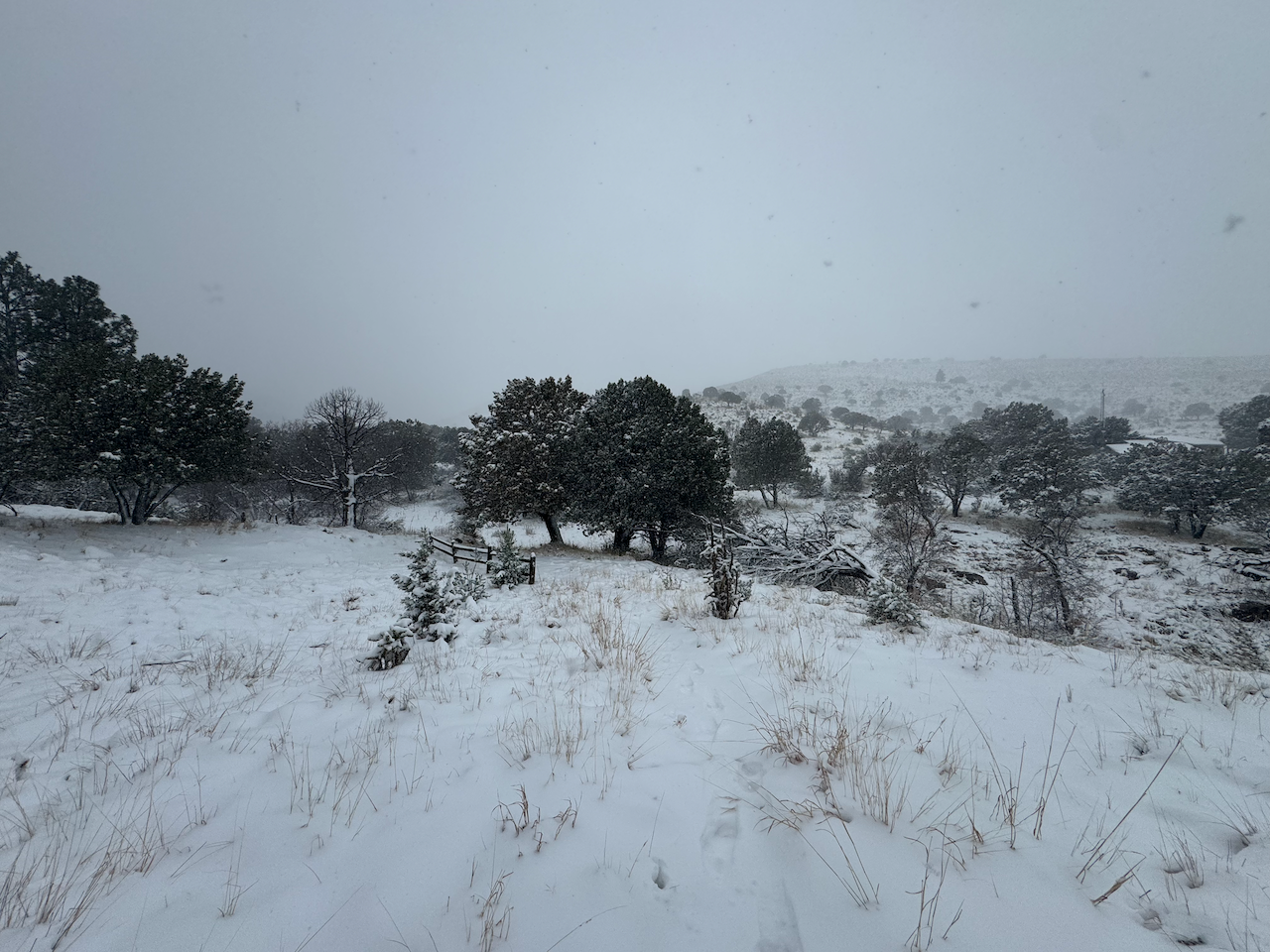
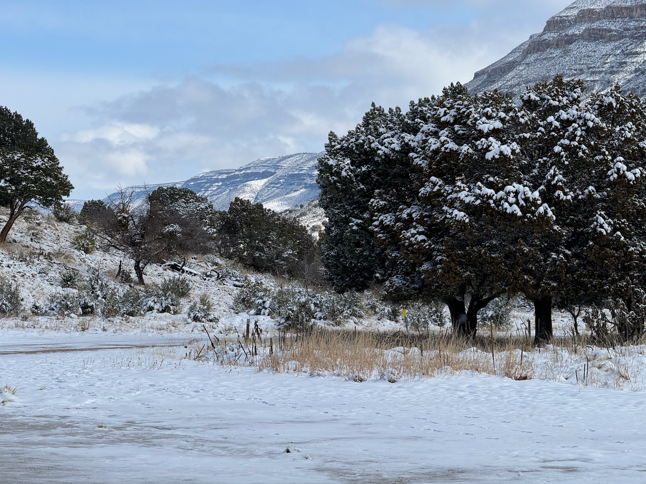
I don’t recall getting any precipitation over night. By morning, (mid 20s) there were gaps in the clouds, some of the accumulation had disappeared from the road and parking lot, and I began to wonder if maybe my concerns had been unwarranted. But by 10 a.m the snow returned, falling pretty heavily. Even the wild turkeys wandering through the area had a coating of snow on their backs. Just after noon I walked up to the trail head and ventured out past the wilderness boundary to get a feel for conditions on the trail. The uneven stones on the trail were hidden by snow, and it seemed a good way to turn an ankle. The conditions up above 8,000’ where I would have been approaching at this time would have been extremely difficult. I also imagined how the trails would be when all of this started melting. I returned to the trailhead and shot some video, as the snow was coming down pretty hard then. It would snow most of the day, finally ceasing in the afternoon. I swept the snow off my stove and cooked dinner on my picnic table. I slept well that night and when I woke up I stayed in my bag a while as it seemed kind of cold “out there.” My thermometer—which had been frozen to the aluminum picnic table since Friday—read 18º when I finally left the tent around 8:45. The sky was crystal clear, and after the extended dawn ended (there in the bottom of the canyon) the snow began to quickly melt as temperatures warmed into the forties.
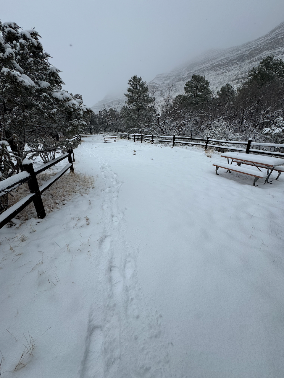

There had been the couple from Colorado camped up at the RV/corral area, and one other tent camper that night. I walked around taking pictures but royally screwed up many of them by fat-fingering the shutter button on my iPhone and taking screenshots instead!!

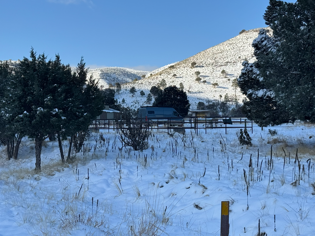
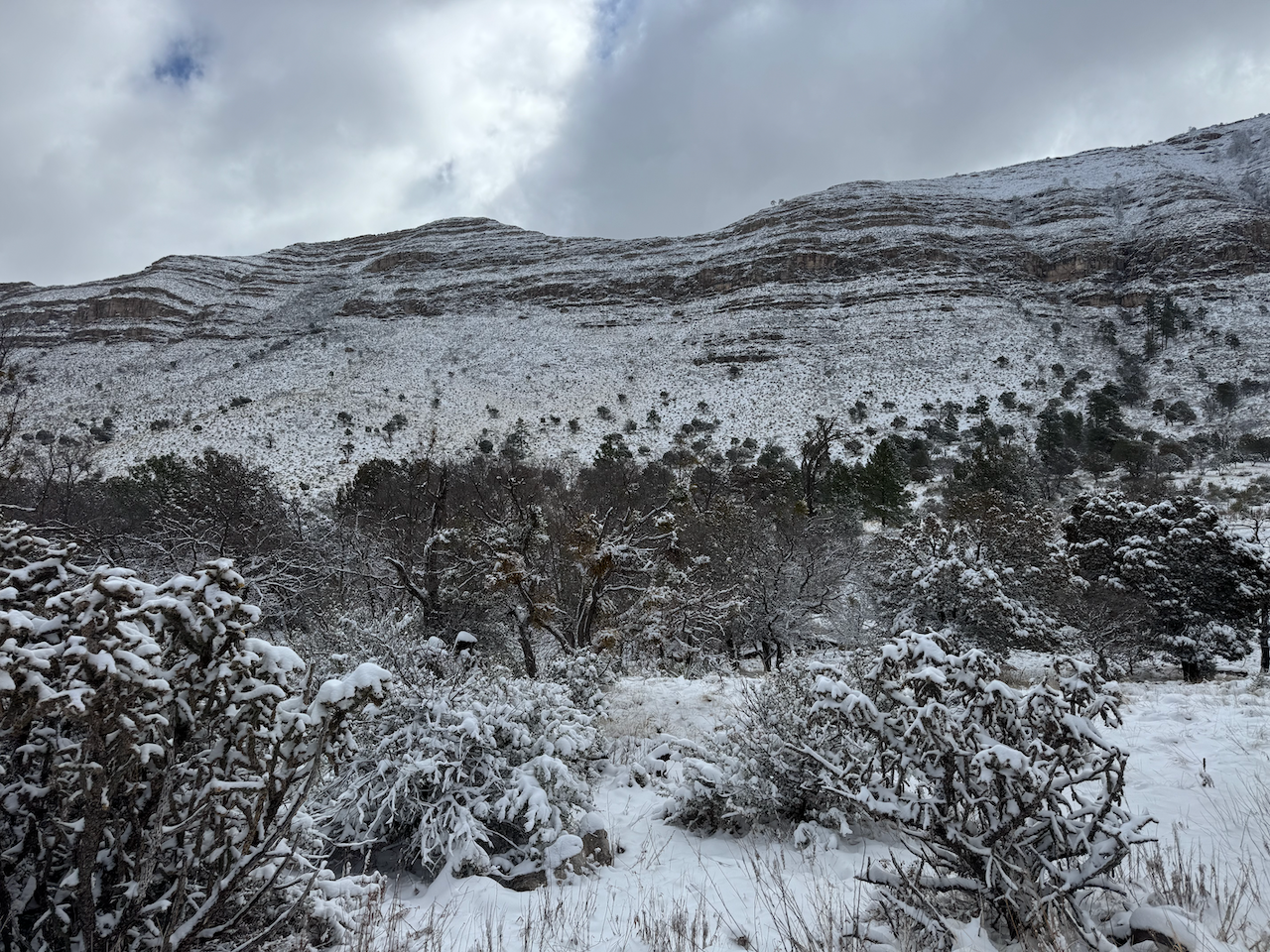
Another family arrived up at the RV area (maybe Sunday morning?) After mid-morning I walked out to the wilderness boundary again, and as I had expected it was all turning into a muddy mess. But at least the snow and ice evaporated quickly in the dry air; after wiping down my chair and table they were dry within an hour or so.

The afternoon turned quite pleasant, mostly clear with occasional clouds and I spent the rest of the day wandering about, taking photos, looking up at the highest elevations and that evening I played around with night photos on my iPhone. That night the only really negative occurrence of the entire trip happened when a big truck came in well after dark and very noisily set up there camp in the RV/corral area. Most irritating indeed was the bright string of lights they decided to string up. At least they weren’t down in the tent area but I could only imagine how their immediate neighbors felt. Here we are with some of the darkest skies in North America but hey let’s string up some bright lights for no reason!
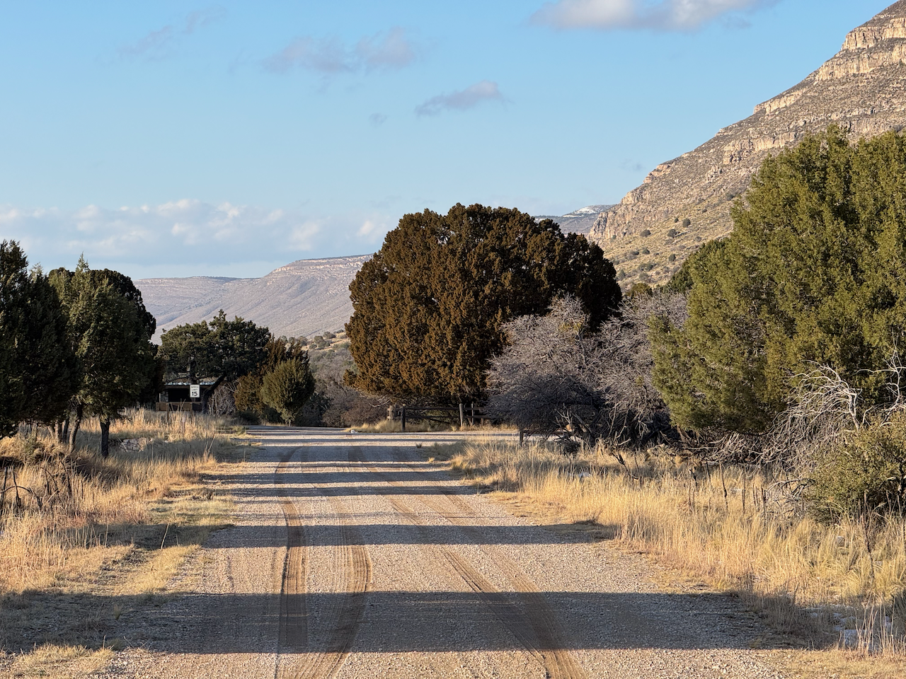
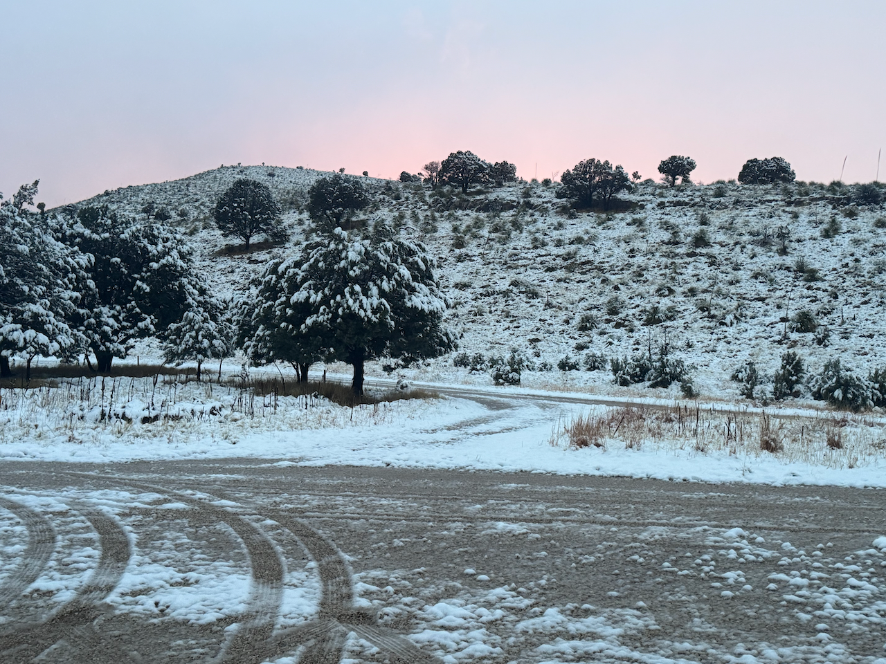
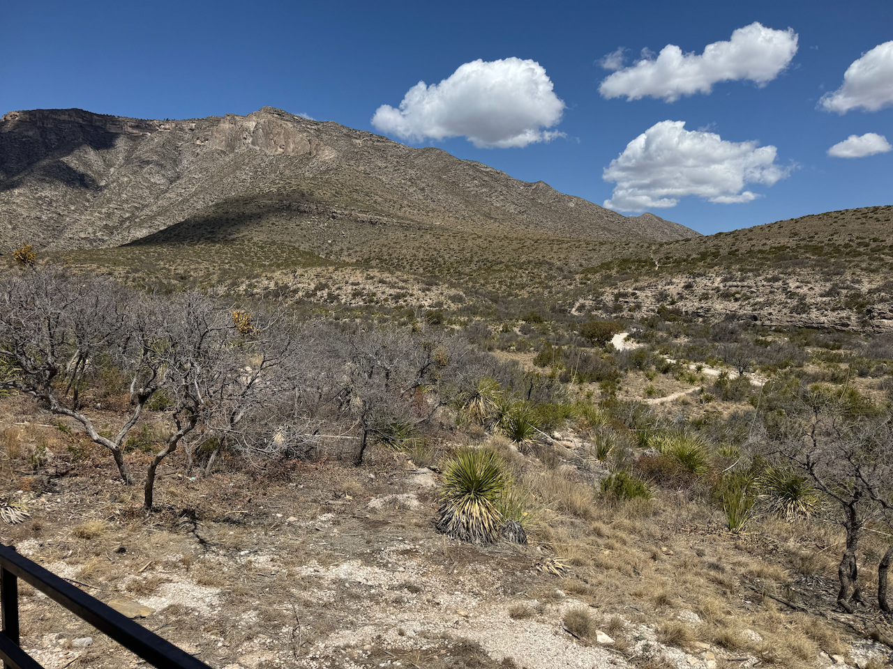
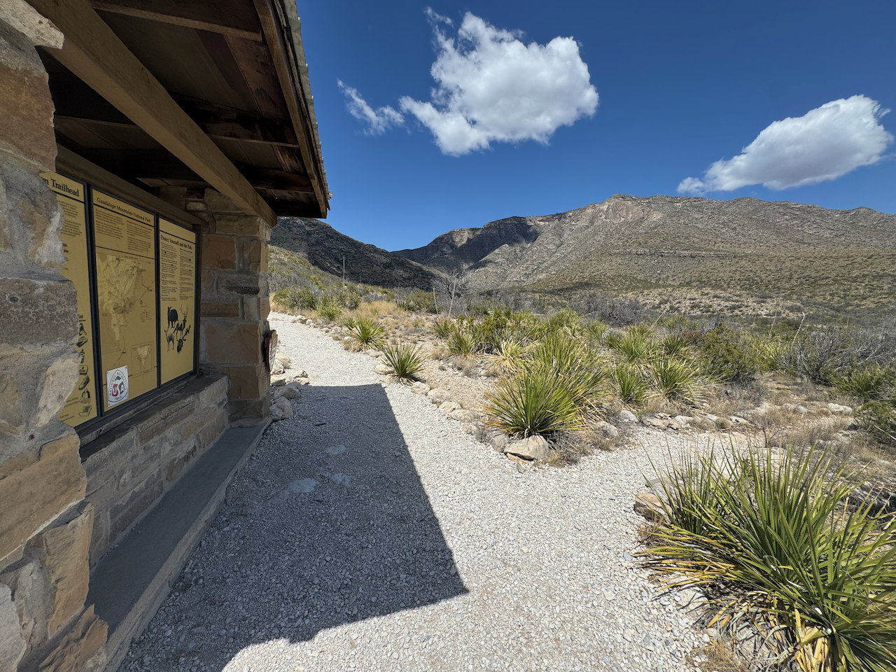
Got up in the morning, broke down camp fairly quickly, made coffee and was gone by 9:45. It was a beautiful day, and I enjoyed the drive out. A couple of hours later I decided to make a stop at McKittrick Canyon, almost forty years to the day I first visited it in April of 1985. I didn’t have time for a hike, but just wanted to revisit the trailhead and the visitor center (which I’d last seen on a gloomy, foggy day after descending from a multi-day backpacking trip in October of 1986). I think they’re increased the parking area there. There were quite a few vehicles there but i didn’t see many folks around; I assume they were hiking the trail. The rangers’ offices in the visitor center were all closed up. I walked out to the trailhead, took a few photos, and returned to the Odyssey. I got home to Austin around 9:30.

Gear:
My focus was on my backpacking gear so just some mention of my other gear here. I’d actually brought my OR Advanced Bivy to use backpacking if I expected a lot of wind.
- CamelBak Rogue 70 oz. Hydration Pack
- Keen Circadia Mid Waterproof Hiking Boots (size 13)
- Hubba Hubba NX (2019) tent
- Marmot PreCip Rain pants (XL) (ready for replacement)
- Garmin inReach Mini (also used iPhone 15 ProMax satellite messaging)
Lessons learned:
- Well, actually what I learned in the 2017 snow episode served me well here. First, the tent is going to collapse unless you keep the snow off of it. Second (also from 2017), have decent waterproof bottoms as the wet snow will stick and soak through permeable wind pants. My old Marmot pants were a great improvement over the cheapos I had I 2017 but I need something better yet.
Discover more from Phil's Phieldnotes
Subscribe to get the latest posts sent to your email.