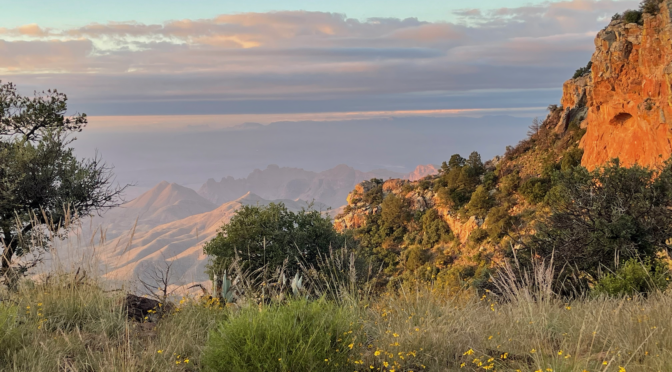
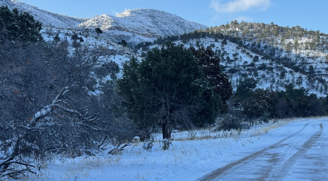
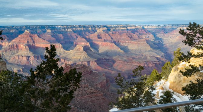
In late 1977–probably during semester break in December–my high school friend and baseball teammate Kelly and I took a camping trip to Big Bend National Park. I write this almost fifty years after the trip; I have no notes, just some foggy recollections, a handful of Polaroid prints, and possibly a roll of 35mm film somewhere around here that hasn’t yet been digitized. We’d done some winter camping on some property owned by some friends’ of Kelly’s family. I wouldn’t say we became expert campers, but we learned some things; how to manage all the Coleman fueled items (stove, lanterns), how to pitch my ancient, huge Sears canvas tent, how to stay reasonably warm. It would be my second trip to BBNP, and I was itching to return.
Getting there
Kelly had a yellow Ford Courier pickup with a camper shell. Manual transmission of course. We headed out I-10/290W. The Interstate wasn’t completed at that time; I remember only a couple of things from the drive out there; it was a cold, drizzly day and I was concerned about slick spots on the road. I particularly recall driving down the switchbacks on US 290 near Sheffield, one of the last sections of 290 to be converted to I-10 to the north. And I recall we stopped for a burger in Sanderson; I forget where but it seems like it may have been a Dairy Queen, and I was a bit surprised by the number of folks there. It was still cold and drizzly there.
Arrival
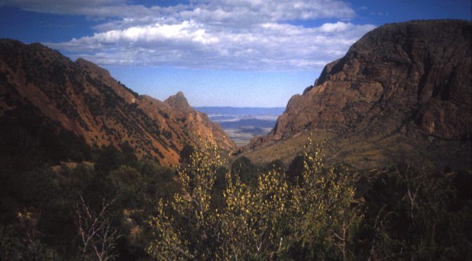
We arrived at the park, and I remember it was partly cloudy, much warmer, and driving up Green Gulch stirred the memories of that same drive and wonder I had felt on my first trip there as a nine year old kid. Descending down into the Basin I remember smelling burnt rubber. We got a spot in the Basin campground; it wasn’t difficult I’m sure because it was rarely crowded back then.
We set up our tent; and I’m pretty sure I had my neighbor’s cot; I used to borrow it occasionally. It was wood and canvas and very likely from his dad’s WWII experience, or at least an army surplus item. The tent, a huge Sears family tent made of canvas and metal tubing, was spacious but probably weighed 30 lbs. or so. Kelly like to over-prepare a bit, so you can see in the photos plenty of Coleman fuel and two lanterns.
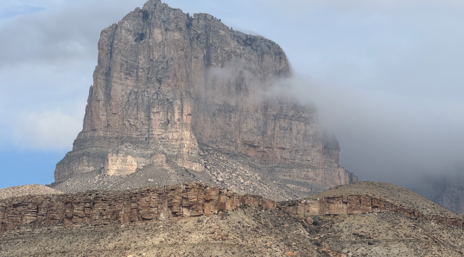
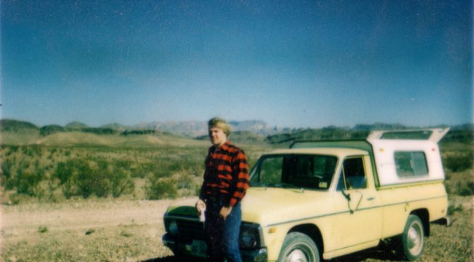
This looks like breakfast; I see sausage, bread, Nestle’s Quik. Cerro CastolonYours truly and the courier, somewhere on the unpaved road.Kelly, somewhere along the River Road I believe.
I have no idea on our itinerary really, but I distinctly recall some places we went. I know we drove down the Glen Springs road from the turnoff from Park Road east of PJ. I was white-knuckling it over some of the granite spots and other rugged areas. I suspect the current road may have been rerouted at some point. We stopped at Glen Springs and explored. I remember seeing tons of tin cans, and other garbage, and wondering what the history of Glen Springs was. I remember looking at the map and deciding to head on to the river, and then over to Rio Grande Village. The road was rough, but I also remember it getting easier along the river and I actually got going pretty fast.
I recall we did the South Rim. I remember Kelly taking a nap along the way, either up or down, somewhere past Boot Spring where there were some granite boulders warming in the sun.
I remember driving around the west side and seeing a lot of wild burros.
I remember making a phone call from the phone booth that used to stand by itself outside of one of the restrooms in the Basin campground, and talking to my friends back in Austin, “You won’t believe where I am right now!” (Long-distance calls from remote locations were pretty exotic in those days.)
P.S.–Oh, I remember one more thing. On the way in we stopped at some general store in Marathon. It was like you might imagine a remote general store in that tiny town in the 1970s, pretty sparse as far as camping gear. But I remember the high ceiling. And on the return trip we stopped at some gas station on the south side of US 90, remote and one that doesn’t exist any more. Maybe near Langtry/Comstock?
Gear:
Old Sears canvas tent
A lot of Coleman fuel, Coleman lanterns, Coleman stove.
In addition to whatever instamatic type camera we had, I could swear I borrowed my dad’s Ricoh 35mm rangefinder and shot at least one roll.
Schlitz beer and Marlboro reds
Blue jeans and flannel, and Tony Lama cream-colored wing tip boots
Hiking boots were some old high lace up work boots.
Lessons learned:
I learned I love it out there and it became a goal to head out there whenever I could–although it would be seven or eight years until my next trip.
A note about some of the photos here–I scanned many of these slides thirty years ago when I had to squeeze them onto floppy disks, so their resolution is poor.
I was twenty-six years old, still in the middle of my offshore oilfield career. I had read the old “Trails of the Guadalupes” guide, published by the Carlsbad Caverns Natural History Association, backwards and forwards while working on out in the Gulf of Mexico and had decided I needed to go see Guadalupe Mountains National Park (GUMO) and climb the highest mountain in Texas. But I also wanted to go back to the place I first fell in love with the desert mountains, Big Bend National Park. My last trip there had been when I was still a teenager with my friend Kelly, in 1977. I had also been reading, repeatedly, the Hikers Guide to Trails of Big Bend National Park. I was working offshore at this time, but had a week off and that may explain my odd departure times.
I decided I wanted to revisit a couple of backpacking trips I’d made years ago, partly because a lot of my earlier trip had been obscured by clouds and fog, and partly just to get out to a not too crowded part of the San Juans again. I would visit an area where I’d camped and backpacked going back almost forty years, the San Juan mountains and the Weminuche Wilderness. I first visited the San Juans on a long trip in 1986, car camping at Vallecito campground on the western side of the wilderness area, based on a suggestion from my parents. I returned for a couple of backpacking trips in the 1990s, in the Williams Creek area which is about thirty miles north of Pagosa Springs on USFS roads.
Williams Creek trailhead is about thirty miles north of Pagosa Springs on mostly unpaved US Forest Service roads.
My previous backpacking there had been going up to Palisade Meadows via the Williams Creek and Indian Creek trails, the Divide, and back down. Once I’d returned the way I’d gone up (1995), another time (1997) I’d made a loop continuing along the Continental Divide Trail (CDT), camping at Cherokee Lake, then returning down via the Williams Creek trail (the blue track on the map at the top). On that 1997 trip I’d spent night #2 at Cherokee Lake, up on the Divide, where I’d been hit with an evening mountain thunderstorm. (I was without a tent, only a tarp. The experience was…educational.) The following morning the trail was completely socked in by clouds–I could only see a few yards. I wound around the “Knife Edge” descended past the Williams Lakes and finally got below the clouds somewhere on the steep forested trail below Williams Lake. Some other memories of that hike are that I lost the sole of my hiking boot and used a bit of parchute cord to somewhat hold it in place for the balance of the hike, and at least one stream crossing somewhere not far from the divide where I pondered quite a long time on how to safely cross. I also recall having seen a distinct spur trail to a campsite in a meadow on the way back.
My concerns going into this trip were 1) stream crossings, 2) finding suitable campsites, and 3) my own general physical capabilities at age 66. The first two falling under the general heading of “trail info” that in this day and age usually isn’t an issue, but there is very little out there in detail for this trail. I had my old trail guides, one of which dated back to the 1980s; and a very few trip reports. Mostly fine with me; I prefer lesser known locations.
Intended route was up Williams Creek to the CDT, then return either via Palisade Meadow, or just an out and back. Also considered possibly returning the longer route to the West, via Cimarrona/Hossick. Ended up only going as far as “Campsite 20240905.”
Being substantially older than my previous trips there, and cognizant of some conditioning issues I’ve experienced, I trained quite hard for this trip. I’d already lost about fifty pounds over the past few years with diet and exercise, and specifically added hiking with a backpack to my regime. I’ve learned through the years that backpacking in the mountains requires more than just cardiovascular conditioning; you need to prepare your feet, your back, shoulders and other smaller muscles for the journey. I worked up to carrying an additional 50 lbs. a couple of times per week, and even brought my pack in to Gold’s Gym (where I do my daily cardio) and toted it on the treadmill at inclines up to 30 degrees.
I made a minor modification to my Gregory Pack: the sternum strap buckle is right over my, well, sternum and I can feel pressure there when I wear a heavy pack. I don’t know if that would cause an issue over time, but to be safe I wrapped the buckle with some closed cell foam and tape. Ugly but a nice cushion.
Practicing like this exposes any potential issues with ones feet; I filed off some bunion-caused calluses, wrapped my feet with Leukotape (I use this to replace what I used to use Moleskin for), and got some little latex toe booties for blister protection and relief.
Bottom line: I was in great shape for this trip, save for the one thing you can’t train for in Austin–altitude.
Getting there
I left Austin the day after celebrating Mom’s 92nd birthday with my brother who’d come in from California. I stayed the first night in Santa Rosa, NM(4,600′), followed by a night near the Williams Creek trailhead at Cimarrona Campground(8,400′). On the drive up from Texas, I started thinking about the elevation gain up to the Divide. On previous similar hikes I’d never really suffered from the altitude change (from Austin at ~550′) but then most previous trips I’d spent more than one night at altitude. I suddenly had second thoughts; “Geez, I shoulda maybe planned another day or two at altitude.” Oh well, there’s no way to ‘cram’ acclimatization.
The drive from Santa Rosa to Cimarrona campground was fairly short, although the last stretch from Pagosa Springs takes a while because it’s mostly on unpaved roads. I was pleasantly surprised at the lack of traffic, very few headed out my way on this September Thursday afternoon. I was hoping my first-come, first-served campground wasn’t full. I needn’t have worried, it seemed like most people were in the nearby Williams Reservoir site with boating and fishing. I drove on a bit past the campground to check out the trailhead for the next day. I vaguely recalled it from my visits the previous century. There were a few vehicles, and a few horse trailers, as there’s a horse camp site there now.
The site was great; large, with a picnic table, fire ring and grill. I hadn’t planned on a fire, but there was abundant wood left there, and the camp host also sold firewood bundles. Then I realized I couldn’t find my hatchet in truck. Oh well. I spent the afternoon going through my pack and making sure every thing was there, and fine tuning some last-second clothing and food choices. One troubling issue was the altitude. I felt fine, but on a whim I got out my pulse oximeter–86%! Had I been back home, I would have gone to the ER. Here however I knew it was just an altitude thing. I took a couple of deep breaths and it recovered to over 90%, still not ideal. I resolved to be extra-cautious the next day.
Did NOT want to see this on the pulse oximeter.
Williams Creek is not a trail used a whole lot, especially by backpackers. It’s mostly used by horse packers and those riding for a day ride; there’s a horse camp next to the trailhead. So there is much less information available than there is for the more popular trails.
Sign at Williams Creek trailhead. A lot, perhaps most, of the users are on horseback.
Underway
I broke down my campsite just before dawn and drove the short bit to the trailhead. (I’d used a different tent for car-camping so I had already packed up my pack.) I don’t know the temperature but it had been 38º the previous night at the campground so I’ll assume about the same. But the official (and the eyeball) forecast indicated a nice few days coming up, maybe a bit warm if anything. I was wearing my “experimental” ultralight layering system and headed up the trail around 9:00 AM.
Closest weather station I could find at a similar elevation (8,513′) was near Wolf Creek Pass1 or Rio Grande Reservoir (9,455′)2.
Not a quarter-mile and I ran into my first downed tree, requiring a slight scramble. “This doesn’t bode well, ” I thought, but it turned out to be the only significant tree crossing my path the entire trip. Right after that, I heard voices coming up behind me and a couple of guys and their dogs greeted me and passed me. They were going a bit faster than I was and eventually disappeared. A little bit after that I heard more voices and the pair had stopped to let a party of folks on horseback come down the trail. The lead horse eyed me very nervously, so I talked to him and the riders as they passed and moved as far off the trail as possible. As they passed, they told us about a “very big bear” reported up the trail. And not long after that we saw bear prints in a muddy section of the trail. At that time I joined the two hikers and we continued up together.
HIked the first couple of miles with these fellows from Oklahoma. One had gotten married on the CDT above here (on horseback) a couple of years prior, had since broken his leg and had vowed to recover and hike this again. We’re looking at bear tracks in the mud here.
During a pause at a nice resting spot, I got to know the dogs a bit and learned the owners were father/son-in-law going only as far as the Palisade/Indian Creek cutoff. The trail has some steep spots the first few miles, flattening out in the broad meadow where my friends turned around and I continued on (around 11:30AM).
I was moving fairly quickly, about 2-2.5 mph uphill with about a 40lb pack and felt strong, no effects felt from the previous night’s low oxygen readings. But I also wasn’t pushing too hard. I constantly was on the lookout for suitable camp locations, and soon discovered one significant difference since my earlier trips. There were substantially more trees down throughout the canyon. There was only the one crossing the path but along the sides of the trail the deadfall was piled high. Very few places up the canyon were open to wandering off the trail much let alone set up a camp.
I began to think I wouldn’t make it up to the Williams Lakes before time to make camp, and my concern about the lack of potential sites below the final ascent to the lakes increased. Doing the math in my head, I started thinking about a camp before that final ascent, as I really did not want to get caught on the steep forested slope in the dark. The few resources I’d seen had mentioned only a handful of possible campsites in along the creek and it was difficult to figure out where they were, likely due to the mileages being off by a few tenths of a mile. There were a few though, and I noted them as I passed.
Sometime after noon I began to notice I was slowing down. The trail wasn’t appreciably steeper (although the footing was a bit difficult in spots) and I wasn’t feeling particularly gassed, but I had slowed down to less than a mile per hour. It felt eerily similar to the time I’d run out of water in the desert a few years prior. I decided the prudent thing to do would be to find the next likely good camping area and stop. At around 9800′ the trail ran along the canyon wall, and I saw an expansive meadow about 100′ below me. I paused there, studying the far side of the valley, where Williams Creek ran. There were some “benches” (small rises) that seemed clear, not too many trees, and not too much deadfall from what I saw at that distance. It was only early afternoon, but I thought I’d much rather spend a pleasant evening camping in the remote San Juan mountains than a stressful afternoon up a difficult ascent not knowing how if I’d find a spot to stop. I’d hear marmots shrieking shrilly at me, and as I started down the steep rugged slope a marmot at the top of a boulder watched me intently but decided to let me pass. My goal was what seemed to be some clear areas on one of those benches that seemed to be a good spot to camp.
Marmot gatekeeper at the spot where I left the trail. Looking at the valley meadow where I camped, on the far side just left of center.
First Camp
I worked my way down to the bottom, past a few random boulders and through the high grasses and other flora and made a mental note of my path to retrace when I returned to the trail. At the bottom I was glad to discover it was pretty dry and there weren’t many buzzing insects. There was also another marmot on a boulder near the bottom, keeping an eye on me. (Are you the same guy that was at the top? ) I spotted a squarish area that seemed to have been recently flattened by some animal(s). Indeed! There was an old horseshoe hanging from a nail in the nearby tree. So others had found this a good camping area, too.
Flattened grass implies visitors in the not-distant past.
I went a few yards farther down the use trail and there was another small clearing, this one surrounded by a couple of hewn logs as benches, and an old fire pit in the center. The fire pit was at least a few months unused. I took off my backpack and sat for a bit on the bench. I looked around for potential widow-makers3. There was one possible one, but I determined it would have to be a very unlucky circumstance indeed for me to end up underneath its fall. So this was home for the night.
Somebody has been here before.View from the dining room.
I pulled out my chair zero and had a sit in the open area next to my site. It was still afternoon, so plenty of time to setup my tent and cook dinner. I had a snack and enjoyed the view; I heard Williams Creek off to the East a bit, the opposite side of the canyon from the trail. There was a thicket about 50 feet away that surely housed a few animals. The valley opened up to the south, back down towards where I’d started the day, and tree-covered mountains surrounded me. But on closer inspection I noticed huge swaths of the trees were dead. Climate change had led to an infestation of pine beetles in Colorado decimating many of the mountain forests. This was the reason behind the massive deadfall in the Weminuche, and why I was so concerned about widow-makers.
Mountainside decimated by beetle infestation.
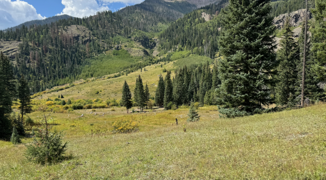
View looking down the creek valley.Perfect campsite obviously used before.
Among the new gear I was using was a 10 liter Ursack for bear-resistant food storage. It was the first time I’d used a sack rather than either the old hang method or my tried and true–but oh so bulky and heavy!–Garcia Machines Bear Canister. I thought the chances of bear encounters were low but not zero, considering the tracks we’d seen.
Bear bag secured (hopefully) to tree. Don’t think I got it tied quite tight enough to ensure an animal couldn’t wriggle it free.
After dinner, I secured my bear bag for the final time and spent the rest of the evening watching the sun set and admiring the scenery. Elk(s) bugled loudly. Any concerns I might have had about buzzing insects were allayed as there were few; I assumes it was late enough in the season that it was sufficiently dry. Or perhaps my treatment of my clothes with permethrin had helped. Either way, I resolved to try to stay awake until 10 pm if possible as I have sleeping problems and didn’t want to wake in the middle of the night. My efforts were futile as I gave up and went to sleep around 9:15. Sure enough I woke a few hours later; following good sleep hygiene principles I got into my chair zero and spent about a couple of hours reading and thinking.
My wearable biometric recorder–the Whoop strap–would later tell me I would get a lot of deep sleep that night, and i did go back to sleep and wake after sunrise. It was a bit chilly, but I lounged in the pleasant sunrise, made breakfast, and thought about the day. I felt good but not particularly full of energy. I would later find out my pulse oxygen sensor in the Whoop strap measured my O2 that night at 82%! That’s quite low, and I’m glad I made the decision to skip the rest of the trip to the Divide and just return home.
Looking up the valley toward the divide. That dead tree behind my tent was the only possible “widow maker” and I was pretty confident it wouldn’t reach me.
Returning
I packed and left camp around 10:45 and started back. Made my way back up the steep off-trail path where marmots once again eyed me. The hike down was uneventful but I spent a lot of time enjoying the scenery when I could, and focused on looking for potential campsites for the future. The “spur trails” mentioned in the guides I’d read were nowhere to be found, but that was mostly due to the number of downed trees, and to the fact that the GPS mileage may have been off a bit from what the guides had had making them difficult to sync with my observations.
I think this would be a nice place to camp and also to explore.Possible spur trail to campsites.
I did see a number of areas that looked promising for campsites, a couple on each side of the trail, in nameless meadows surrounding the creek. The hike was pretty comfortable, and I moved reasonably well. I’d taken about six hours on the hike up; the descent took me about 4:45. Although I felt strong maybe I didn’t look it; while I hadn’t seen a single hiker since the previous morning, I did encounter two or three horse parties, and one of them seemed overly concerned for my well-being. The last one was a couple about my age, leading a third horse. They told me they could help me out if I needed, I chuckled, “No, I’m just old and a bit slow. Feel great!” Just then the horse they were leading took a slight stumble. “He’s kind of old, too.”
I arrived at the trailhead shortly before 4:00 PM. I found the couple tending to their horses near their trailer and told them I’d made it back ok and thanked them for their concern. The truck was roasting in the arid sunshine, so I took a moment to let the A/C take effect and took off my boots, but since the campground was just a bit down the road didn’t spend much time decompressing,
Profile for ascent and descent. I left the recording on after I finished, so ignore the time and distance totals.
Triple Crown Button Down Long Sleeve | Evergreen UL*
Unisex Super Thermo T-Shirt Base Layer with Inlay – Navy, XL*
Helinox chair zero
Ursack Major Bear Sack – 10 Liters*
Opsak
REI Backpacker Low Gaiters XL Black*
*New item for me
I tried a few things different this time, moving more ultralight than plain old “light”. Intrigued by Ryan Jordan’s (the founder of Backpacking Light) podcasts and articles, I spent a few dollars to dabble in ultralight cool to cold weather layering options. The 1x Alpha 60 Hoodie is so incredibly lightweight you have to hold it to believe it. It’s obviously not too good blocking wind, so I also wore my Patagonia rain jacket as a shell at times.
I also used gaiters for the first time; wasn’t sure what the terrain would be like, and also was curious to see if they’d help discourage water from getting in over the tops of my boots in stream crossings. Verdict: They did help keep my feet dry, but a major caveat is these “XL” gaiters are pretty small, and I had to loosen them to their extreme limit just to manage to somewhat fasten them. So they’re actually “L” at best (I wear size 13).
Lessons learned:
Don’t neglect acclimatization! I knew better; should have spent at least one more day at the campground at over 8,300′.
The ultra-light garments performed well. Almost a little too warm at times, in the sun and with no wind it was a bit unseasonably warm at times. The Thermo T-Shirt base layer and Triple Crown Button Down seem hardy; I’m not so sure about the Alpha Hoodie. It’s so fantastically light though.
Lightening my load really helped. Total pack weight, whatever it was, was much less than I’d been training with (up to 47 lbs.) and load was comfortable (although I’ve had to modify the sternum strap on the Whitney pack.)
Took a trip out to Guadalupe Mountains National Park last week. I’d reserved Sunday and Monday nights at Pine Spring, Tuesday/Wednesday/Thursday nights at Dog Canyon. I intended on climbing Guadalupe Peak again Monday, then I was planning on a backcountry stay on Wednesday night, possibly at Blue Ridge (as discussed here; https://bigbendchat.com/tentative-plan-for-one-night-backpack-dog-canyon-b-t18146.html).
I’d been getting in pretty good shape over the past six months, doing cardio, hiking, and most recently hiking with a pack to start conditioning myself for backpacking. But I had an unexpected trip to take my 89-year old mother to California to meet her new great-granddaughter from New Zealand who was visiting family in Berkeley…but I digress. Bottom line is I was out for a week, then home for only a couple of days before leaving on my trip.
I left Austin around 4 pm arriving Ozona around 8 pm. I began this habit of breaking up the drive to GUMO a few years ago; gives me plenty of time to pack, take care of chores, and hardly feels like any time at all for the first day. And then it’s nice to get to my campsite early enough to where I don’t have to rush to beat sundown (especially in Winter). I got to GUMO just before 1:00–oops, Noon Mountain time; went to the visitor center to make sure I didn’t have to check in or anything (got that Senior Pass heh heh, and had already booked the camping) and wanted to confirm I could get my Wednesday night backcountry permit here on Tuesday morning as I left (I could).
Site 16 at Pine Springs–you know, I think it’s “Pine Springs” Visitor center, but “Pine Spring” Canyon (no “s”)–I think is one of the better car-camping spots. It has a large footprint, split-level. It may have been an accessible one at some point.The upper area (where I put my tent) is surrounded by shrubs so there is some privacy. And most important to me, sufficient screening against the plague of over-bright lighting that infests modern campgrounds. I put the tent fly on, probably didn’t need it–weather was absolutely perfect.
I’ve been coming here since 1985 and have seen many changes; new paved road and fancy new visitor center, new outhouse at end of campground road, water faucets that have come and gone, different regulations vis-a-vis fires. I think the site has burned badly two times.
16 is one of the better sites, kind of split-level.View of Hunter from site 16
Here’s another person/s who didn’t make it down before sunset.
Seems there’s always someone coming down from Guadalupe Peak well after dark. That light in the upper center is one or more hikers slowly making their way down.
Speaking of sunset: I can’t say enough about PeakFinder. It tells you exactly when and where the sun will rise/set based on exactly where you are and the surrounding mountains. To wit:
Pine Spring Canyon looked a bit different, almost as if it were muddy.
Anyway I got going on the trail up Guad Peak around 8:00 AM. I packed 3 liters of water, probably too much but I kind of wanted to see how I’d hold up, especially my joints, and also wanted to get ready for a backpack Wednesday. This was my fourth time up; 1985, 1997, 2000 (an overnight trip) preceded it. So it had been twenty years since my last climb up.
Hunter Peak to the right.
It was familiar in a lot of ways, and a lot of elements were just as I remembered–the last few switchbacks on the northeast facing start, some cut straight out of what seems solid limestone (“Lead animals here”) and then the abrupt turn “around the bend” which takes you out of the limestone and into a shaded forest on the north-facing slope for a while. The wooden bridge was familiar, although I recall the wood being pretty new in 1985. And of course the metal pyramid at the summit, placed there in 1958 (my birth year).
One notable difference–there was no summit register!
The famous, fierce Guadalupe Pass winds had laid down for the day and the conditions were perfect. The clear sky had been obscured for a while by a high overcast as soon as I reached the summit, but I wasn’t much concerned with aesthetics as I’d been up several times before. The ascent took me about 3:42. I chatted a while with those who shared the summit; a young Polish couple, a couple from Austin, two more individual hikers. I stayed on the summit maybe 45 minutes, an hour, then started down. Not much significant to report–I paused to enjoy the views a bit more on the way down, and about a mile from the finish my hydration bladder ran out of water so I filled it from my reserve.
That night at the camp site, a couple of things struck me. First, chucklehead in a site across the way had a light of some sort that burned with the light of ten thousand suns and illuminated half of the mountain. Then I noticed the horizon which had formerly been black, then more recently had begun to show lights from oilfield activity, was now fully illuminated.
This chucklehead had an incredibly bright lantern that illuminated half the mountainside and ruined everyone’s view of the stars.When I first started coming out here there would have been zero lights looking 50 miles to the East. Now there’s a combination of flares and lights from the oilfield.
When I got back to site 16 I made dinner, cracked a cold one and began to ruminate on the hike that day and my plans for my upcoming overnight. I was a little disappointed in my speed; it took me over seven hours. I see now it was closer to 6:30 actual moving time, but still that’s a lot slower than I used to do it in. The part that slows me down the most is what I call “steps,” that is, big steps–foot, foot and a half–up (or down). I used to spring up them on the way up, and hop down them on the way down. But over the years I’ve learned I have to do them in a very particular way or I’ll get severe pain. I have to step up only with my left foot first; on descents I have to step down first with my right foot. Also, on descents, if I hop down too many times over the course of a couple of hours I’ll get excruciating pain in my foot. (Of course these are exacerbated with a heavier pack.)
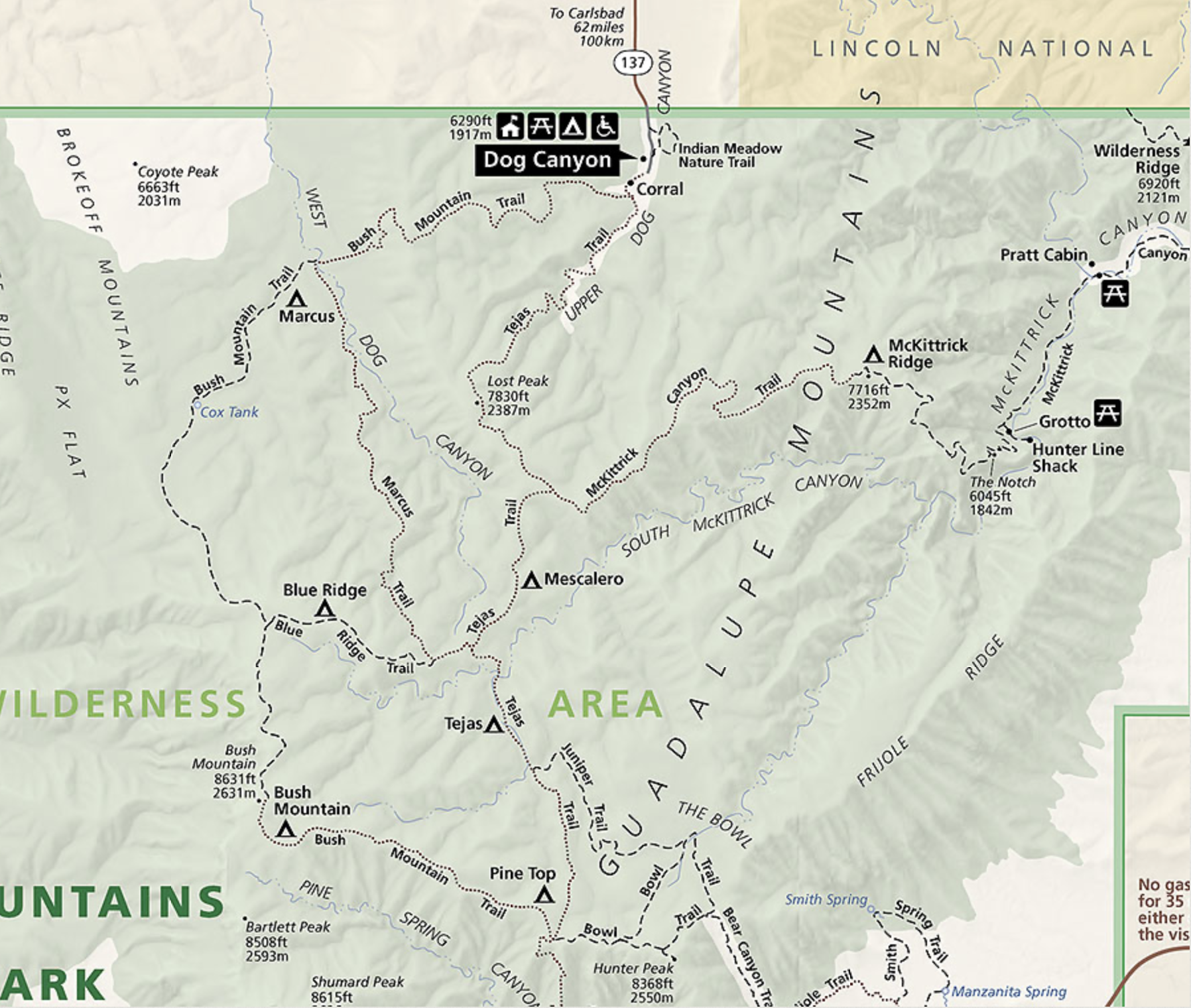
My proposed backpack trip on Wednesday would have been: leave Dog Canyon, ascend Marcus overlook descend to Marcus backcountry site, continue on a gentle ascent but where the trail becomes difficult to find, then on to a steep ascent where the trail is difficult to find, rarely used, and in the most remote corner of the park before setting up camp. Now, one thing I felt was that the hike up Guad Peak had been more difficult than I remembered from 2000 and a helluva lot more difficult than in 1985. So, anyway, on Tuesday morning as I got my permit for Wednesday night I decided on only going to Marcus backcountry site and back. It would still be terra incognita for me, to a new part of the park.
Trip Report GUMO 3/1/22
Dog Canyon-Marcus Backcountry
The helpful young woman at the visitor center with whom I’d spoken on Sunday was also the person who gave me my wilderness permit on Tuesday morning. As I was explaining why I’d decided only to do Marcus and eliminate the long loop to Blue Ridge, she mentioned something I thought incorrect but because the Center was still under Covid protocols and limiting people inside, I didn’t want to get into a discussion. I just smiled and took the permit for one night at Marcus from Dog Canyon. She’d said, regarding a Blue Ridge trek, “At least when you get to Dog Canyon you’ll have most of your elevation gained.” As shown below, this is not the case. The route to BR would include quite a bit of elevation; taking the route counter-clockwise, it would have put me at the southwest-most point on the trail, where the trail is hardest to find, where the final elevation gain is the greatest, at the end of a long day with a pack full of water. Hence the decision to only go as far as Marcus.
The purple lowercase sigma-looking track was my original plan.
Original proposed route; I cut it in half by only going to Marcus backcountry site and back.
You guys probably know I much prefer to stay at Dog Canyon campground rather than Pine Springs. Before last year, when online reservations for Dog Canyon became available, I often had the entire campground to myself. I’d have considered it “crowded” if three sites were full. The newer system has, so far, not only changed the quantity of campers but in my experience the quality as well. Previously, it seemed that folks who camped there were respectful of the solitude, quiet, and dark environment. My recent stay in October had given me a taste of camping neighbors who were not respectful of those characteristics at all. Apprehensive, I would pleasantly surprised over the next few days. All my camping companions were stellar folks. About six or seven of the tent sites were taken and there were a couple or three campers up by the corrals.
Evening view from site #9
Since I was no longer doing the long hike, I didn’t have to leave a daybreak Wednesday. I had my backpack mostly packed Tuesday, went over it again in the morning and included 7 liters of water, which I knew would be too much, but I didn’t want a rerun of what had happened to me on my Shumard backpack (here: https://bigbendchat.com/tr-shumard-canyon-backcountry-site-nov-2017-t15420.html) where I ran out of water. Split the water between 3L in the Gregory hydration bladder and 4L in three separate bottles, not wanting a potential single point of failure. I did other things to try to lighten the load: I didn’t bring any redundant clothing, no shell, only a Marmot Quasar down jacket for evening top and heavy poly bottoms for same. I splurged on a new Thermarest NeoAir XLite sleeping pad. Also my Helinox Chair Zero, and (crazily enough) Crazy Creek seat/pad—the CrazyCreek was maybe excessive but I wanted to try it again. Lightweight poly top, long sleeve hiking shirt and long pants, socks and lightweight hiking shoes (that need to be replaced), balaclava and mitten/gloves, and of course my floppy sun hat which is mandatory in lieu of natural head covering. Sleep system was OR Advanced Bivy, TNF Superlight long bag, and groundsheet. MSR PocketRocket and cookset, and a few more odds and ends.
Starting off on Bush Mountain Trail, the grass was pretty high.
All in all, the pack felt fairly light. I left Dog Canyon CG about 9 AM and ascended to the Marcus overlook, a hike I’d taken a dozen times before. I felt strong, pace was good—the rest day after Guad Peak had definitely helped. Took about 2:15 to get to the overlook, with one rest break. The rest of the hike was mostly descent off of that ridge, until the last half-mile up to Marcus BC. The trail down was—diverse, let’s say. Sometimes it was a well built and engineered trail, with boulders building it up to make it fairly level as it skirted the mountainside. But other places, especially the mile or so before getting to the bottom of West Dog Canyon, it’s just a straight chute cut out of the hillside, through dirt, boulders and large rocks, and to my mind a bit too steep, I would have preferred a longer trek with switchbacks. I found that stretch exhausting, constantly having to brake myself and sometimes step around the ‘chutes.’
Looking up a wash at a turn in the trail. This spot might potentially hold some water.Well-constructed Bush Mountain Trail below Marcus overlook.
The trail junction with Marcus Trail (off of Bush Mountain Trail) is at the bottom of West Dog Canyon, and you can see the sign for a good ways when you approach from the East. There was also a lot more dirt than rock down there. I’d noticed since the overlook all the other footprints I’d been seeing had dropped off and looked like only one person had been on the trail for at least a few days. I proceeded on straight, (Marcus BC site is on Bush Mountain trail, not the Marcus Trail). At this point the trail went through very tall and very dry grass; but a wide swath had been cut through it and no cairns, although visible, were necessary. At this point, past the old Cox Tank, one finds the remains of ranch structures; all that’s now left is some corrugated metal blown around, and some charred vertical posts.
I believe that is about all that’s left of the former ranch outbuildings around Cox Tank.
After a few more tenths of a mile, you come to the Marcus BC sign and turn left up into some woods. The trail goes up a fairly deep dry wash and ends at Marcus sites 1 and 2. I got there just before 1 pm MST. I could clearly see a single set of bootprints there; looked like someone had walked up through #1 to #2, looked around, then left. Didn’t seem to be a trace of a camp. There were clearly prints of a small animal strolling through #1, too. I chose to set up in site 2; I was pretty sure nobody else would be coming in that day, so the close proximity of the next site didn’t bother me. Although the site is sort of surrounded by mountains, #2 gave me something close to a view; I feel claustrophobic when I camp where I can’t see some distance.
Sleeping system–OR Advanced Bivy, old and heavy ground sheet, TNF Superlight Long bag. All over 20 years old. The yellow is a brand new Thermarest NeoAir XLite sleeping pad. Incredibly lightweight.
I set up camp; including my Chair Zero along the perimeter which let me put my feet down about a foot below tent-pad level and made it very easy to get out of the chair. (My only complaint about this incredibly lightweight chair is that it can be hard to emerge from.) Had a good snack PRO TIP: Do NOT store trail mix with chocolate in your top backpack pocket even if the ambient temps are in the 50s. Greenhouse effect melted it all. I hung my food from a nearby tree as per NPS suggestion, for protection from smaller critters, so only elevated it about five feet.
My stuff at Marcus site #2. They recommended I hang the food.
Since PeakFinder showed the sun going behind the SW mountain at 6:15 I had plenty of time to hang out, explore, do nothing. I did all of those. I wandered over to the west and looked down on the wash which Bush Mountain Trail continued on up. I explored the site, found sites #3 and #4, and oh hey, way over there #5. Only a couple had numbers, and several were getting pretty overgrown with grass. I waited until the sun went below the mountain, made my dinner (classic Beef Stroganoff) and went to bed. I only sleep about six to seven hours a night, so winter nights in the backcountry can get a little boring. I listened to a couple of podcasts I’d recorded before leaving, dozed off after a while. I’d hoped to relieve the boredom by watching the night sky full of stars; I woke up around 1:00 AM but was disappointed to find only the “normal” amount of stars. Apparently a thin, high overcast had crept in. I finally fell back to sleep and awoke around 5:00.
Not exactly sure the reason for the logs. They don’t look like borders for sites. Possibly could be later used for trail maintenance. Wondered if they may have been from old fencing from the ranch?
The weather continued to be perfect (aside from the star blocking high clouds). Probably in the 40s-50s overnight, and little to no wind. In the morning I got up, fixed breakfast, packed up and left. I know my pack was lighter due to water and food depletion but also I felt really strong, I guess conditioning starting to kick in as well as getting used to the altitude. I felt really strong on the whole return hike; well, maybe except that section going up the “chute” from around trail junction for a half-mile or so. There was one real downer along the way, though. I discovered a fairly recent fire ring right off the trail. I had my head down climbing up the trail through grassland and noticed a patch where the grass had been flattened. I was wondering what animals had been there when I saw a fire ring at the edge of the patch of flattened grass. Ugh.
Fire ring (illegal). Near the start of the slope back up to Dog Canyon.
Oh well, I continued on back to Dog Canyon and got there before noon. I hiked faster than I had the day before, and faster still than I had on the Guad Peak hike.
Conclusions: Very enjoyable, although not very long, overnight hike. Could I have made Blue Ridge? Very likely, but it may have been difficult—and maybe miserable— at the end. I still plan on taking that swing around the NW corner of the park. The location of those sites is kind of awkward for me, one’s too close, one’s maybe too far.
The NeoAir is fantastic—some people complain about the rustling noise it makes but it didn’t bother me. I got the normal width as I use it in my bivy, but could see how people might roll off of it, especially if unconstrained.
The Chair Zero was also a big hit; I am not flexible enough to sit on the ground, so having such a lightweight option really makes all the difference.
I used the Crazy Creek chair back because I knew I’d have a few hours wide awake in bed and wanted to have a variety of reclining options. It was not fantastic, but not bad either. One of the first luxuries I’d toss in the future, depending on situation.
(There is a separate Trip Report for my backpack to the bottom that trip here.)
Work in progress…
I headed out to Grand Canyon National Park in January of 2011 to camp and do an overnight backpack to the bottom of the canyon. Why January? Well, less crowded. I had overheard a Ranger telling another visitor seeking a backcountry permit on that 2007 trip that aside from New Years’ Eve and New Years’ Day, it was very unlikely they’d have a problem securing a first-come first-serve permit for Bright Angel campground (at the bottom). Hmm, I thought at the time, I’ll come back. And I did.
Trip report written some thirty-four years after the fact, relying on photos, map notes, and memory.
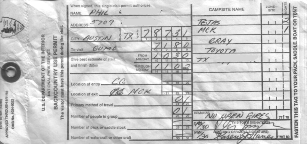
GUMO permit Sept 1986
Starting from Pine Spring Campground, I got up to the crest at the trail junction near Pine Top where I met Ranger Craig. Turns out he was doing a backcountry stint, and we hiked together for the next two days. He was quite the naturalist and helped me identify a lot of flora and fauna.
We stayed one night at Tejas backcountry site, then over to McKittrick Ridge for the next night. Somewhere along the McKittrick Trail we came across an angry rattlesnake.
Rock rattler that surprised us along the McKittrick trail1983 Trails Illustrated map of GUMO with notes from three 1986 backpacking trips. Lower section. Note that the park HQ was still in the old shed at Frijole. There are a couple of errors in my hand-written notes there; please hold your calls. The plane site says “B-29” and not “B-24” and it’s in the wrong location.McKittrick CanyonAbove McKittrick Canyon
In the morning, Craig left for elsewhere, and I returned back toward the Tejas trail.
This is a trip report copied almost verbatim from what I wrote in 2000.
I took this trip on what I figured to be the last non-busy week before Spring Break; however, it was already getting crowded in the campsites (the Basin was full). I had arrived the night before around midnight; seeing that the other campsites were full I simply napped in the cab of my truck. It was fairly chilly, probably around 35-40, so I bundled up pretty well. I did see a coyote exploring the trash cans once early in the morning.
Trail distances for Pinnacles Trail to South Rim, return
via Laguna Meadows (from Basin trailhead):
3.5 miles to Emory Peak trail
4.5 miles to Boot Canyon campsites
4.8 miles to Boot Spring
5.3 miles to Southeast Rim Trail jct.
6.3 miles to Southeast Rim Trail jct. at the South Rim
8.0 miles to Colima trail jct.
8.8 miles to Blue Cr. trail jct.
12.1 miles to Basin trailhead
A bit after sunrise I went on into the Chisos Mountains to the Basin and the ranger HQ to get a backcountry permit. The nice older couple behind the counter, apparently camp hosts, pulled out a notebook with photos of the various campsites in the backcountry to help me to determine where I would go. Seeing the full campsite status, I was more concerned with getting away from crowds than a scenic site, but finally decided on Boot Canyon #4 and SW #3 just off the South Rim.
I don’t have any notes saved from this trip. I was only nine years old. I really fell in love with Big Bend during that trip; actually, with the whole idea of deserts and mountains. I’d been to Colorado on a family trip a few years earlier and recall being amazed at the mountains and the abandoned mines we saw high up on the slopes; and the scary drives over the unpaved roads along the mountainsides. But for some reason, on our trip to Big Bend something clicked.
I know this trip was around Easter Sunday, in 1968. Looking at a calendar I see that fell on April 14 that year; I’m guessing we were there for the week prior. I don’t think we got spring break in those days, either at my elementary school or for Dad’s job at UT.
I don’t remember the long drive out there on highway 290, although I can assume I was probably getting bored. But to this day I have a vivid recollection of the drive approaching the Chisos, as we began to ascend up The Basin road, past some drums full of water for overheated radiators. I kept staring at the rugged cliffs and thinking “Wow, I wonder what it’s like up there! Wandering around up there would be the greatest thing ever!”
I really want to finish up all the hiking trails in Guadalupe Mountains National Park. I’ve never been up the Permian Geology trail to the Wilderness Ridge BC site. I’ve never been up/down the Marcus trail, nor the northwest corner of the Bush Mountain trail.
Map of GUMO north
I want to do the loop of Marcus trail/Blue Ridge/Bush mountain to finish up that corner of the park. It’s the least used bit of trail in the park I believe. I actually did do the Blue Ridge section back in the 1980s; even have a backcountry permit for Blue Ridge backcountry site but I didn’t use it. I just hiked out from I think Mescalero to Blue Ridge to Bush Mountain and back to Pine Top.
I will start in Dog Canyon, thence to Marcus, and the only question is whether to do the loop clockwise or counter-clockwise.