Tag Archives: Guadalupe Mountains National Park

TR-Guadalupe Mountains NP Backpacking Feb-March 1986 (working Draft)

I believe this was my first backpacking trip ever. I’ll have to go through my notes and photos to recollect exactly what I did, and will update this post accordingly.

Pretty sure the route was Pine Spring TH up to Pine Top for first night; thence to Tejas backcountry site after exploring over to Hunter Peak, then maybe back along Tejas Trail and over to Bush Mountain, then back to Pine Top again for the last night.

GUMO permit feb1986
Continue reading TR-Guadalupe Mountains NP Backpacking Feb-March 1986 (working Draft)

TR-Guadalupe Mountains NP Backpack Sept 1986

Trip report written some thirty-four years after the fact, relying on photos, map notes, and memory.

GUMO permit Sept 1986

Starting from Pine Spring Campground, I got up to the crest at the trail junction near Pine Top where I met Ranger Craig. Turns out he was doing a backcountry stint, and we hiked together for the next two days. He was quite the naturalist and helped me identify a lot of flora and fauna.

We stayed one night at Tejas backcountry site, then over to McKittrick Ridge for the next night. Somewhere along the McKittrick Trail we came across an angry rattlesnake.

Rock rattler that surprised us along the McKittrick trail
1983 Trails Illustrated map of GUMO with notes from three 1986 backpacking trips. Lower section. Note that the park HQ was still in the old shed at Frijole. There are a couple of errors in my hand-written notes there; please hold your calls. The plane site says “B-29” and not “B-24” and it’s in the wrong location.
McKittrick Canyon
Above McKittrick Canyon

In the morning, Craig left for elsewhere, and I returned back toward the Tejas trail.

Continue reading TR-Guadalupe Mountains NP Backpack Sept 1986

TR-Guadalupe Peak February 2000

This is mostly a stub, holding a spot for a more complete trip report later. I don’t have all the photos from that trip digitized yet but am in the process of doing so.

After two previous hikes up to the summit of Texas’ highest point, I realized that the spectacular vista from the top of Texas was not that spectacular under the midday sun. So I resolved to make a summit trip that was a backpack, including a night at the backcountry site “near” (a mile away from) the summmit and spend the dawn hour photographing the views.

TR-Guadalupe Mountains Dog Canyon & Gypsum Dunes November 14-16, 2019

Wednesday the 13th I left Austin after work and some final packing around 6:00 P.M. and got to Ozona around 10:00. Next morning I kind of let Google navigate me, wanting to stay well away from US 285; ended up going East and North of it, to near Odessa, then coming into the Guadalupe Mountains/Lincoln National Forest via Carlsbad. Only in one small section, around Eunice, did I experience much oil field traffic.

Arrived Dog Canyon 1:00 P.M. MST on Thursday. I was a little discombobulated since I have never arrived there so early in the day: Because of the distance, I generally arrive shortly before sundown but since I’d left from Ozona I had a significantly shorter drive.

Map of West Texas and southern New Mexico with route driven highlighted in green.
Austin-Ozona-Carlsbad-GUMO Dog Canyon-GUMO Gypsum Dunes-Ozona-Austin
Continue reading TR-Guadalupe Mountains Dog Canyon & Gypsum Dunes November 14-16, 2019

TR-Guadalupe Peak April 23, 1985

It’s been quite a while since my first climb up Texas’ highest point, Guadalupe Peak (8,751′ now, was listed at 8,749′ then). I don’t have any notes from that hike; just fuzzy memories and some fuzzier photos from an old point & shoot Nikon I used to borrow from my dad.

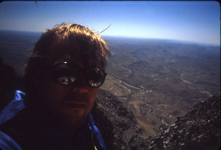
me, approaching summit in '85.
me, approaching summit in ’85.

I was twenty-six years old, still in the middle of my offshore oilfield career. I had read the old “Trails of the Guadalupes” guide, published by the Carlsbad Caverns Natural History Association, backwards and forwards while working on out in the Gulf of Mexico and had decided I needed to go see Guadalupe Mountains National Park (GUMO) and climb the highest mountain in Texas.

Continue reading TR-Guadalupe Peak April 23, 1985

TR-Guadalupe Peak 1997

A very brief trip report.
I climbed Mt Wheeler, highpoint of New Mexico, in summer 1997. Along the way, to get some altitude and conditioning in, I summited Guadalupe Peak again.

I’d started out from Austin and stopped in Davis Mountains State Park. I got up early in the morning and drove to GUMO. I have some notes from this trip:

On to Guad Park–(Note: Dawn (light) not until ~7:00 a.m. CDT here.)

Arrived GMNP ~9:00 CDT. Wx excellent ~50s, -60; light breeze, clear sky. Park almost deserted. Asked young woman behind counter about old Pine Spring Cafe-she didn’t know-was before my time.)

Began ascent ~ 9:50 a.m. CDT-one break past (that place*) (at 1:08 of hike.) in the first extensive forest. Felt good-last 1/4 mile was hell, through several false summits. Summit at 12:45 CDT (2:57 hatse??less 18 minutes in breaks is 2:39 hike. Dead calm at summit. [at summit 35:07; 1:48 for descent-5:20 less 18 less 35:07 = 4:55 total hike – sign at trailhead suggests 6-8 hours.]

“That place” mentioned above, I now remember, is the spot after you finish the first part of the climb. You hike up a steep limestone wall, basically, with some of the trail literally blasted out of the side of solid stone; depending on the wind that day, you may be buffeted by 40-50 mph winds. I was, the first time I’d done that hike in the 80s. But you come around a bend, and almost magically the wind goes to nothing and you’re in a forest. And not far ahead are convenient boulders to sit on and rest a spell.

TR-Backpack-GUMO Shumard 11/16/2017

Gaiamaps link

Tracklog out to Shumard Backcountry site

CalTopo map

I spent most of a week in mid-November (2017) at Guadalupe Mountains National Park (GUMO). Camped 4 days/nights; at Pine Spring CG and in the middle an out/back overnight to the Shumard Canyon backcountry site. I don’t have a *lot* of info to add; i’ve done the El Cap/Overlook trail several times over the decades so didn’t take many photos. I had never done the Shumard Canyon stretch before so this was all new to me. It turned out to be quite challenging due to the trail conditions, and I took very few pics (even though i’d intended to do some night photography). That happens. Continue reading TR-Backpack-GUMO Shumard 11/16/2017

Roger Reisch-GUMO NP

(Pine Springs, TX) Roger E. Reisch, the first employee at Guadalupe Mountains National Park passed away peacefully in Edmond, Oklahoma on Tuesday, February 12, 2013. He was 89. Roger Eugene Reisch was born in the Richmond Heights area of St. Louis, Missouri, on February 6, 1924. He was the second of five children of August and Hilda Reisch.

I discovered his obituaries in the regional media websites (Trans-Pecos Texas, Southern New Mexico) when I was looking for info for  the NPS ranger I’d met way back in my earliest trip to Dog Canyon in Guadalupe Mountains National Park.

(I include the NPS page here, but I’ve also captured the page to a PDF if the park service changes the link in the future.)

https://www.nps.gov/gumo/learn/news/park-mourns-the-passing-of-roger-reisch.htm

I’ll start from way back when. Continue reading Roger Reisch-GUMO NP